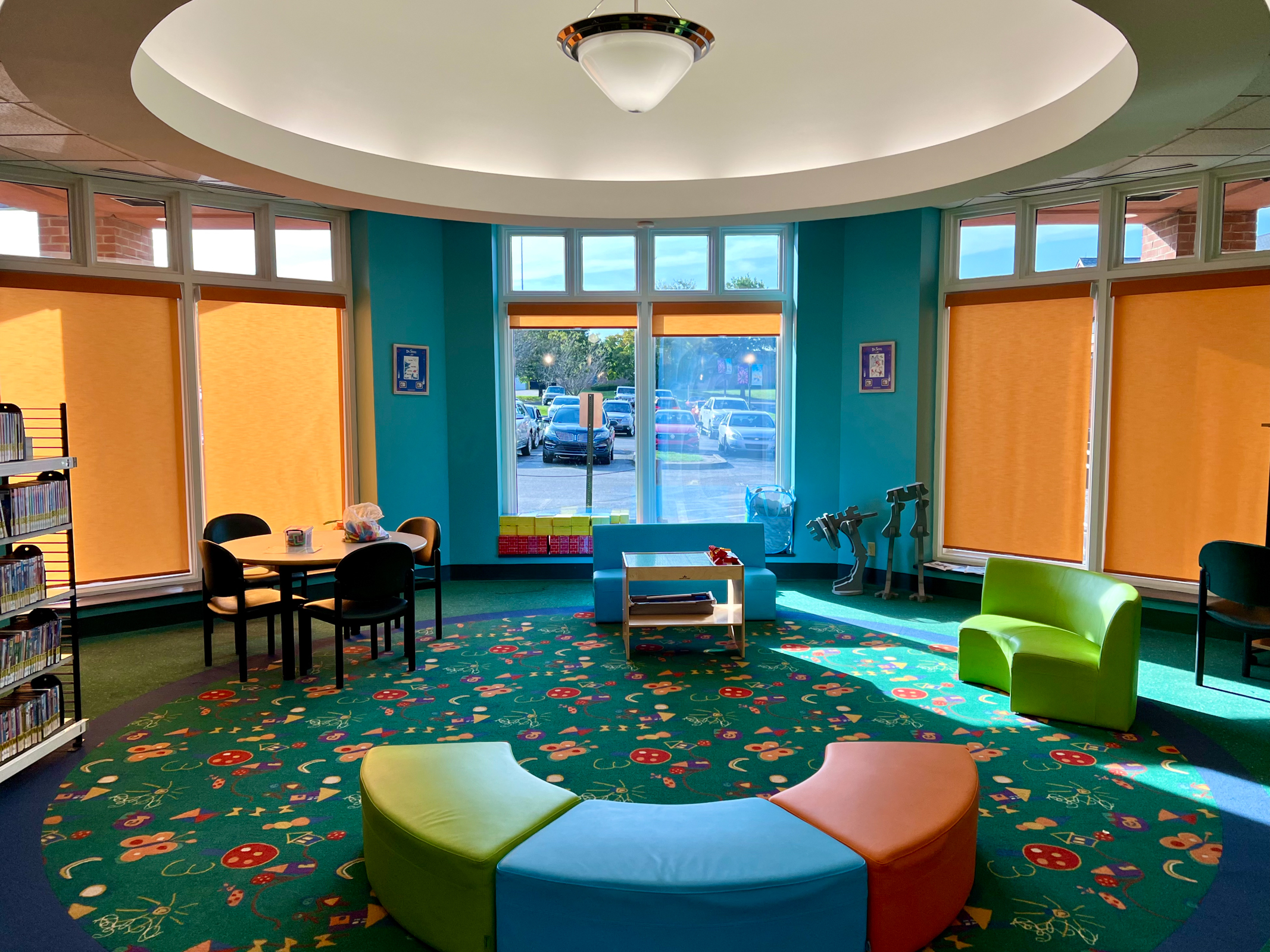
We may be the last people on the planet to begin watching the excellent series The Sopranos. I am surprised that it has taken so long for us to view the murder, mayhem, sex, lies, cheating, cruelty and overall gangster behavior. But after the first few episodes we had to stop for a while. I realized we spent most of our days obsessing over a guy playing a gangster in the White House and I really didn’t want to then spend our evenings watching a guy playing a gangster in New Jersey. A few weeks later we came back to the show. But the analogy seems right. Tony Soprano and Donald Trump are very much alike. They both play the part of a New York, tough-guy goodfella layered with a smooth-talking charm and a blood-thirsty ruthlessness. Family, loyalty and power is everything. They never forget a slight and will seek out brutal revenge eventually. Nothing will get in their way of gaining as much money, power, and domination as possible. They both teach us brand new ways to be cruel. At least Tony Soprano is going to a psychologist. Because we are only in the middle of the first season, we will see how that works out.
I have long been aware of the long running series South Park. I have seen bits and pieces of it over the years but never have been a loyal fan. I am delighted to see how recently they have been ruthlessly skewering Trump and his out-of-control administration. A recent season has gone after Kristi Noam and her ICE Follies One episode show ICE agents making a raid on heaven to pick up frightened Latino angels. This is both horrifying and hilarious to watch but this kind of humor is one of the things the Trumpers really seem to fear. They love being called fascists and horrible but are terrified of being made fun of, especially in front of a large TV audience. Just ask Stephen Colbert.
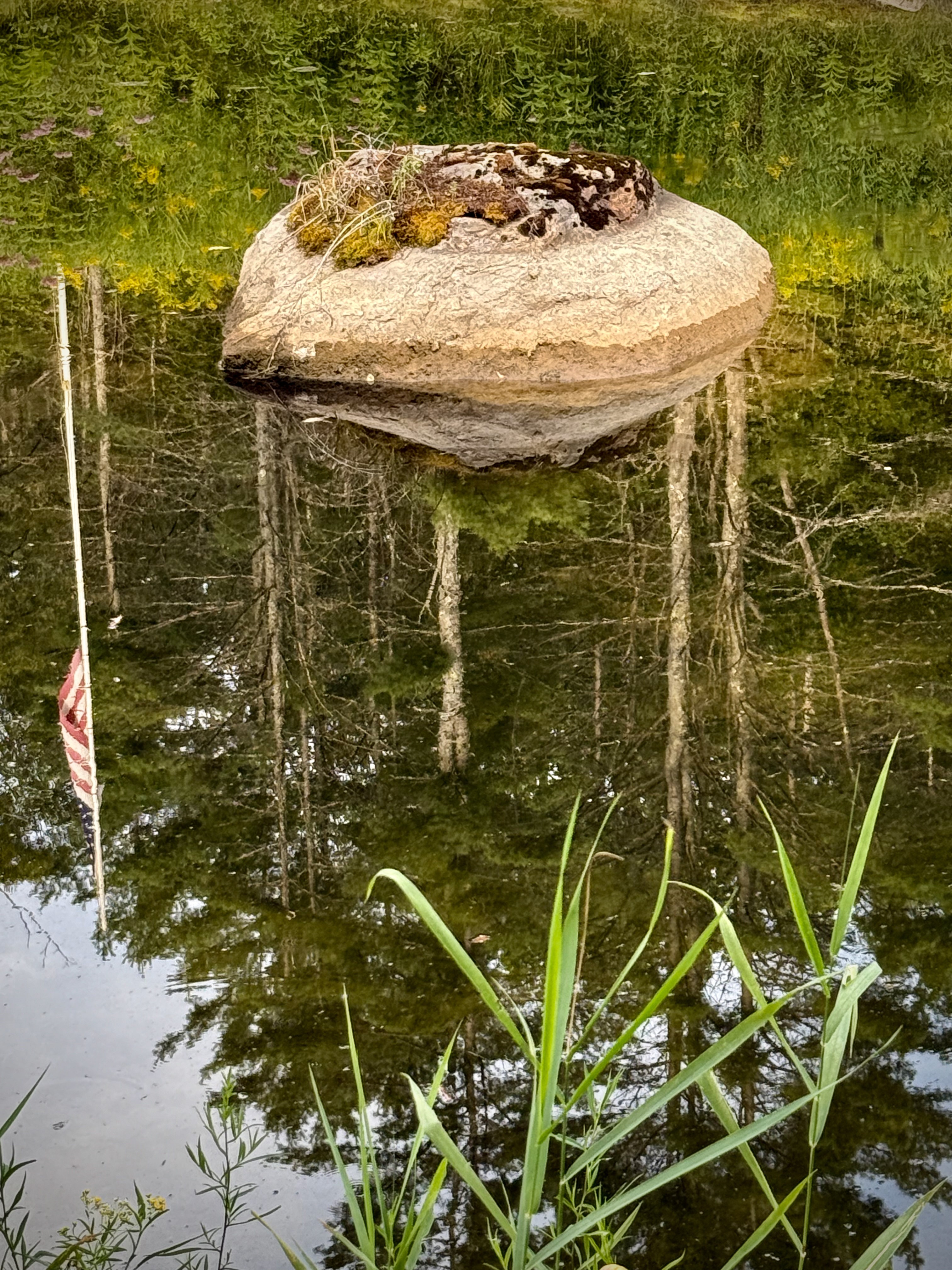
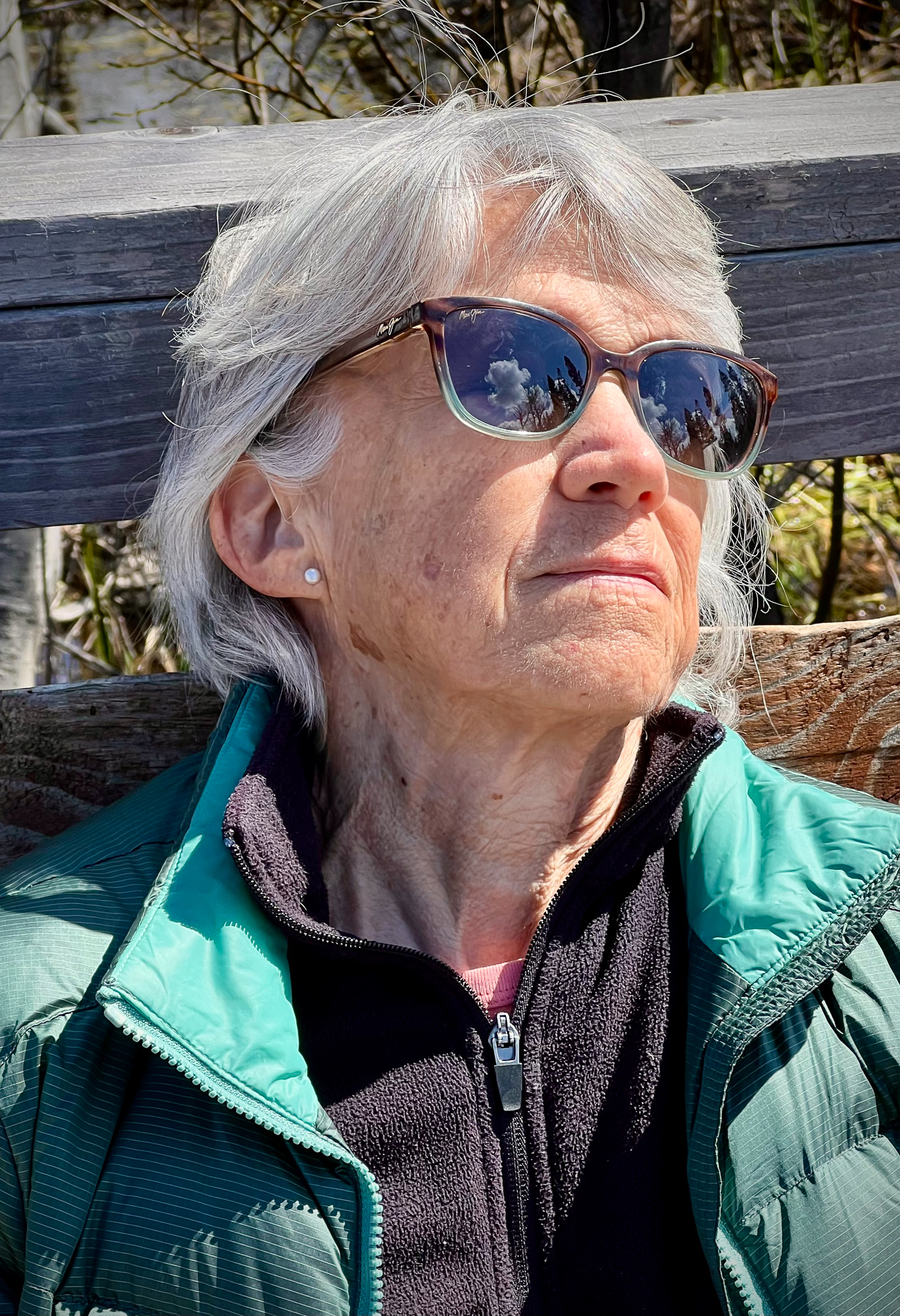
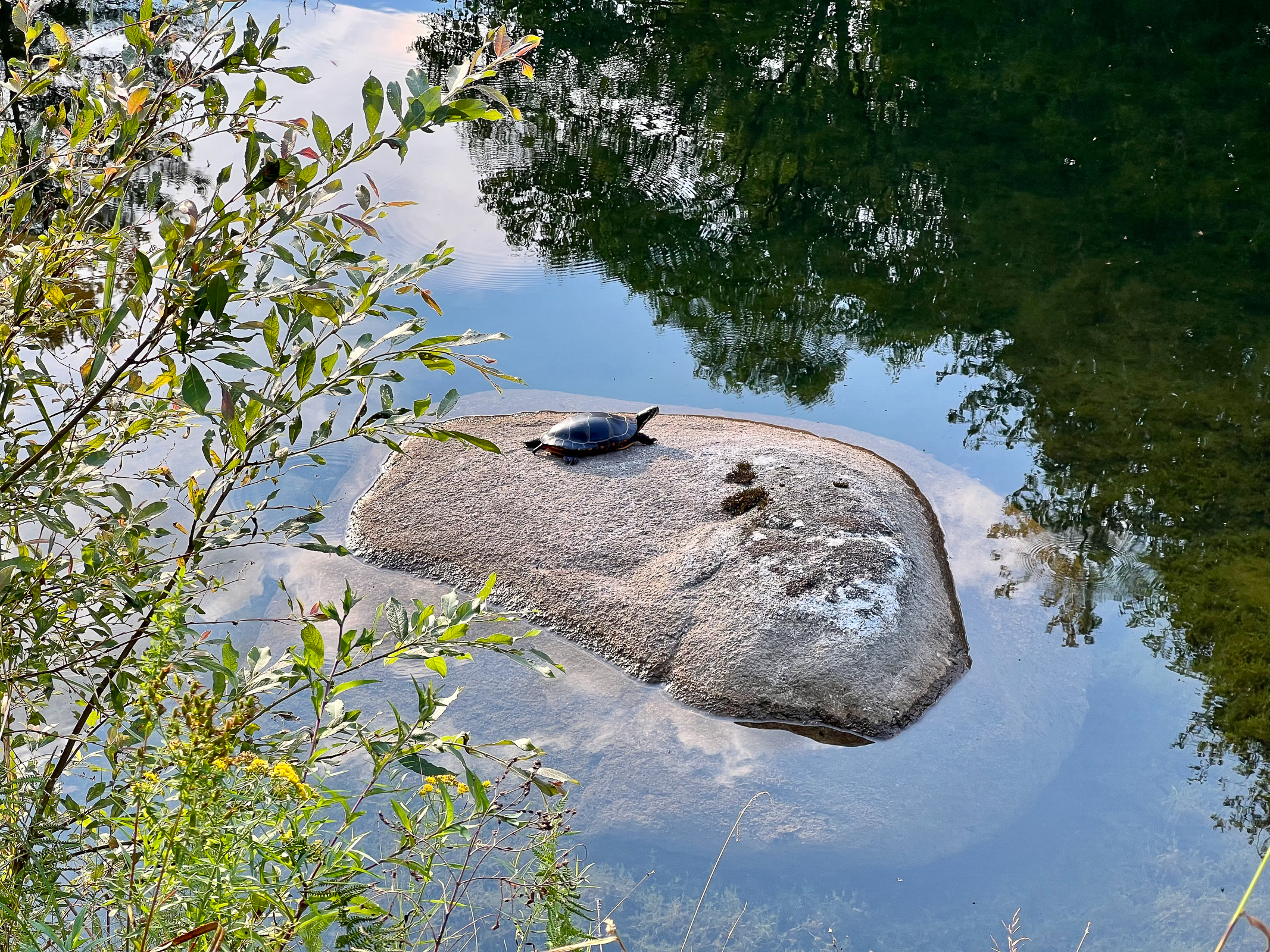
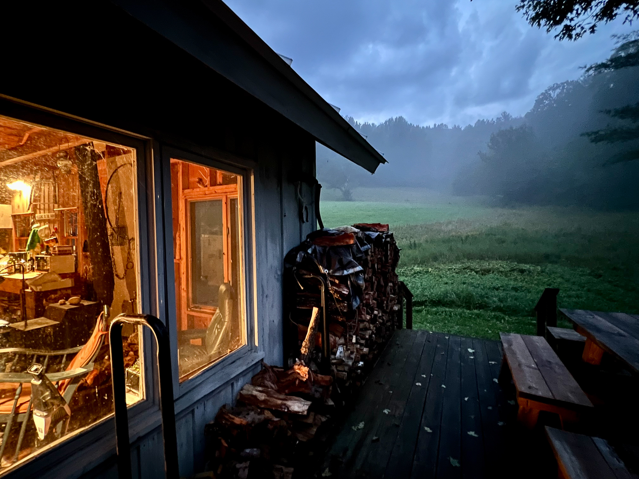
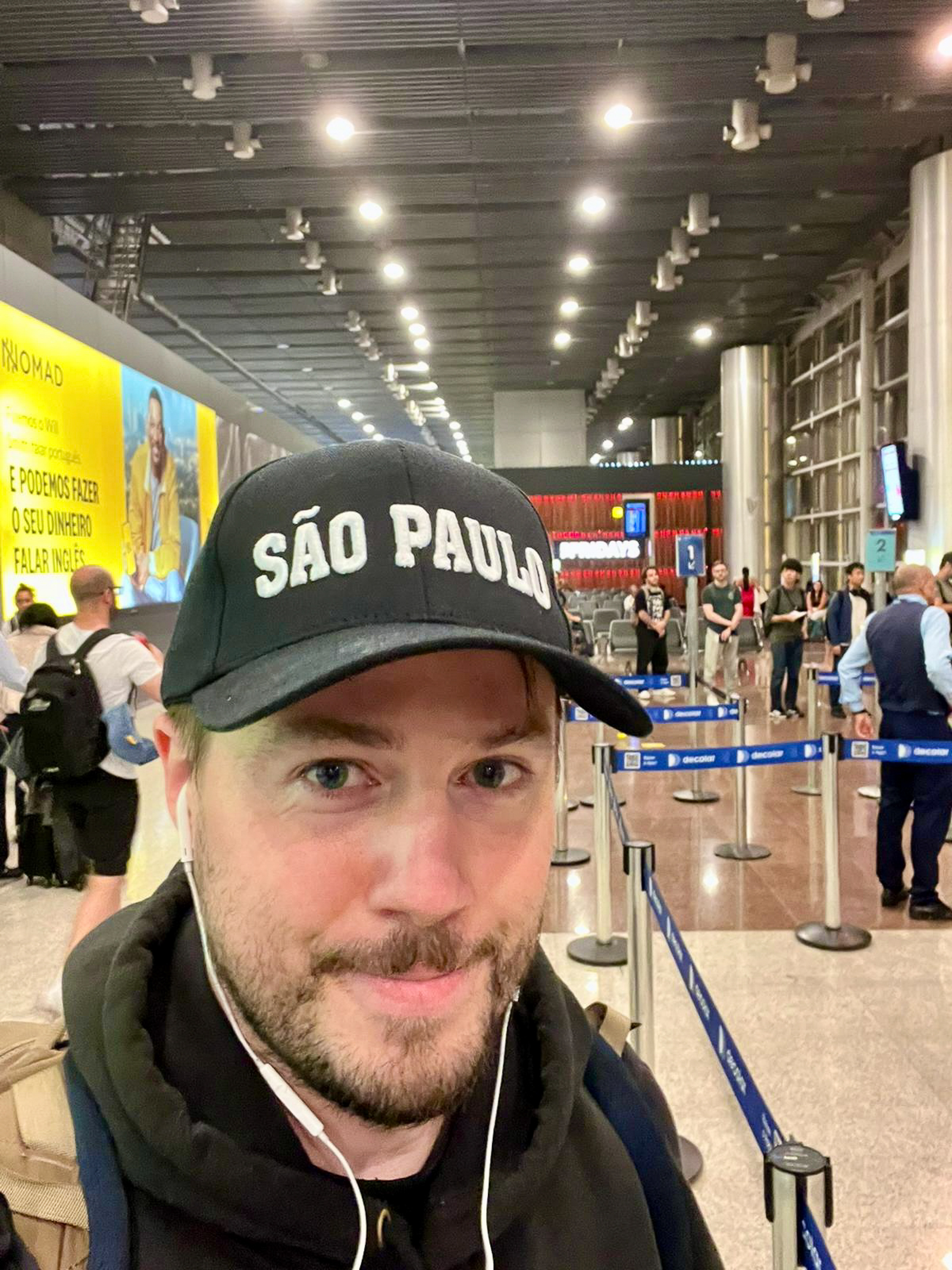
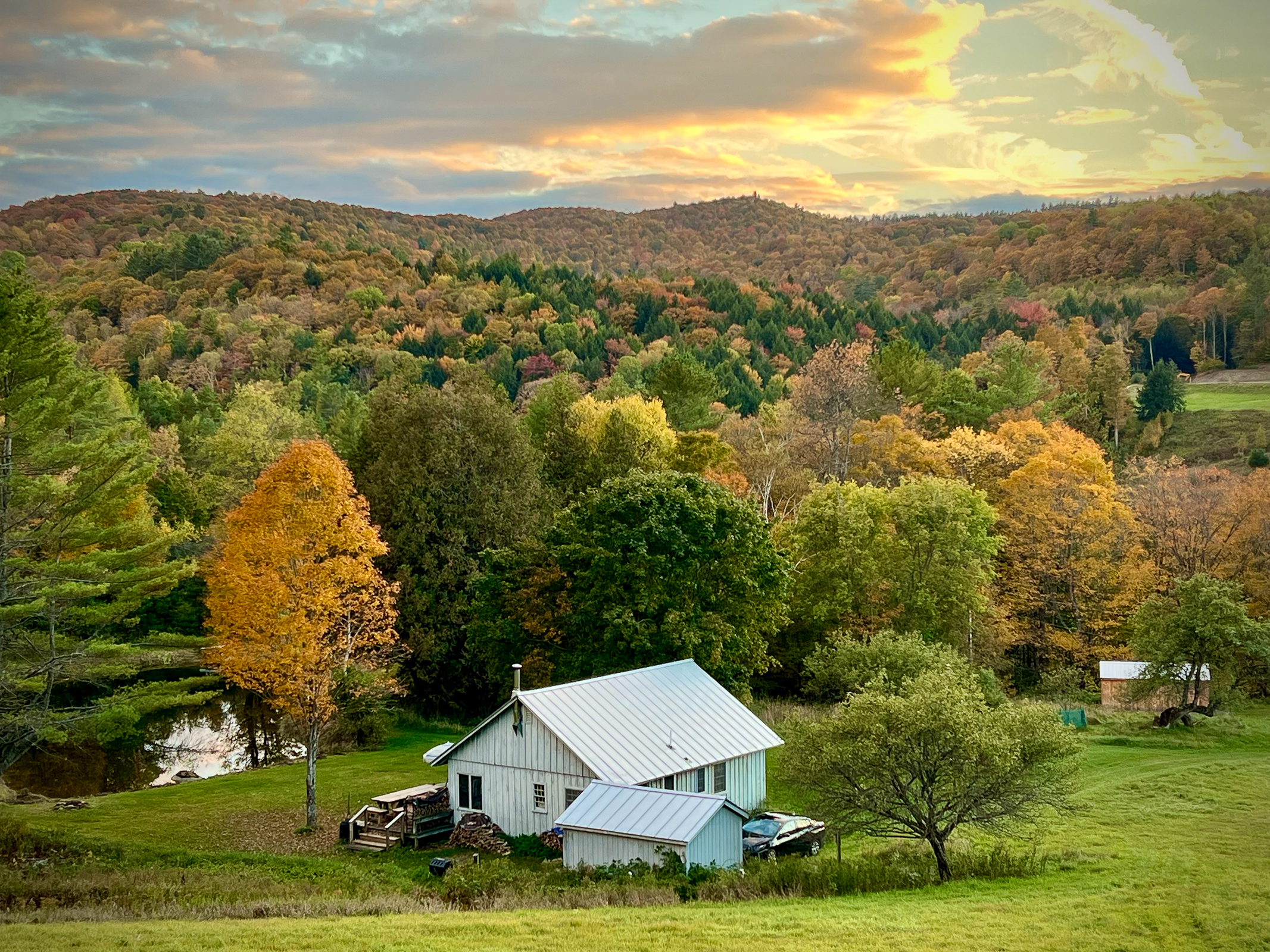
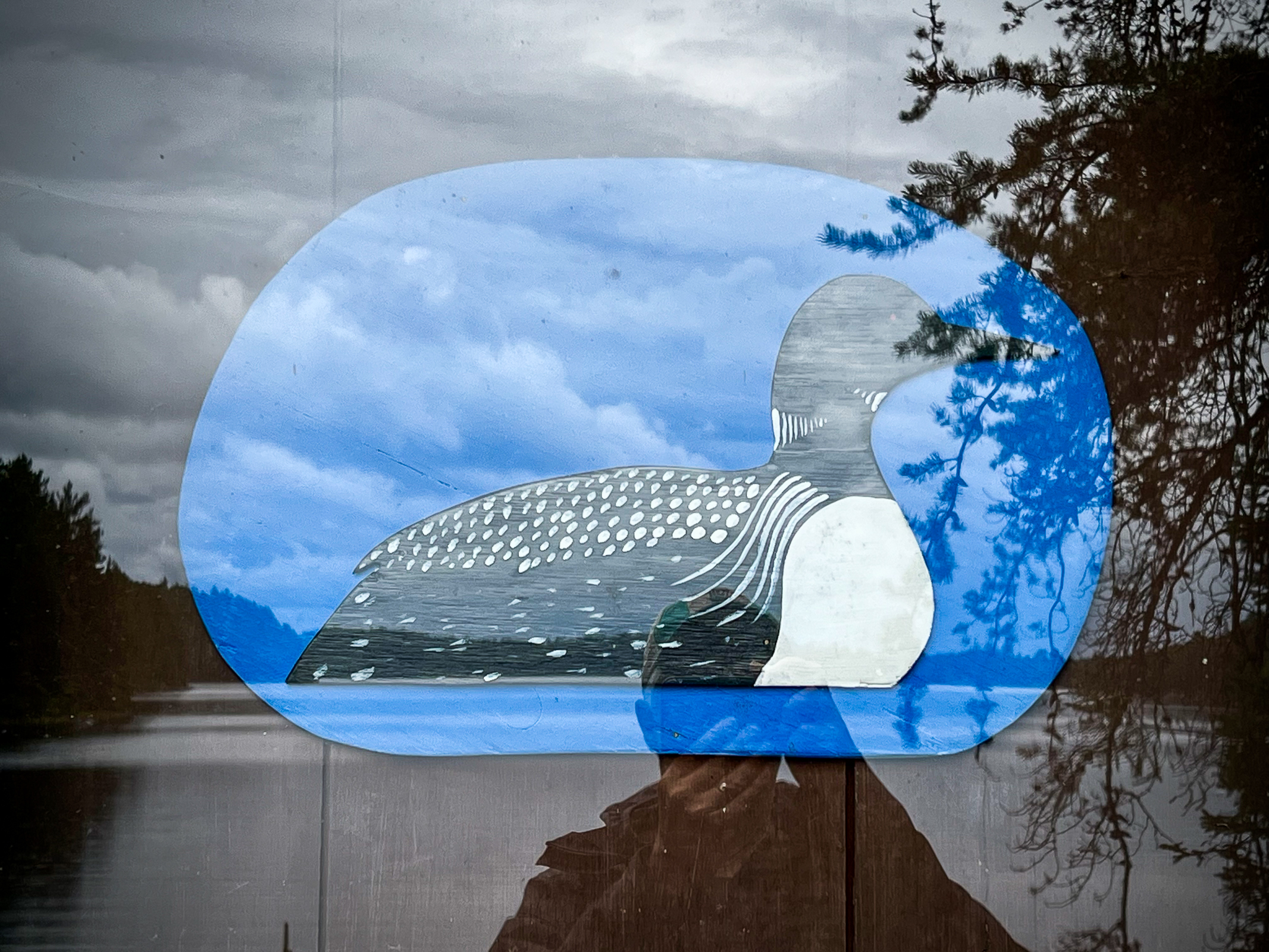
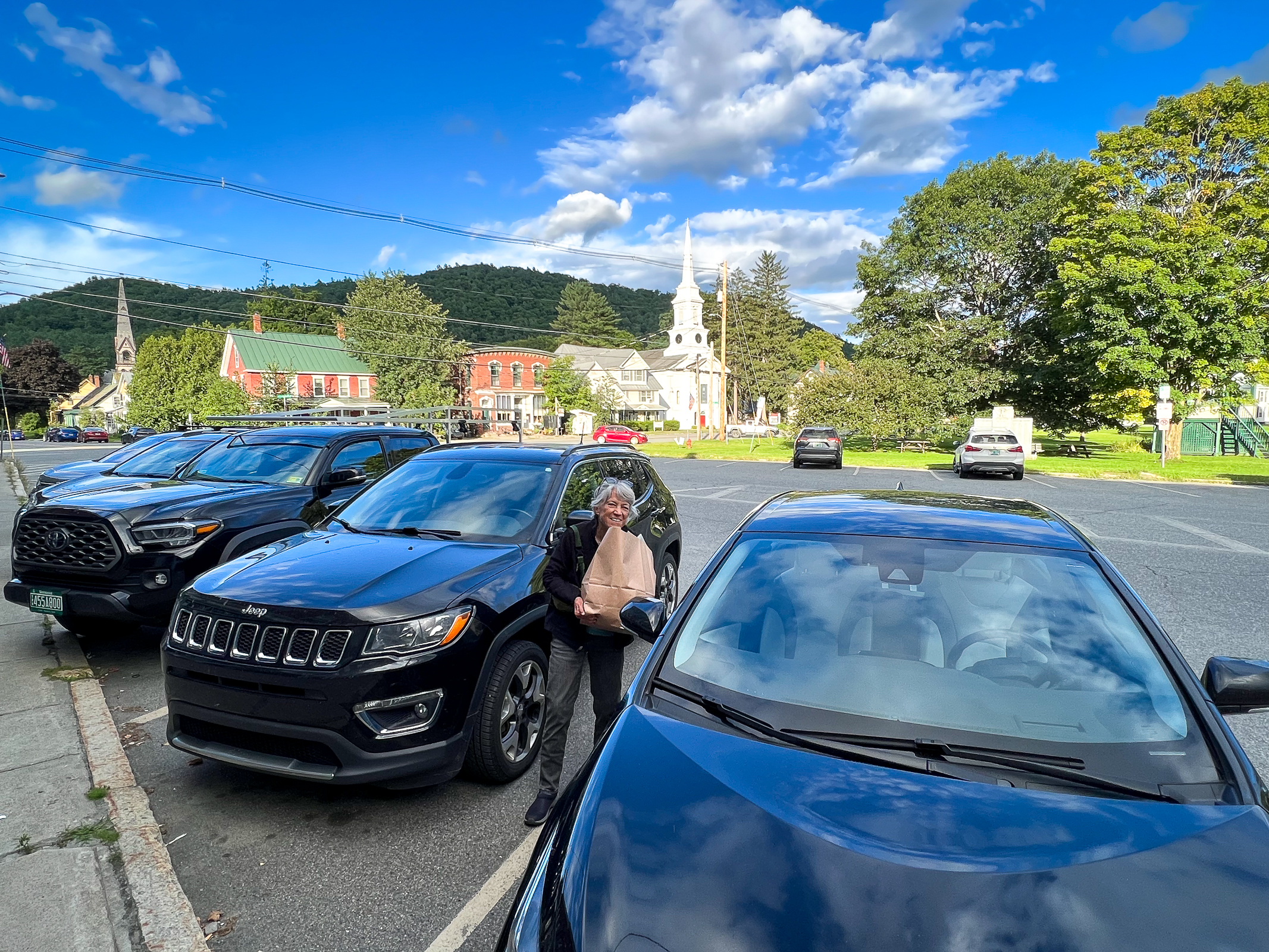
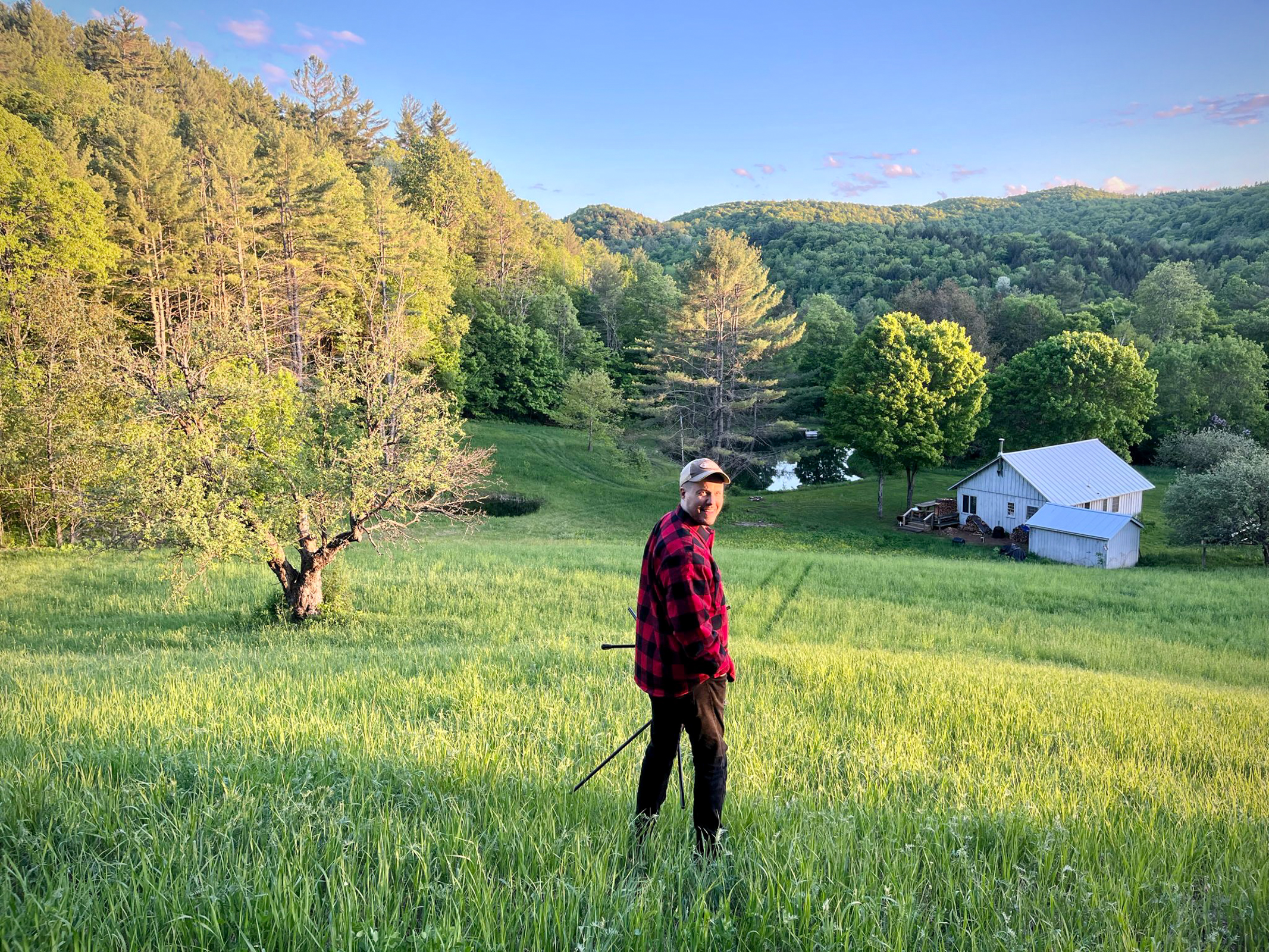
We are now engaged in some serious “deep hanging out” at our cabin in the woods in Vermont. There is some guilt in doing nothing while our country is falling apart. But we hope to use the month here to gather our strength and clear our minds for the hard work ahead when we get back to San Francisco. Before we return, we will be traveling, photographing, and working for six weeks in England and other parts of Europe. More on that later. In the meantime, here are a few photos from our arrival in sweet New England.
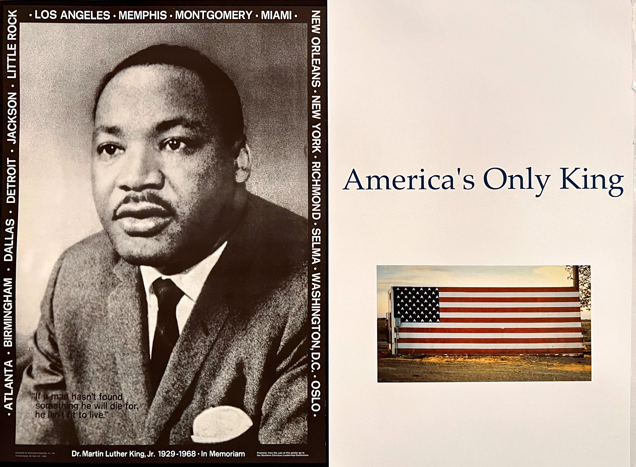
When I was a boy, I read John Kennedy’s best-selling book Profiles in Courage. It inspired my young idealism and helped prepare me for the 1960s. It seems like a good thing to help young people have their ideals shaped by noble thoughts and good examples. President Kennedy’s book used stories of courageous leadership as possible role models for all Americans. People today only have pettiness, anger, and cruelty coming from the incoherent tweets of our current President. No aspirational role models here for the young. Just dispiriting blasts of retribution and ugly, bombastic expressions of his raw power. But many Americans already know that Trump is a coward.
There have been many examples of courageous Americans throughout our history. One of the most prominent in my lifetime was Dr Martin Luther King, Jr. We all owe a debt to his heroism in the face of overwhelming odds. What he was able to achieve before his life was tragically cut short, changed the course of our country for the better. President Barrack Obama was another leader who inspired millions with his moral courage and personal decency.
Today, we are beginning to see other courageous leaders emerge from the travesty of Trump’s recent military occupation in parts of Los Angeles. Governor Gavin Newsom, Mayor Karen Bass, and most recently, California Senator Alex Padilla have all claimed the moral high ground compared to our wannabe dictator/President. Each of them has been threatened with arrest by our cowardly boy-King for simply doing their jobs. In their own way, each exhibits a moral clarity and courage that would have made President Kennedy proud. Each of them, along with many other contemporary heroes, should be included in a revised edition of Profiles of Courage for courageously standing up to President Trump. I look forward to reading that new book when these dark times have passed.
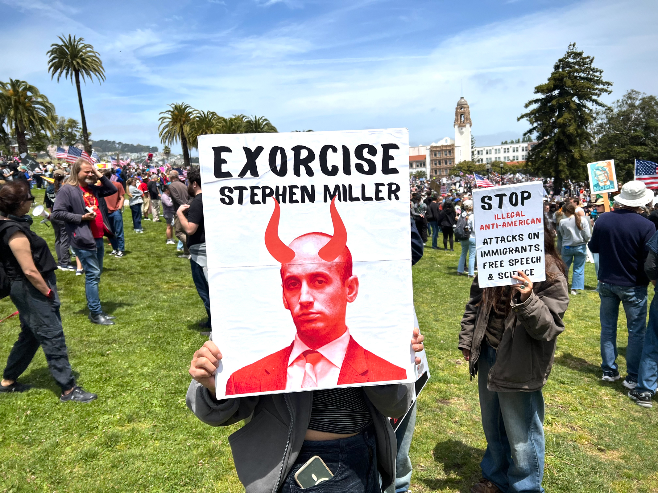
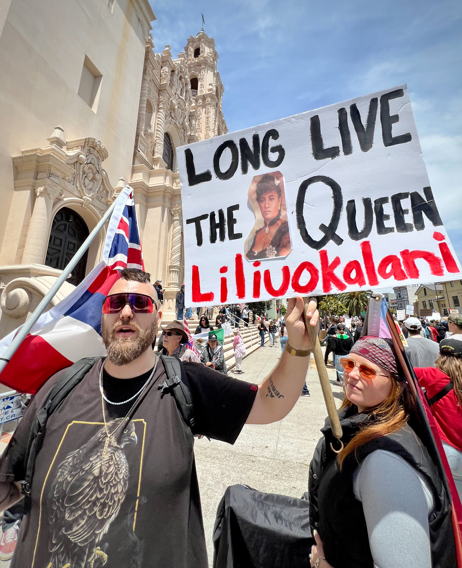
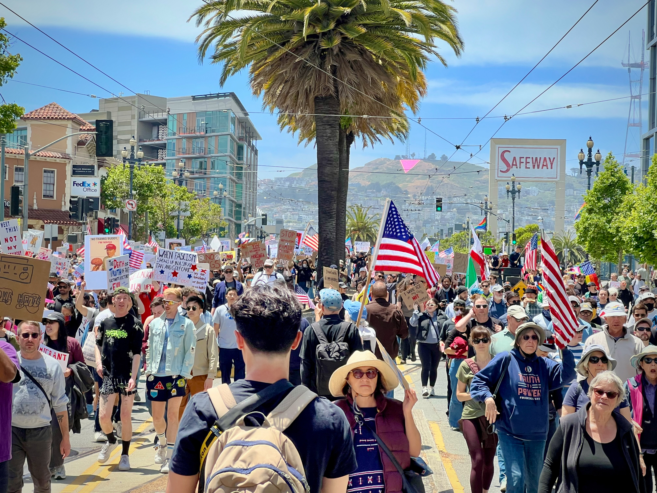
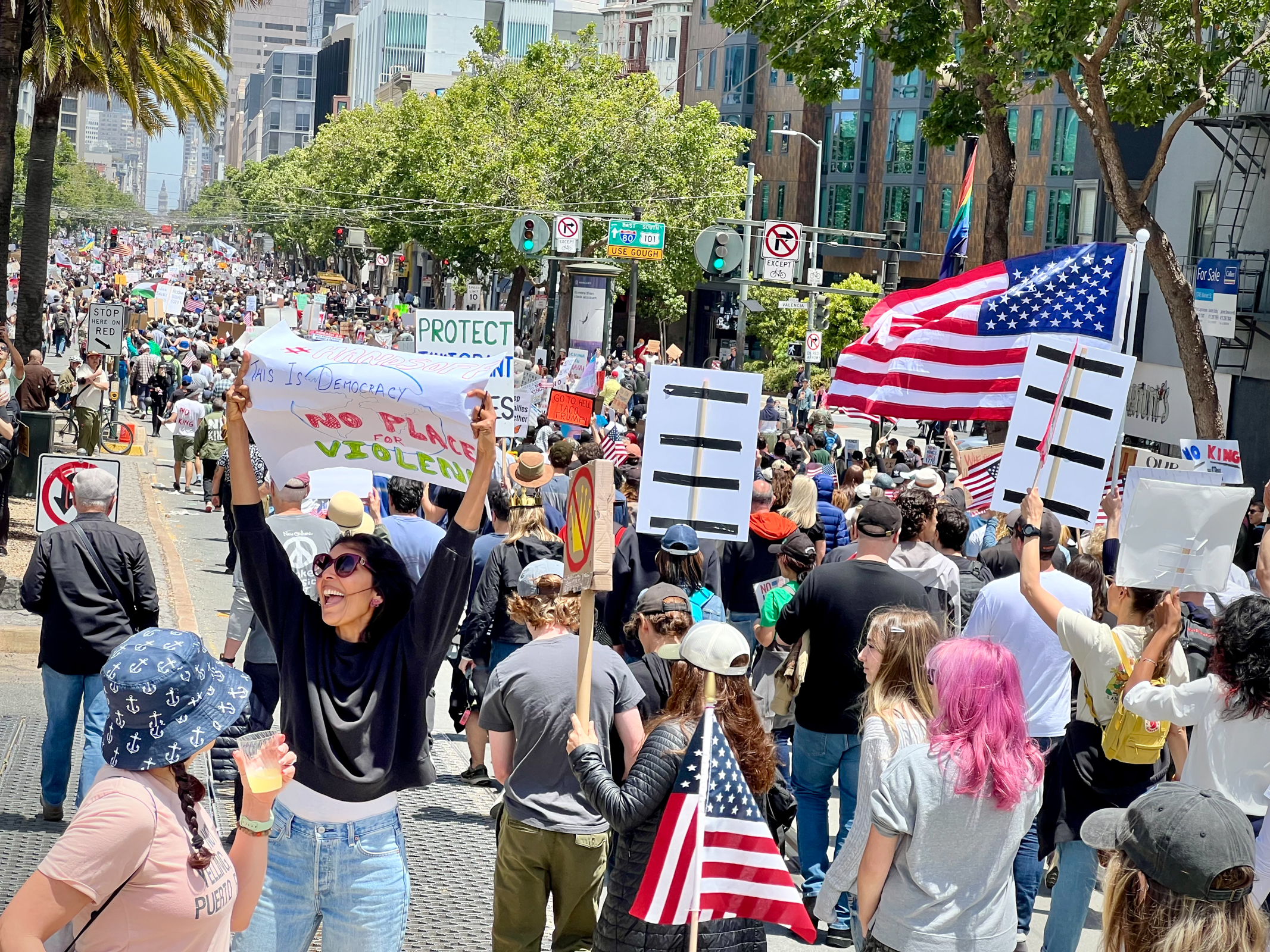
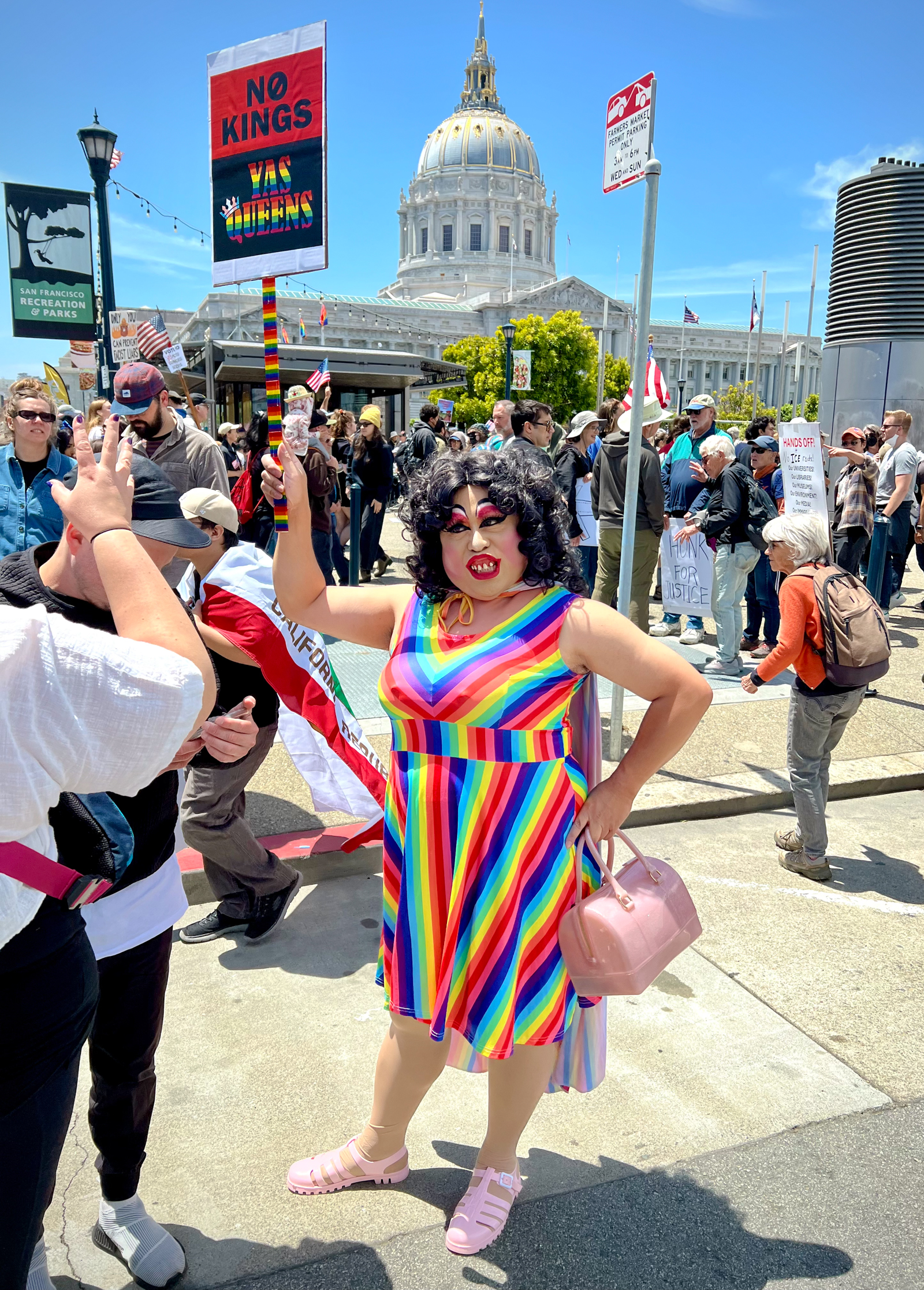
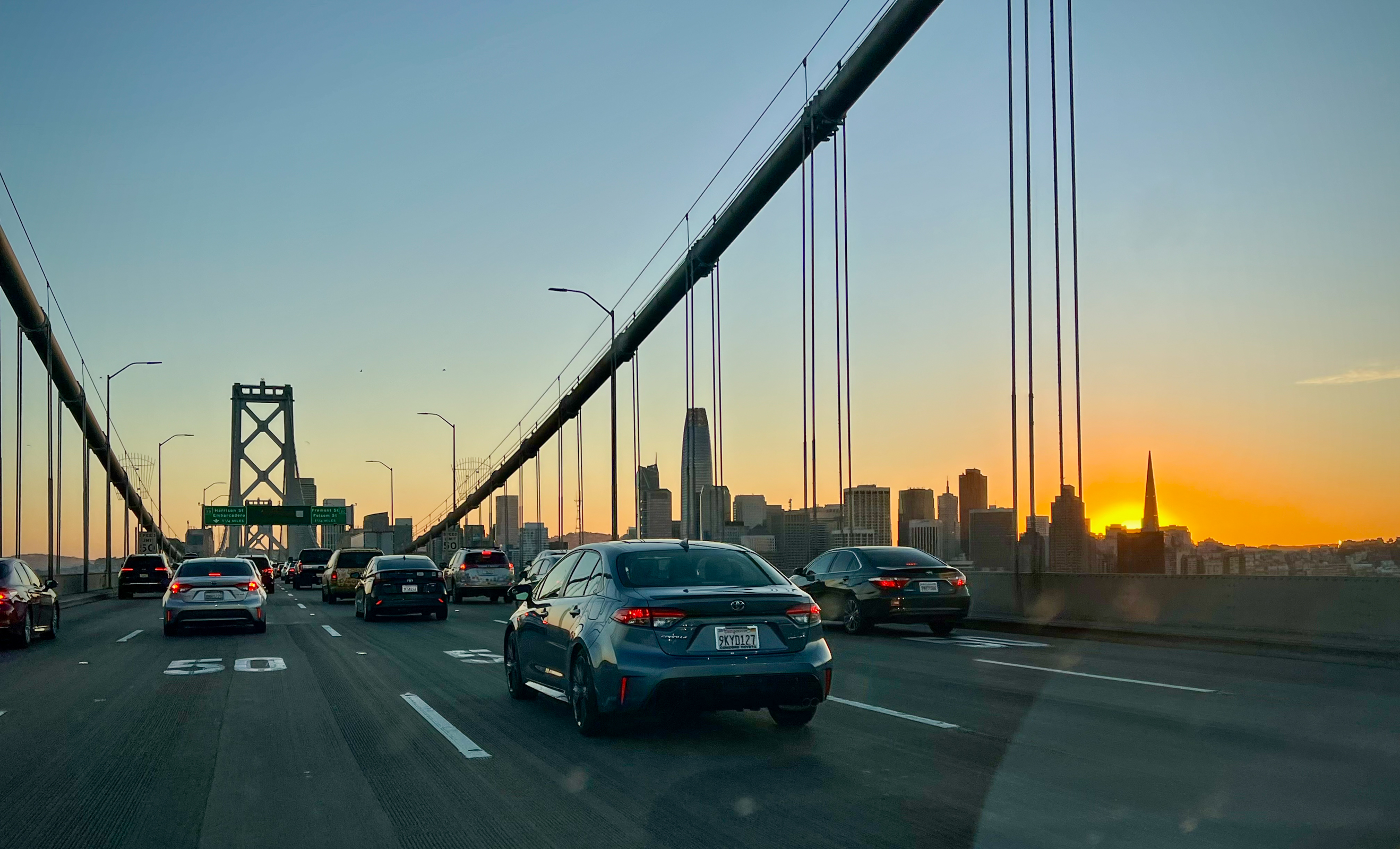
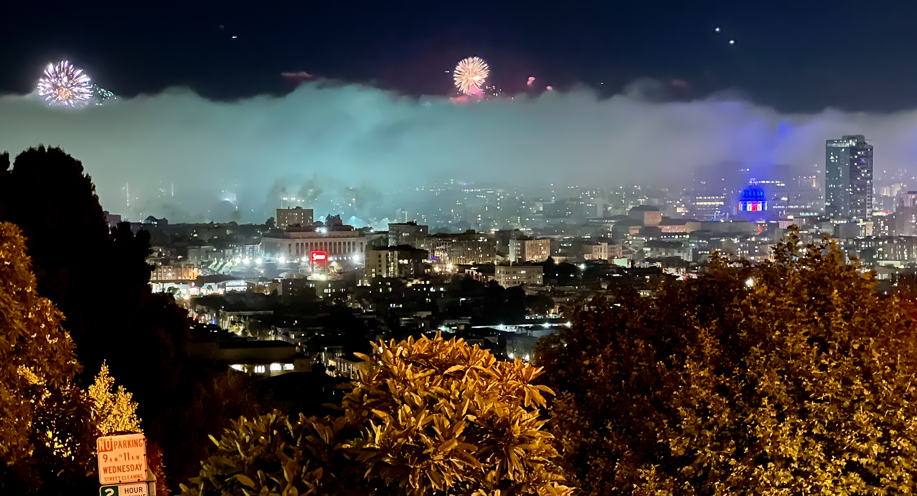
In speaking truth to power, we witnessed a remarkable moment two days ago. The depressing spectacle of watching Trump use the US Army to provide cover for his obscenely expensive birthday party for himself was contrasted with millions of ordinary citizens in over 2000 American cities standing up peacefully, joyfully and forcefully saying “NO KINGS!”
We were fortunate to be able to participate in this inspiring historic event here in San Francisco. Here are a few images from a day that helped me feel that there is still hope for Democracy here in the USA.
As we live through interesting times, I obsess on the news and vacillate between despair and hope. Despair is the easy part. We swim in a sea of terrible stories about Trump playing Godzilla destroying our government, our country and the world. Like the movie Godzilla, we are now living through the sequel that is even worse and more destructive than the original. But even Godzilla met a bad ending, and we can only hope that Trump will do the same. Recent milestones included Trump’s “Liberation” Day in which he attempted to destroy the world’s economy with his bizarre tariffs. We also marked his First 100 Days after which Trump’s poll numbers and the US economic system are now in free fall. But while we are in the middle of Trump’s American carnage, it is easy to give in to despair and give up on hope. I really believe that we are better than this.
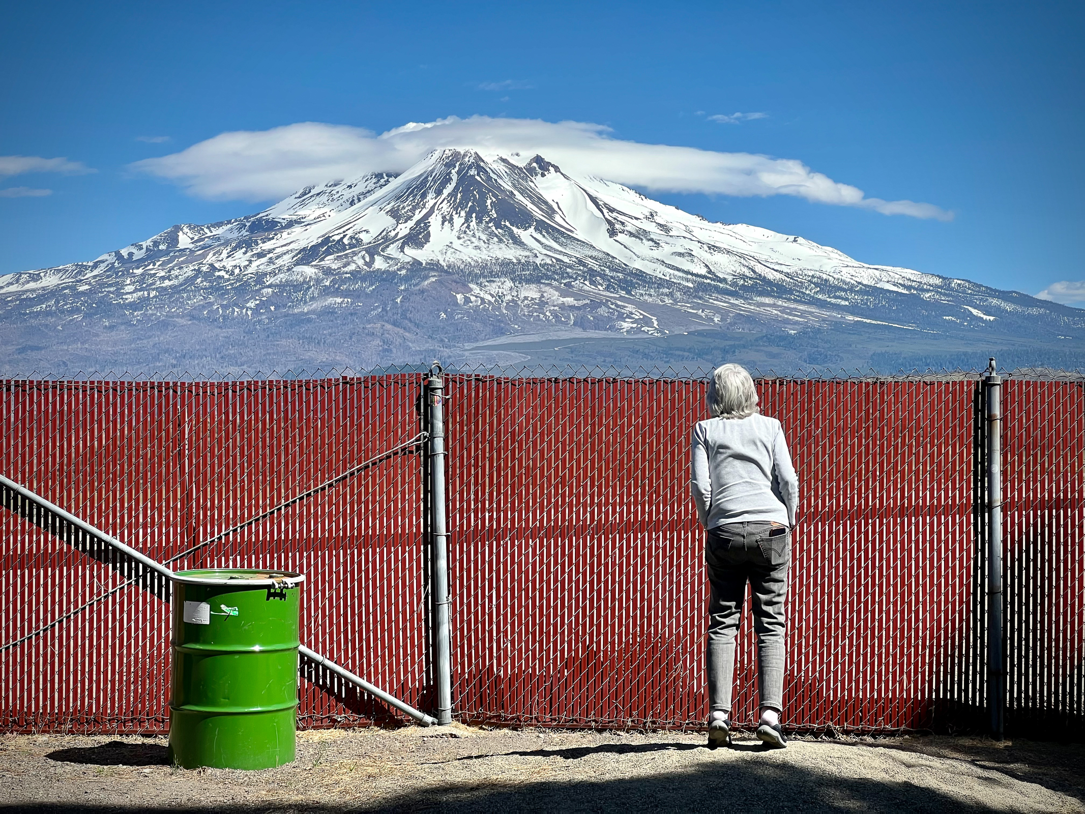
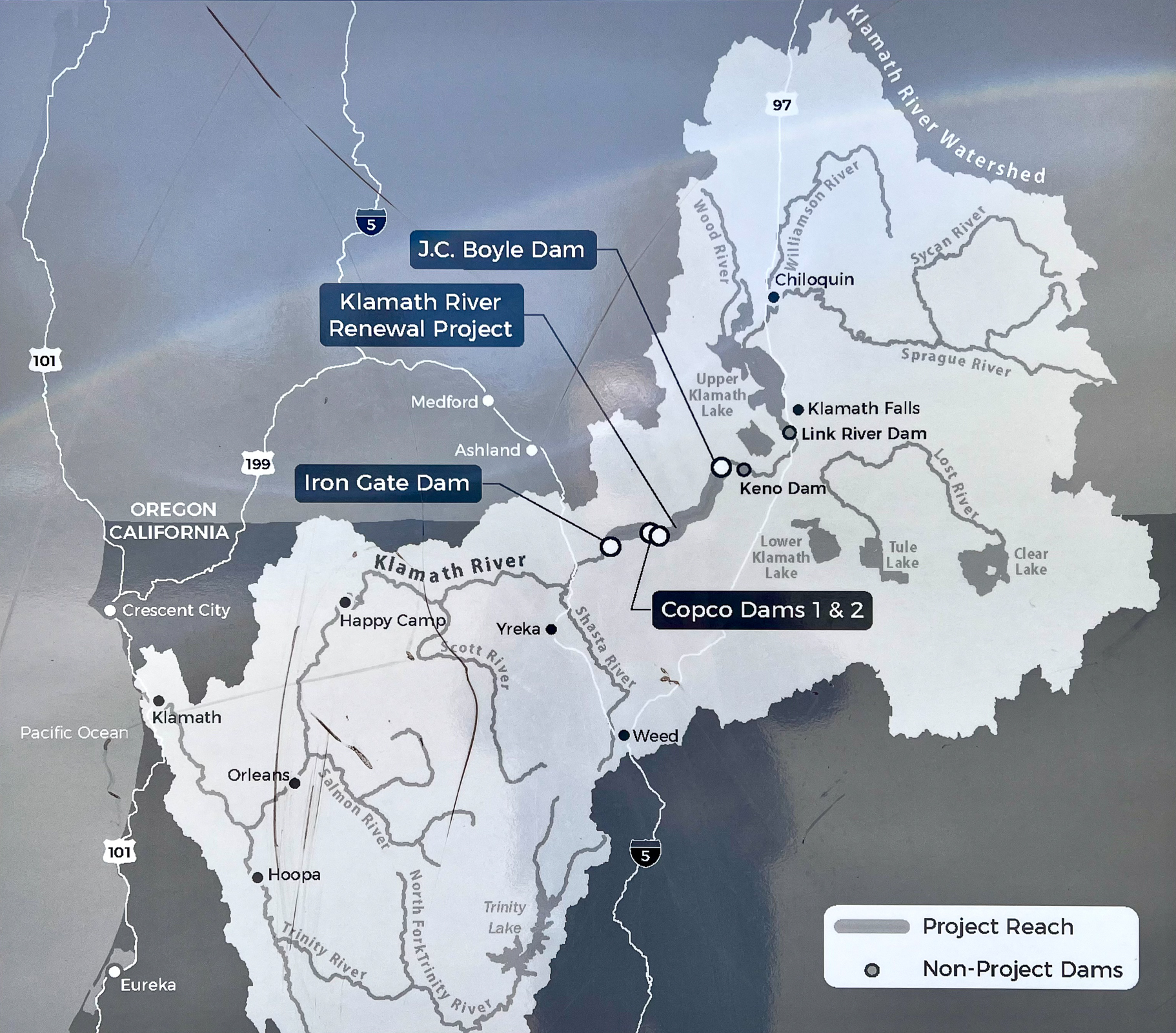
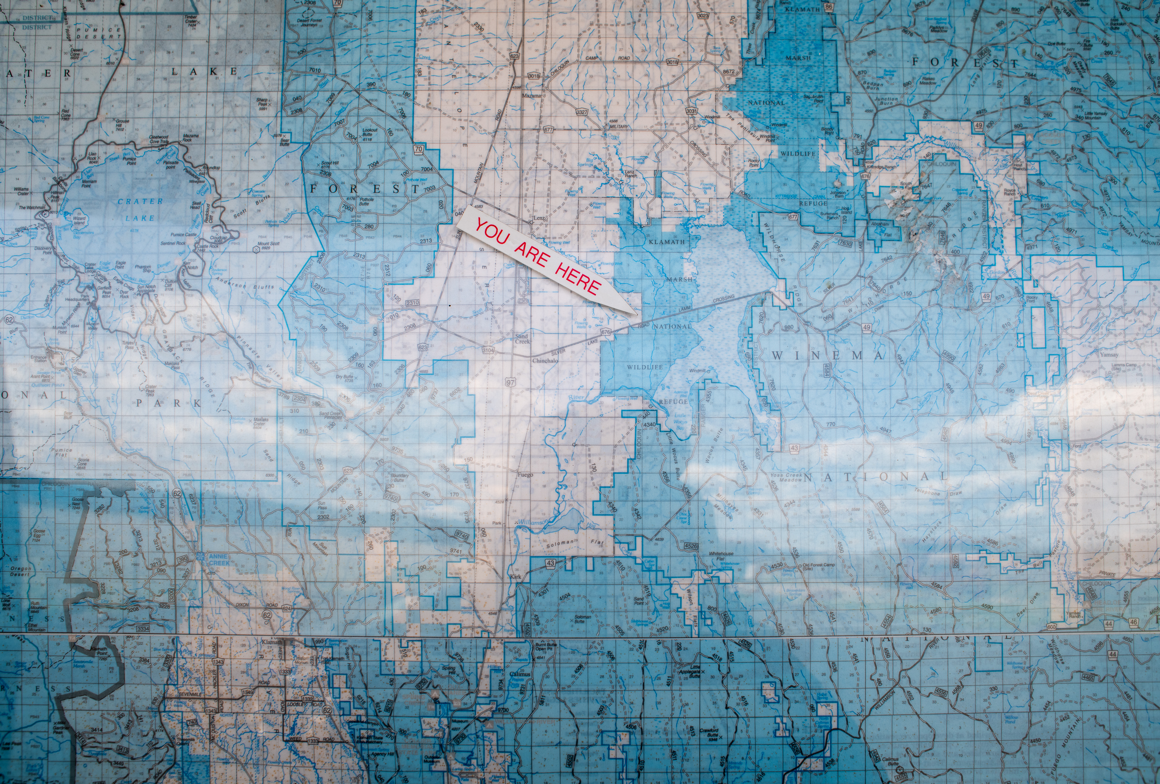
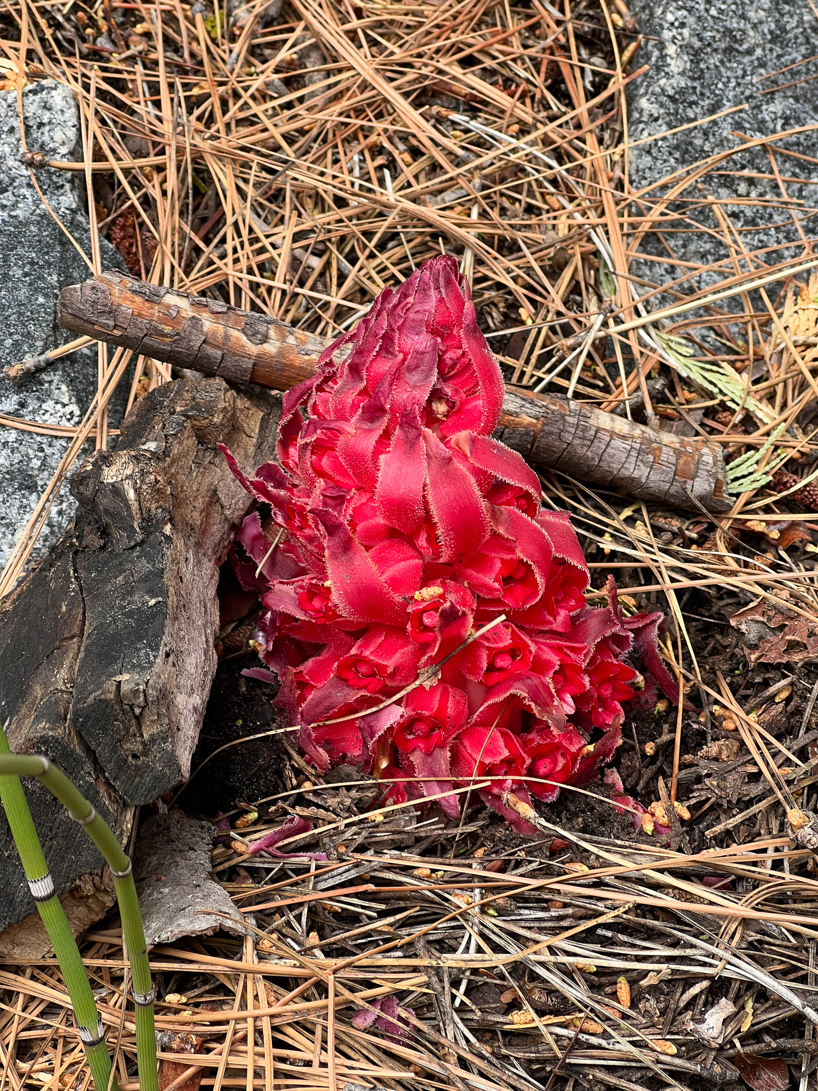
Another recent milestone was Earth Day which seemed to barely register in the news because of all the Trumpian noise. To celebrate Earth Day and hang on to hope, Ellen and I decided to visit one of the most important environmental success stories of our time, the Klamath River. The river flows between Oregon and Northern California, eventually emptying into the Pacific near Crescent City, CA.
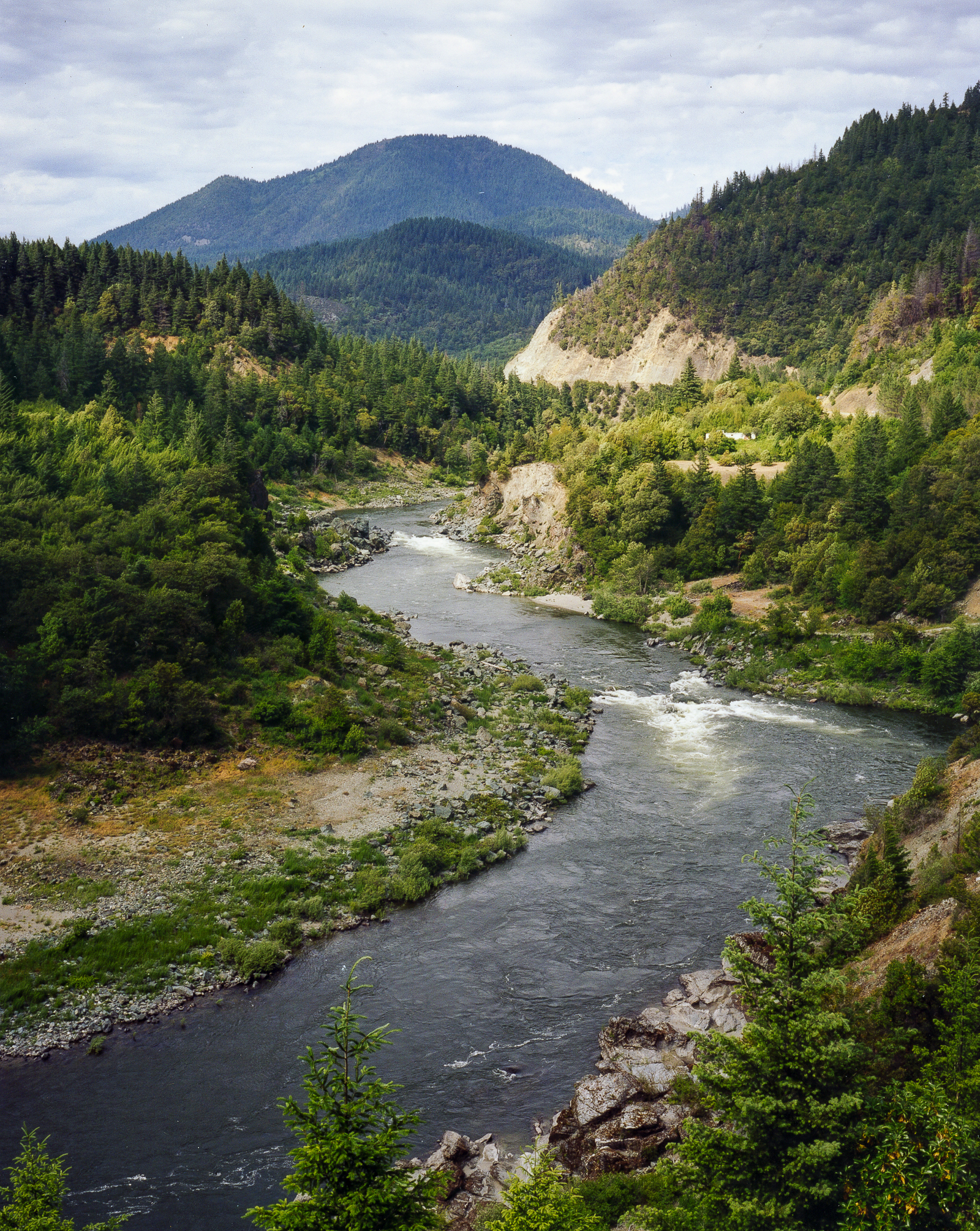
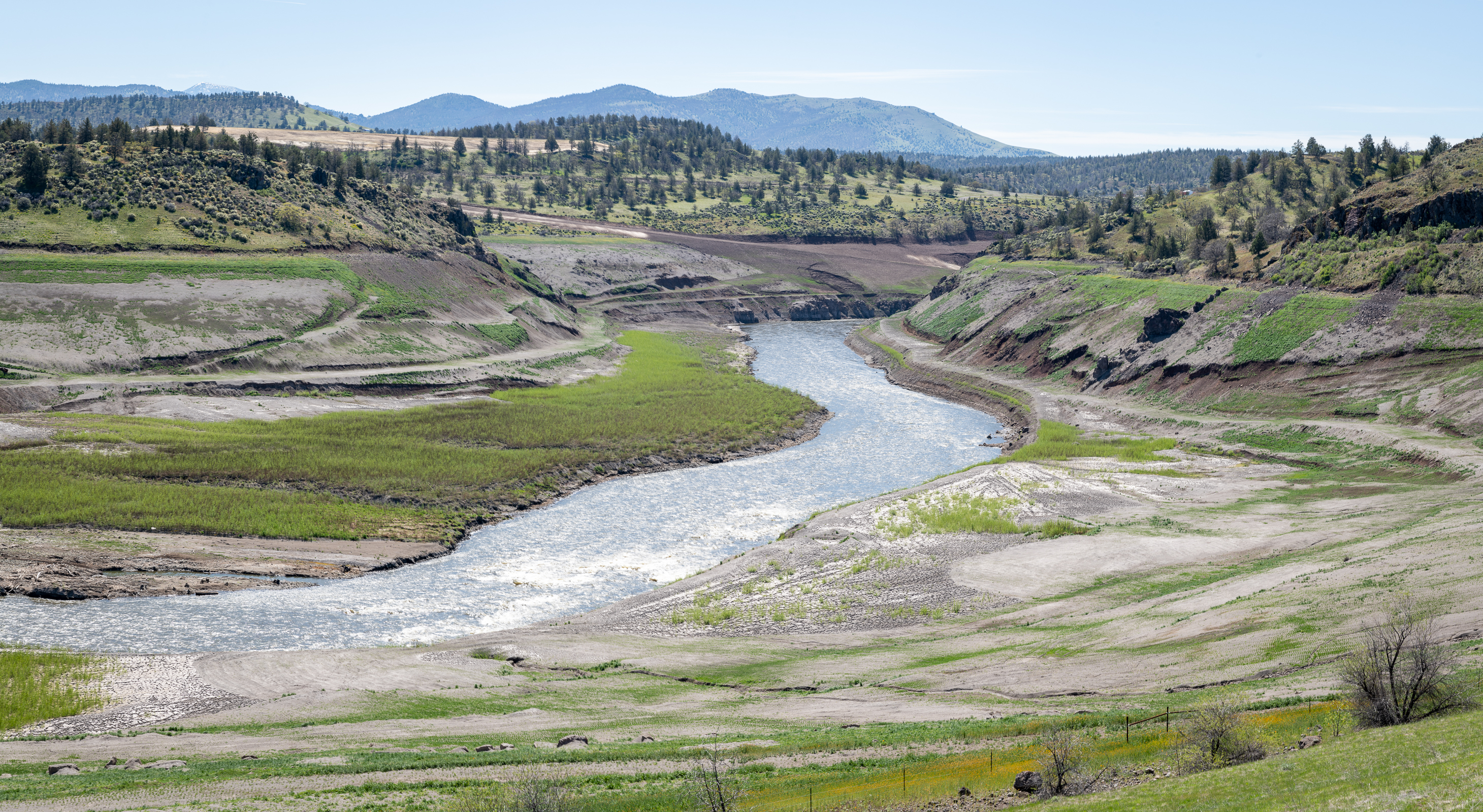
In the Fall of 2024, four dams on the Klamath were finally taken down, after almost 20 years of a fierce water war between the farmers upstream, the Native People downstream, conservation groups, local representatives and the utility company operating the dams. It restored nearly 400 miles of vital habitat for salmon and other species that are essential to the river’s ecosystem and the communities that depend on them. This let salmon migrate upstream for the first time in over 100 years and established new guidelines to achieve a compromise between agricultural needs and Native Tribes. This effort was the largest dam removal and river restoration project ever in the US. In October 2024, the first fall-run Chinook salmon was seen in the Upper Klamath Basin all the way upstream in Oregon.
We visited two of the former dam sites and were amazed by the change. Over 18 years ago I had photographed the entire length of the Klamath for the environmental group International Rivers. We witnessed the damage caused by the dams upstream. We also interviewed and photographed the Native People downstream that were struggling with the loss of the salmon that their people had depended on well into their distant past.
The fact that such a large and diverse group of people could finally come together over restoring the Klamath after so many years should be seen as something to celebrate. The restoration of the river not only affects the river and the people who live near it. It also affects a vast number of forests and marshlands such as the Klamath Marsh National Wildlife Refuge in Oregon and the Tule Lake National Wildlife Refuge in California which we visited. Even though Trump is trying to cut the money that is already allocated for restoration, much of the restoration work is locally funded and will continue despite the weirdo in the White House.
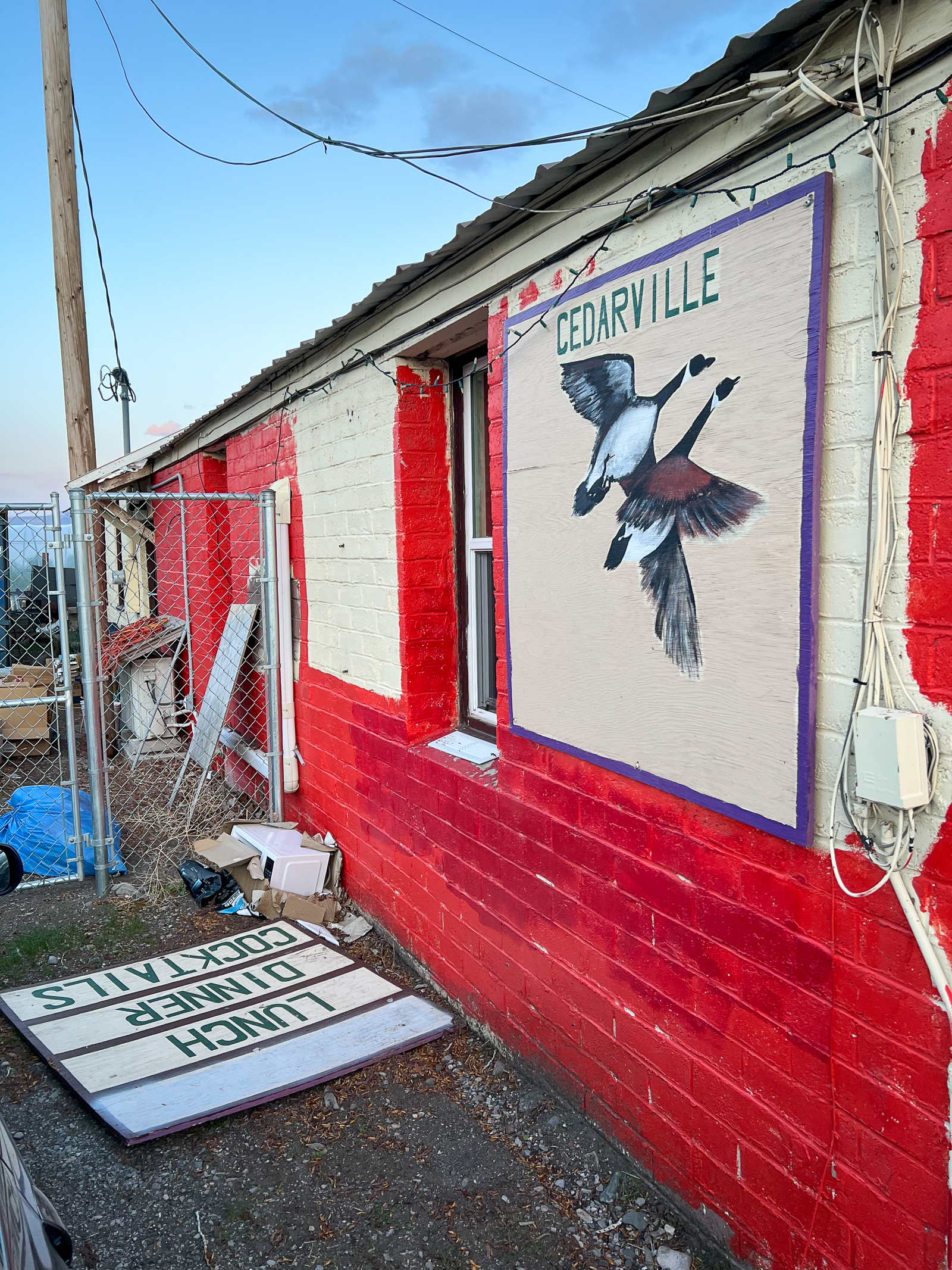
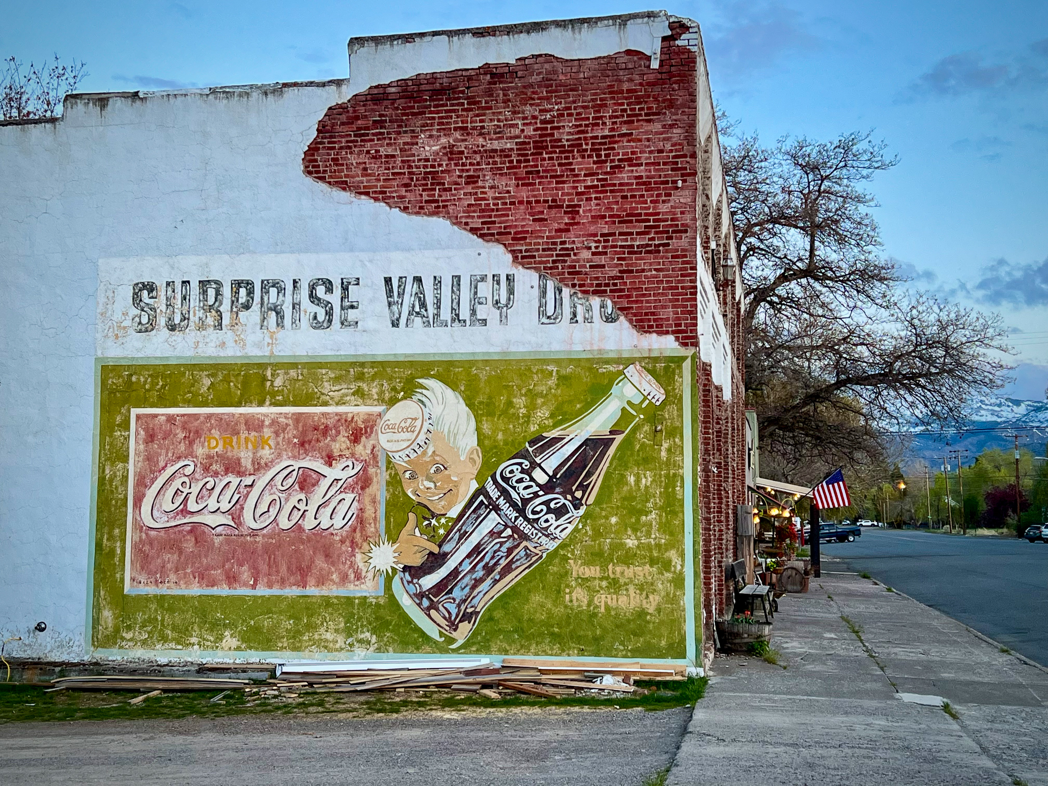
We left the Klamath River Watershed and eventually made our way over the snow-covered Warner Mountains into Cedarville, CA. This is an incredibly beautiful area with the mountains on one side and the vast Great Basin on the other. Located in the seldom visited northeastern corner of California, it feels unique, wonderfully isolated and separate from the rest of the state. When I wandered around the saloon where we had dinner, I noticed an enormous Trump flag with his image and the words “Fight, fight, fight”. I knew I wasn’t in San Francisco anymore and hoped the people who put up the flag don’t get run over by Trump’s madness in the next four years.
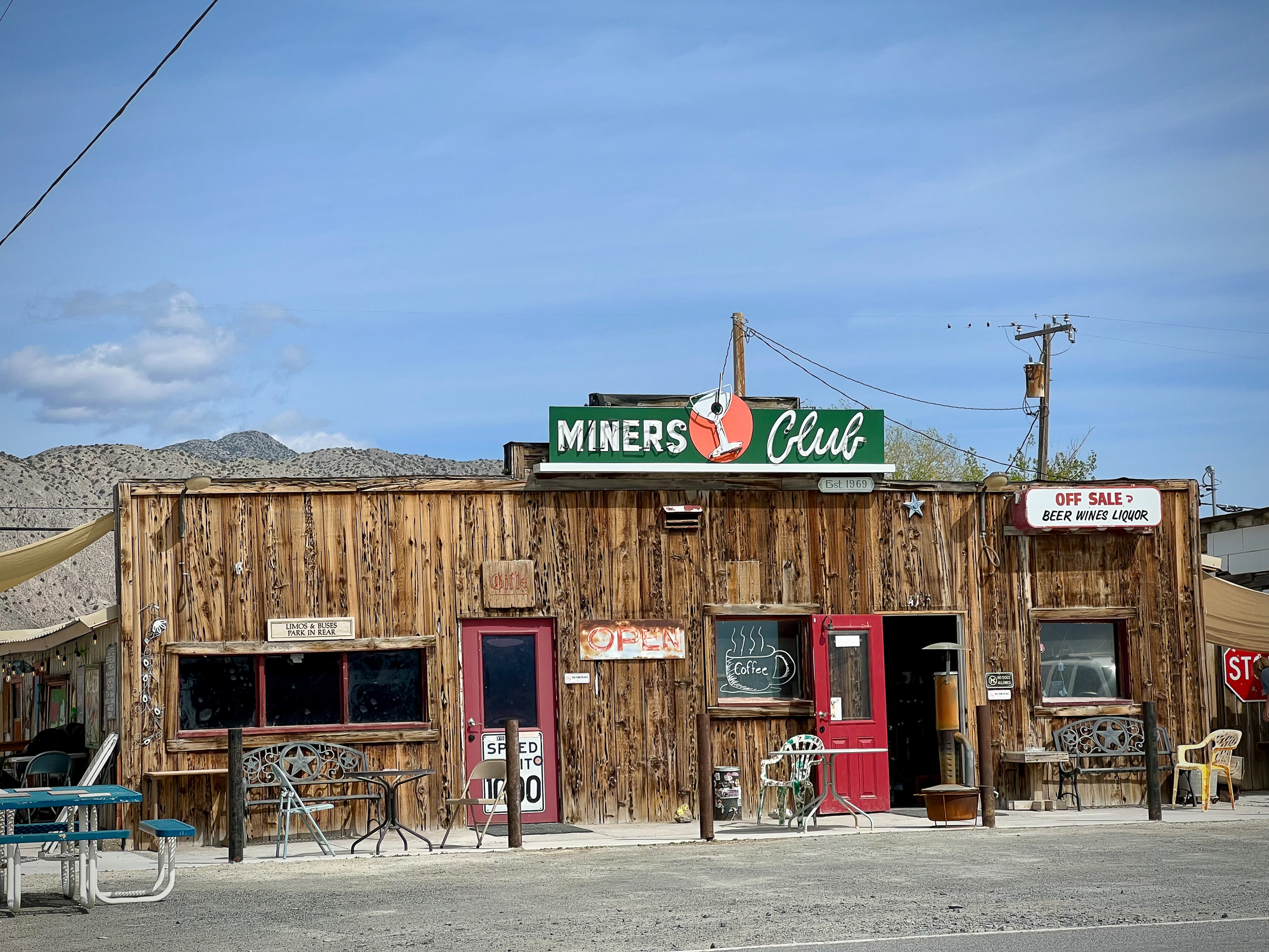
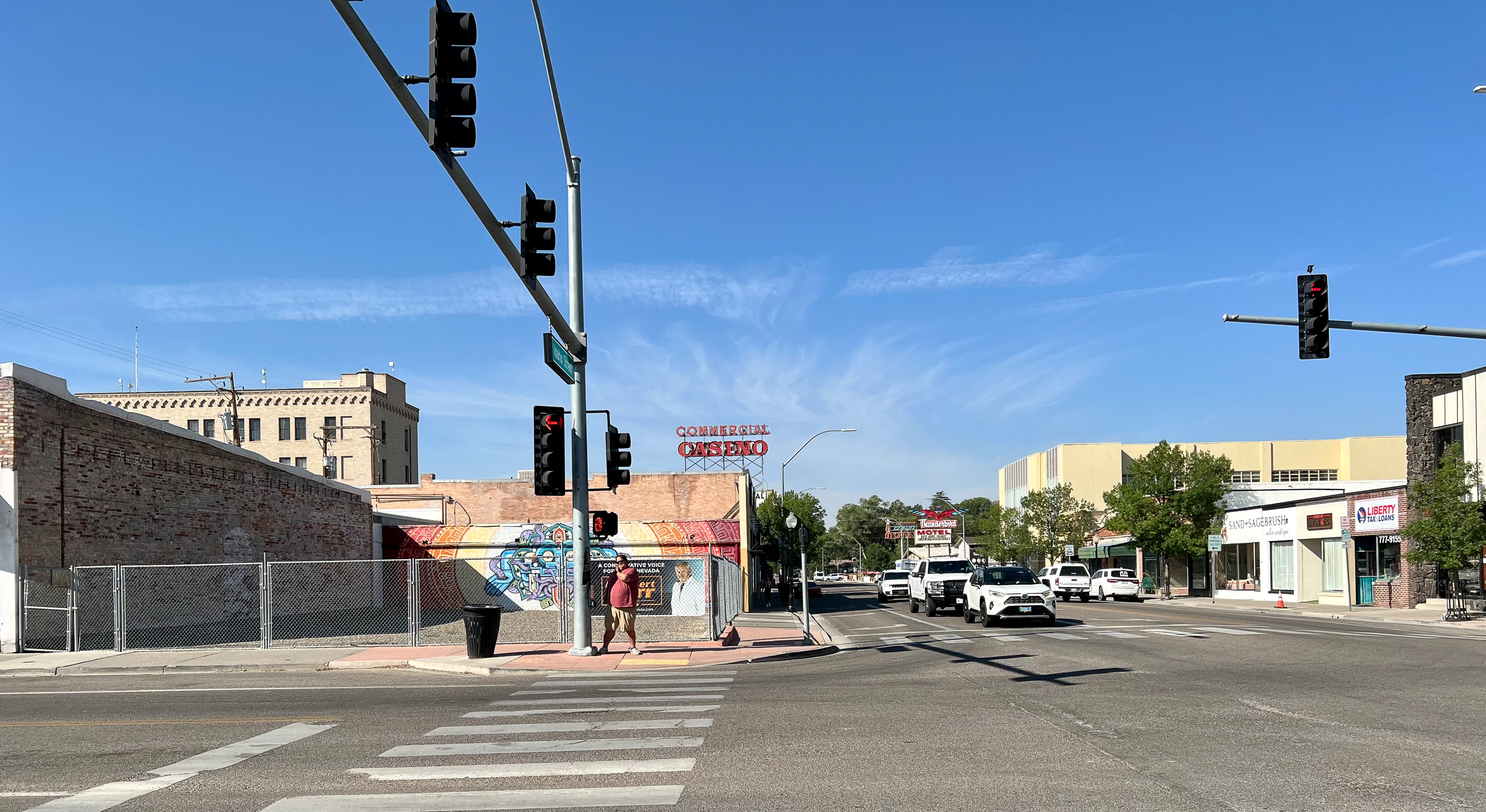
The next day we were fortunate to be able to drive through northwestern Nevada on one of the most remote roads in the country. After hours of endless sage brush and Basin and Range country we landed in Gerlach, NV. It’s claim to fame is that once a year it is home to the nearby Burning Man bacchanal in the Black Rock Desert. I am sure the locals love the money that comes with the revelers but probably wonder about their sanity.
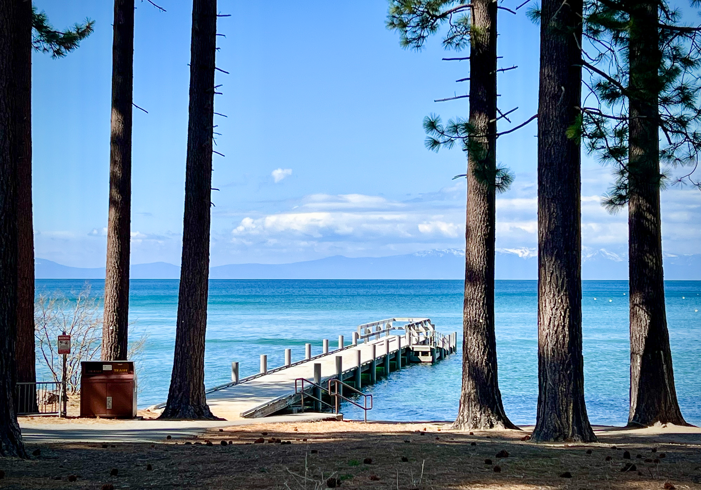
After brief meeting in Reno, ended the day at our favorite place to stay, Camp Richardson’s in South Lake Tahoe, CA. We have been regularly coming here for over 30 years and think of it as a special place to just chill out. When we are here, we mostly hike, drink coffee, sleep and then get up and do it again the next day.
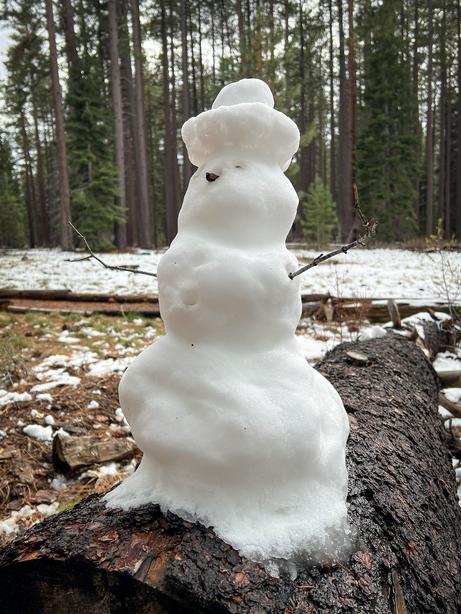
On the second and third days here, it snowed! It was just a little but enough to make it magical (and cold). Hiking in the thin crust of snow wasn’t hard and the chilled air was really invigorating, especially in the High Sierra. We hiked many of our favorite trails to many of the unique places in the Tahoe Basin. Being here is like a giant reset and we savored the solace of nature and the vast open space of Lake Tahoe.
Fortunately, our last day of driving back to San Francisco was glorious! As always, we were sad to leave. But we really needed a chance take a deep rest before plunging back into resisting the attempted take-over of our government by a looney lunatic. When we got home, it was interesting to watch a re-run of the classic Western called High Noon with Gary Cooper. It was made in the early 1950s during the time of the Red Scare and Senator Joseph McCarthy. The Hollywood Blacklist affected this movie as the screenwriter had to escape to England. Cooper’s character became iconic as a symbol of an honest Marshall standing up to the outlaw banditos that wanted to kill him and take over the town. The movie image of Cooper became a part of the famous Solidarity campaign in 1989 when they sought to overthrow the Russian Soviet government that had come to repress Poland after WWII.
Perhaps we need to revise this image for our own time as we are learning how to stand in solidarity against a new dictatorship in the White House.
We have much to be grateful for at the end of 2024. But after our recent election, the next four years seem downright scary and weird. How Trump got elected again is a great mystery. Yes, the Democrats had big problems, and the country seemed in a grumpy mood and wanted to move on from President Biden. But electing a man President who is an impeached convicted criminal is beyond the pale. Anyone who is best buddies with richest-man-in-world Elon Musk and genocidal killer Vladimir Putin cannot be good.
In 2016, Ellen, Walker and I traveled around Ukraine on our first Global Library Road Trip. I gave lectures at the US Embassy in Kyiv that were sent to all the public libraries in Ukraine. The US State Department put together a traveling exhibit of my American public library work that eventually travelled to many Ukrainian libraries as well. At the time, the country was fighting the Russians in a hot war in the eastern provinces of the Donbas. This followed the Russian seizure of the Crimean Peninsula. We looked at how the heroic Ukrainian libraries were helping the country in this time of crisis. Russia invaded the rest of Ukraine in 2022 and the fighting for the survival of Ukraine has been going on ever since this invasion.
I have stayed in touch with several librarians that we met in Ukraine in 2016. Over the years we have followed the agony of a country senselessly besieged as seen through the eyes of several of Ukraine’s public librarians. A few days ago, I sent a New Years greeting to one of those librarians, Valentyna Pashkova. She responded yesterday and added another message to me today.
Robert Dawson Thank you, dear Robert! Your support is important. This night we had air alert and spent about an hour in our bathroom — the most safe space in our apartment. This morning from 7 am till now we are in the bathroom again: another Russian air strike But we are strong! Happy New Year!
The new year has started today with another Russian drone attack at 7 am. A building not far from my house was damaged by drone debris. Resilience, gratitude to Ukrainian defenders, supporting the army, doing our best to preserve and to continue to develop our cultural heritage, to help each other, — this is our everyday life. And confidence in our victory. Please share also that we are grateful to American people for their support. ALA’s Ukraine Library Relief Fund we use to repair damaged library premises, support librarians who lost their houses, etc. — the list of needs is unfortunately long…”
She is referring to the American Library Association’s Ukraine Library Relief Fund. If you wish to find out more or donate to help Ukrainian libraries, please go to:
As we enter a new year, I feel thankful for the peace we have here at home. I am sure that 2025 will bring new problems, but perhaps new opportunities to help make our troubled world a better place. I know that libraries can be part of that help. The journalist Rachel Maddow once said “Librarians and archivists and teachers are the Fort Knox of memory, history, and truth. We must defend them with everything we’ve got.” I couldn’t agree with her more.
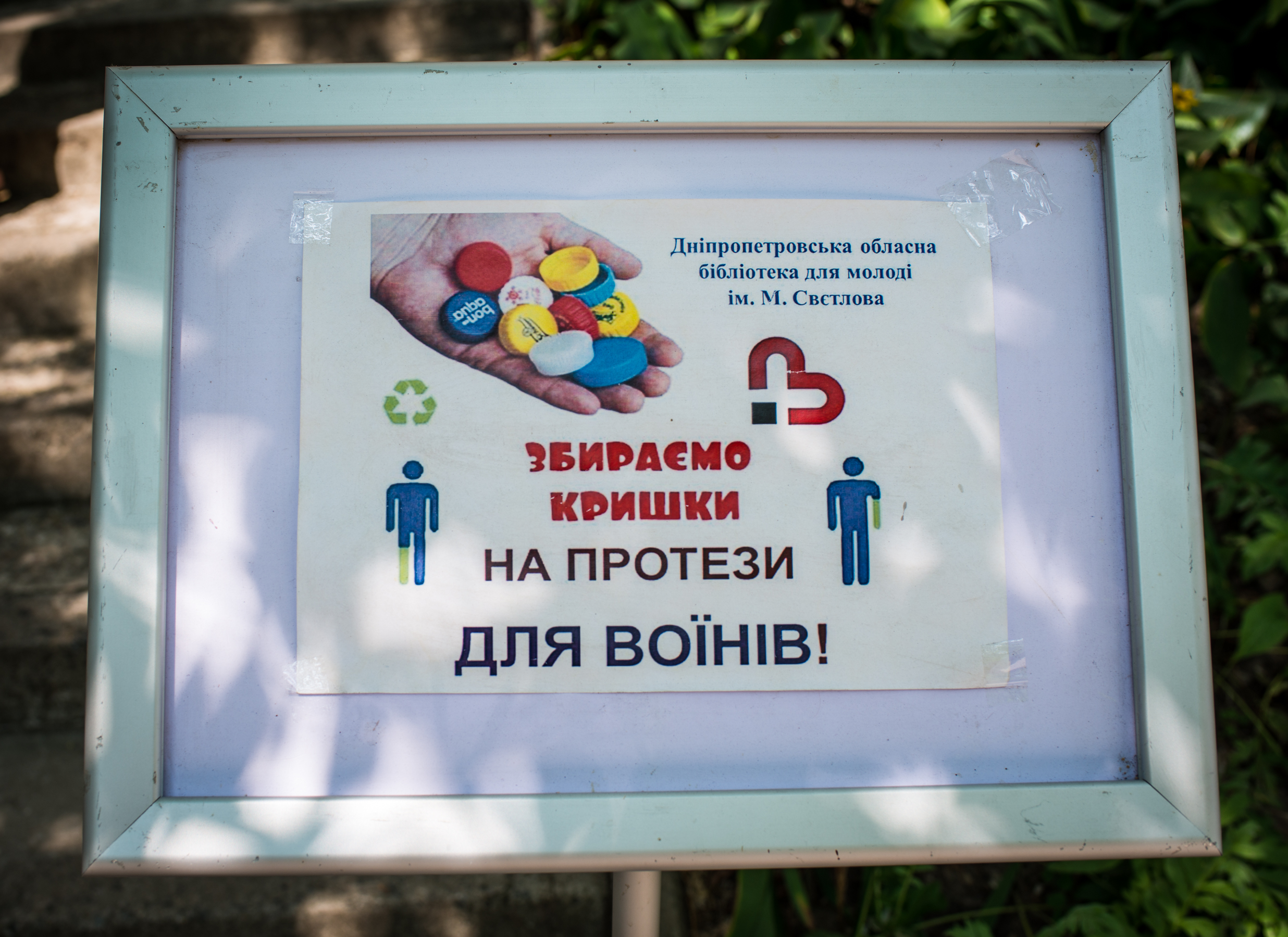
In 2016, as we were leaving the Children’s Library in the front-line city of Dnipro, Ukraine, I photographed this sign outside the entrance. The library was running a bottlecap collection to help returning injured veterans with missing limbs. The translation reads:
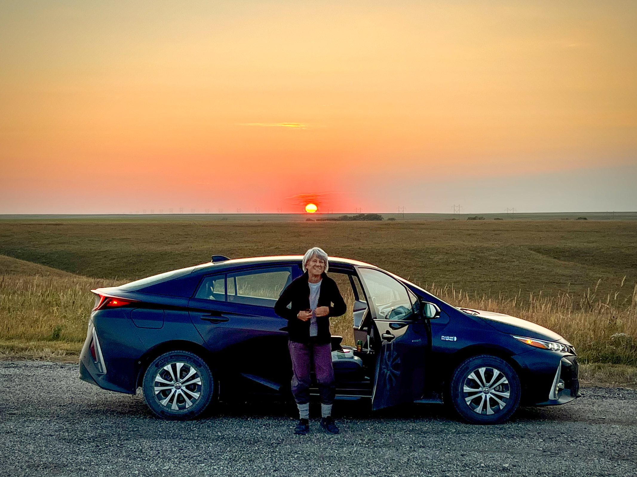
One reason why we make these long drives across the country, is to better understand the mood of America. Living in our Bay Area bubble is great, but I know that the true measure of our complicated nation often lies elsewhere. During most of our drive from Vermont to San Francisco, we saw little sign of a massive partisan battle taking place. But beneath the surface, when we looked in the right place, we saw many unsettled communities.
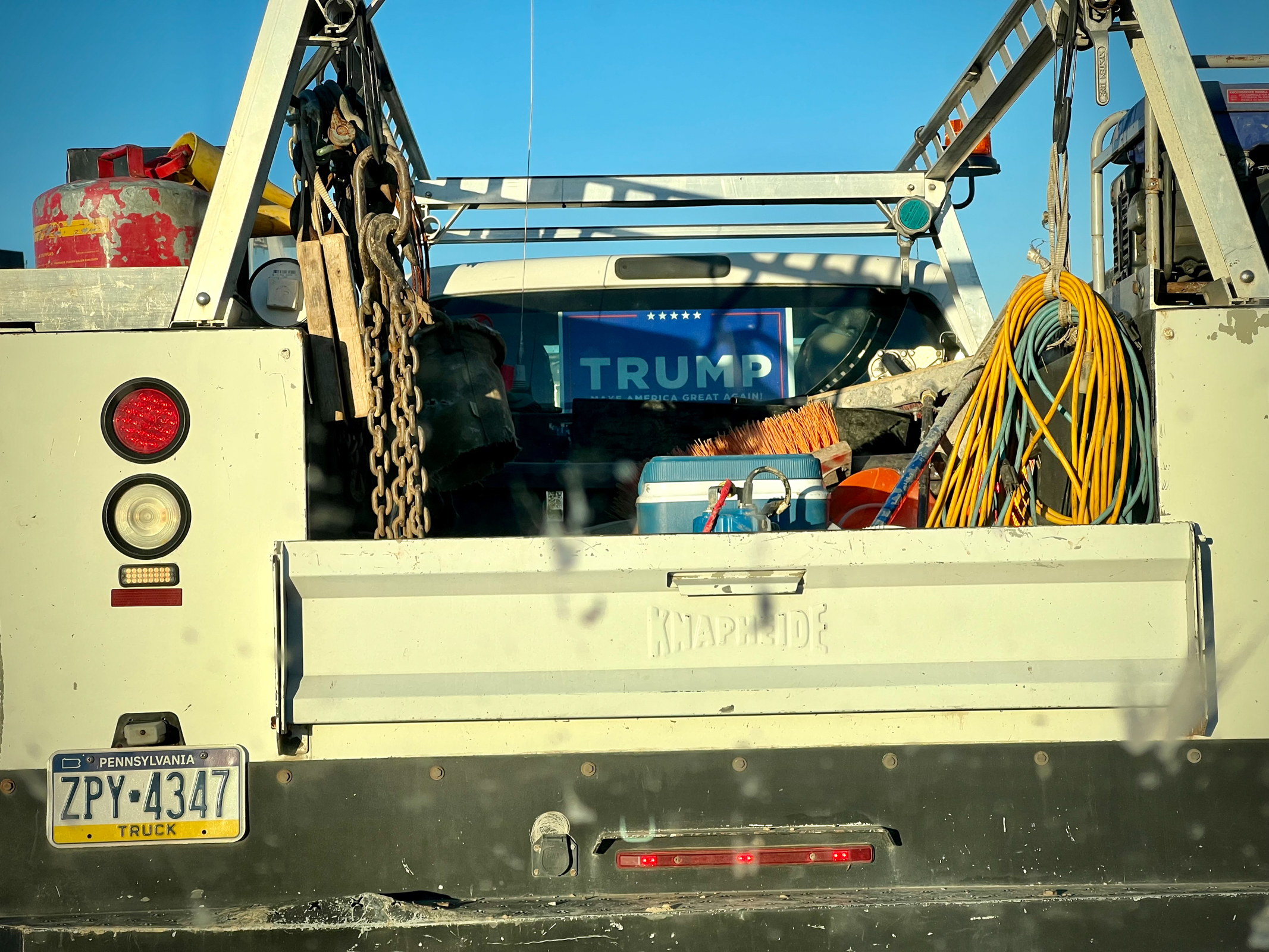
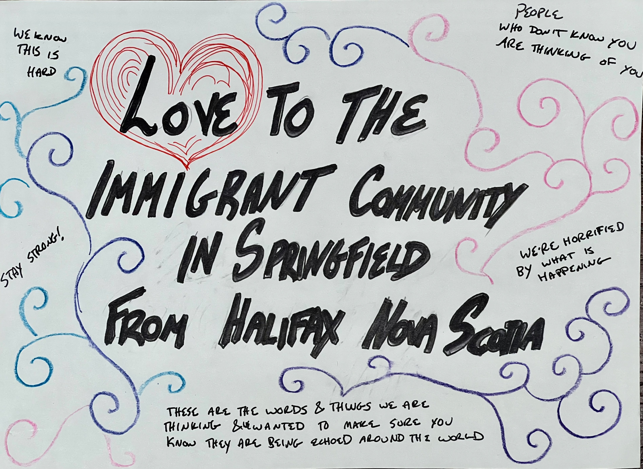
One community that has been the news a lot recently was Springfield, OH. Trump’s description of it being a town ravaged by Haitian immigrants devouring the city’s dogs and cats is, of course, laughable. The trauma inflicted by this political hysteria is real. We went to the public library in Springfield to measure the mood of this normal American town through its library. The stories of people coming into the library angerly screaming “Where are the Haitians?” showed the real-world consequences to the Trump/Vance fantasies. Some of the librarians urgently needing PTSD trauma therapy after these encounters spoke to how unprepared most of us are to the hallucinatory outbursts of the MAGA activists.
One librarian explained how most of Springfield welcomed the Haitian immigrants because they were desperately needed as workers. The economy was making a much-needed comeback because of them and not one dog or cat was missing. The library was quickly stocking up on books about Haitian history and Creole-language texts. And, like we saw last year in the Uvalde, TX public library, the library was the recipient of an inspiring international outpouring of support from people sending gifts and words of support to Springfield.
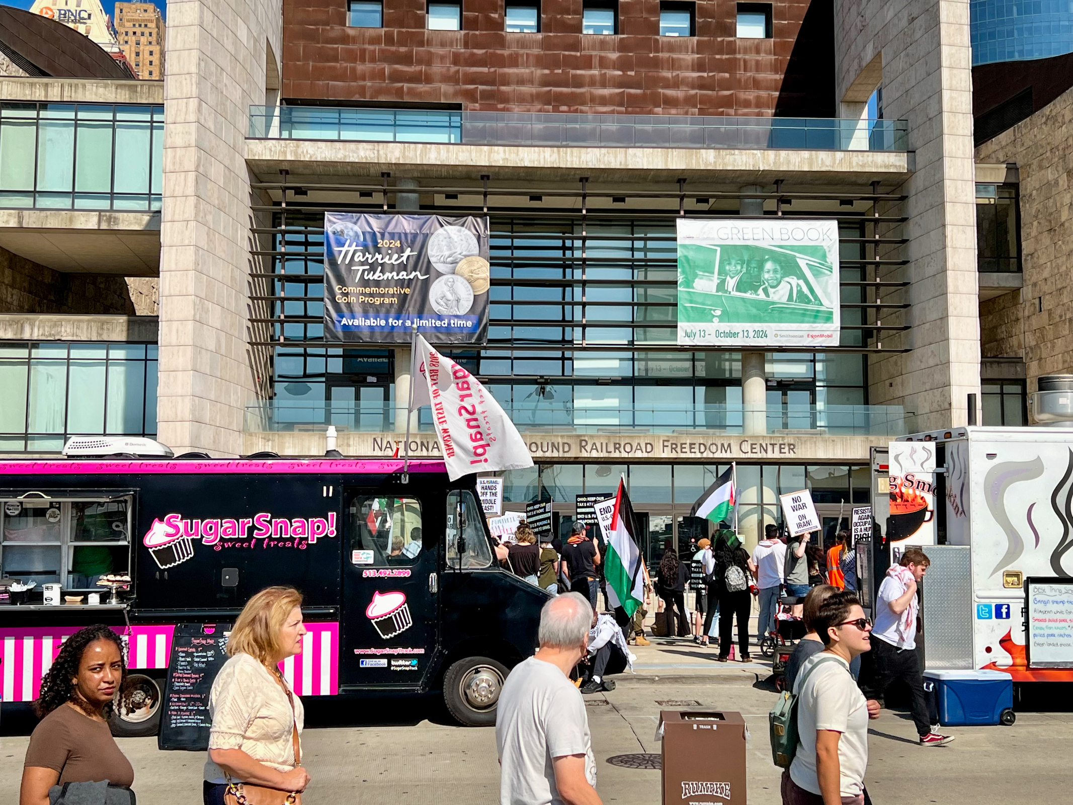
Cincinnati, OH was another surprising stop on our long journey across the country. We looked forward to visiting the National Underground Railroad Freedom Center in the revitalized core of the city. Unfortunately, at the entrance we were stopped by a massive pro-Palestinian, anti-Biden/Harris demonstration. It turned out that Tim Walz was speaking there later in the day and the protest was against his presence. The layers of irony here were just too much and we were very disappointed in missing a significant cultural and historical attraction.
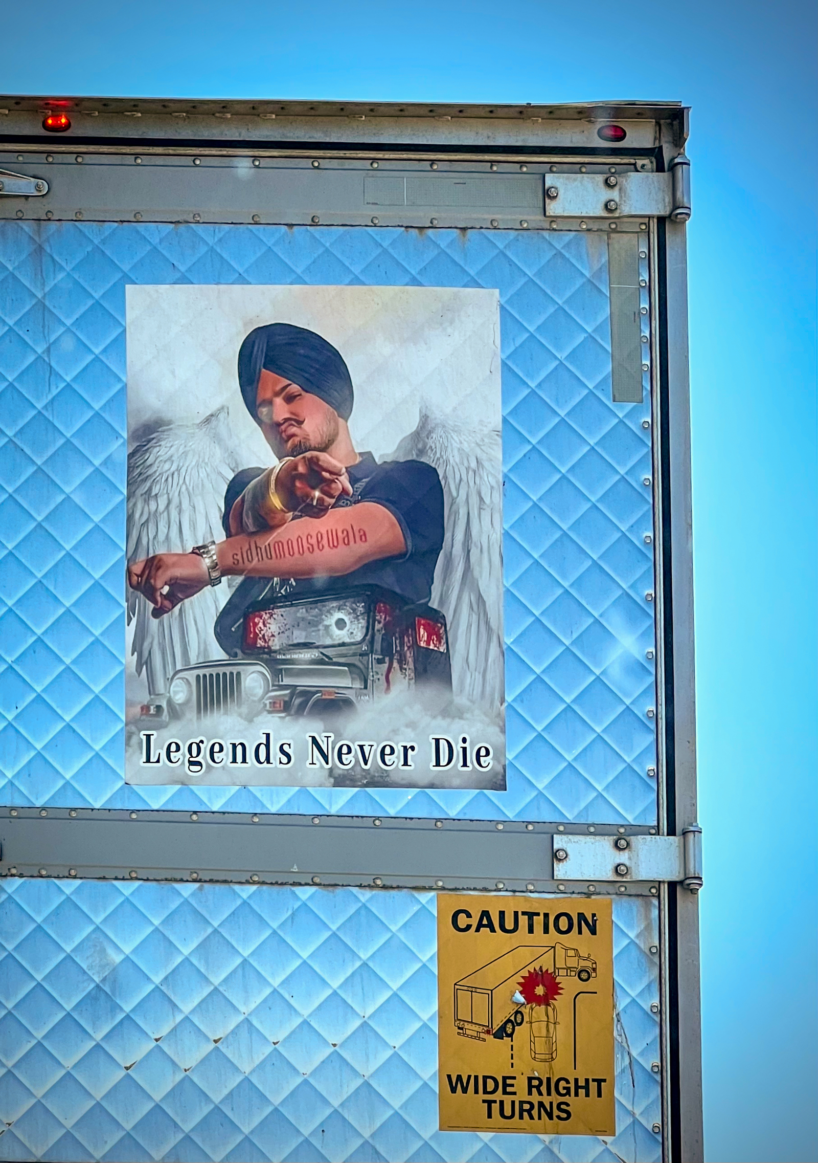
One of the realities of driving the highways and byways of America is sometimes getting stuck in road construction and repair. We spent at least an hour sitting behind a truck with a poster of Sidhumoosewala. We had no idea what it was about, but it seemed rather ominous.
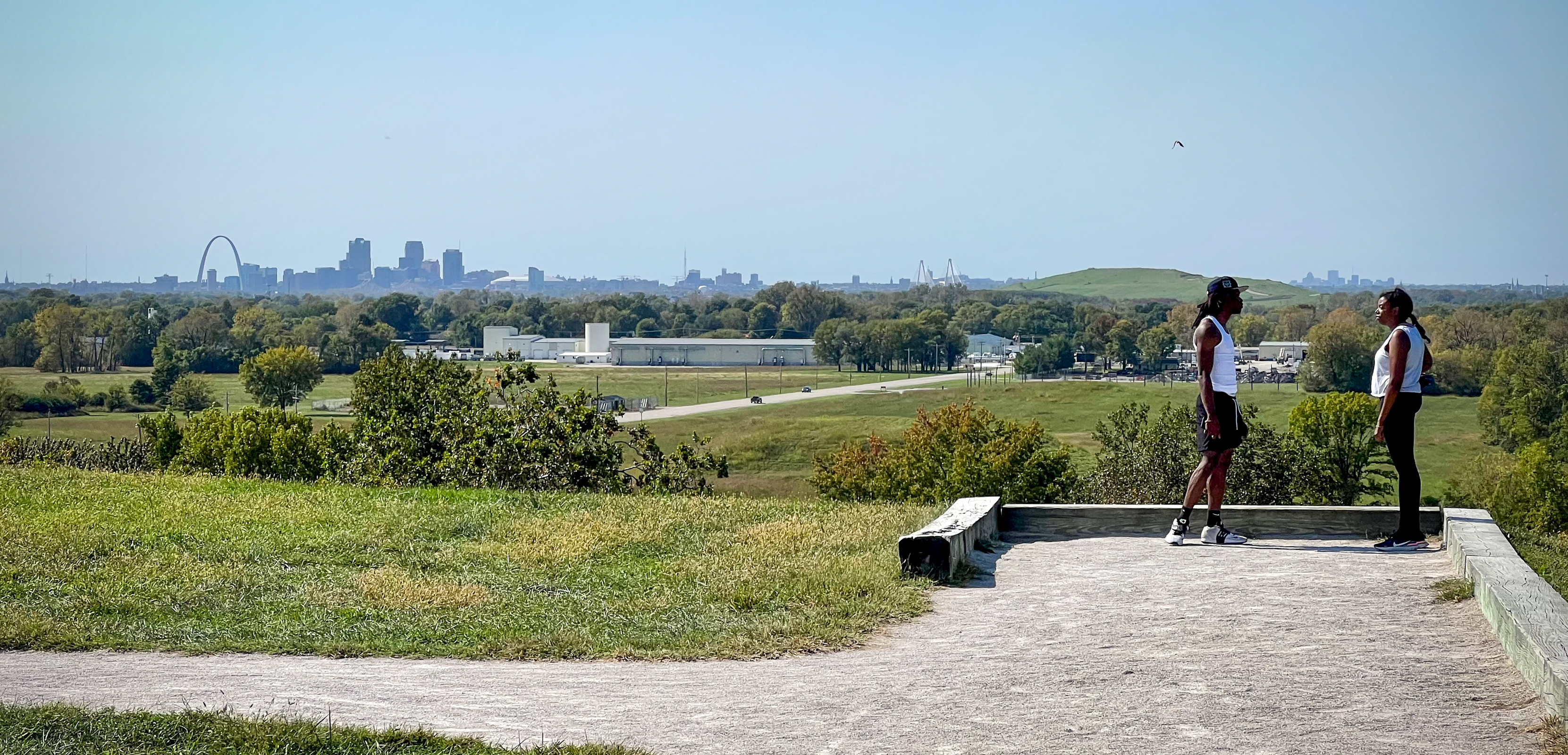
Cahokia Mounds is a National Historic Landmark, and a UNESCO World Heritage Site located just east of St. Louis, MO. At its apex about a 1,000 years ago it was the largest and most complex urban area north of Mexico. It may have been abandoned because of climate change and environmental problems. Modern St. Louis is considered the third most dangerous large city in America today because of crime. We had visited it years ago, and it seemed worse then. The downtown seemed to be rebounding now because of significant urban renewal money, good urban planning and a vibrant Black cultural scene. Perhaps St. Louis can escape the fate of its nearby ancient ancestor Cahokia.
Ferguson, MO is also near St. Louis and was the site of the 2014 police shooting of Michael Brown. The ensuing civil unrest led to the destruction of parts of the city. The only civic structure near the violence that was spared was the Ferguson Public Library. We visited the small library and met the Head Librarian who had just started his job when the violence erupted ten years ago. The library received national attention for its support of the local community including helping teachers open an ad hoc school in the library when schools were closed for safety concerns during the troubles. I photographed a few paintings and signs that remained from that effort. In addition to helping with basic services like insurance, the library also featured a community art display in response to Brown’s death and the related unrest. The library also provided healing kits to local children that contained books and other material related to coping with traumatic events as well as a stuffed animal for the child to keep. I said to the Librarian that he was one of my personal heroes after I learned of the library’s pivotal role in helping heal the broken community of Ferguson.
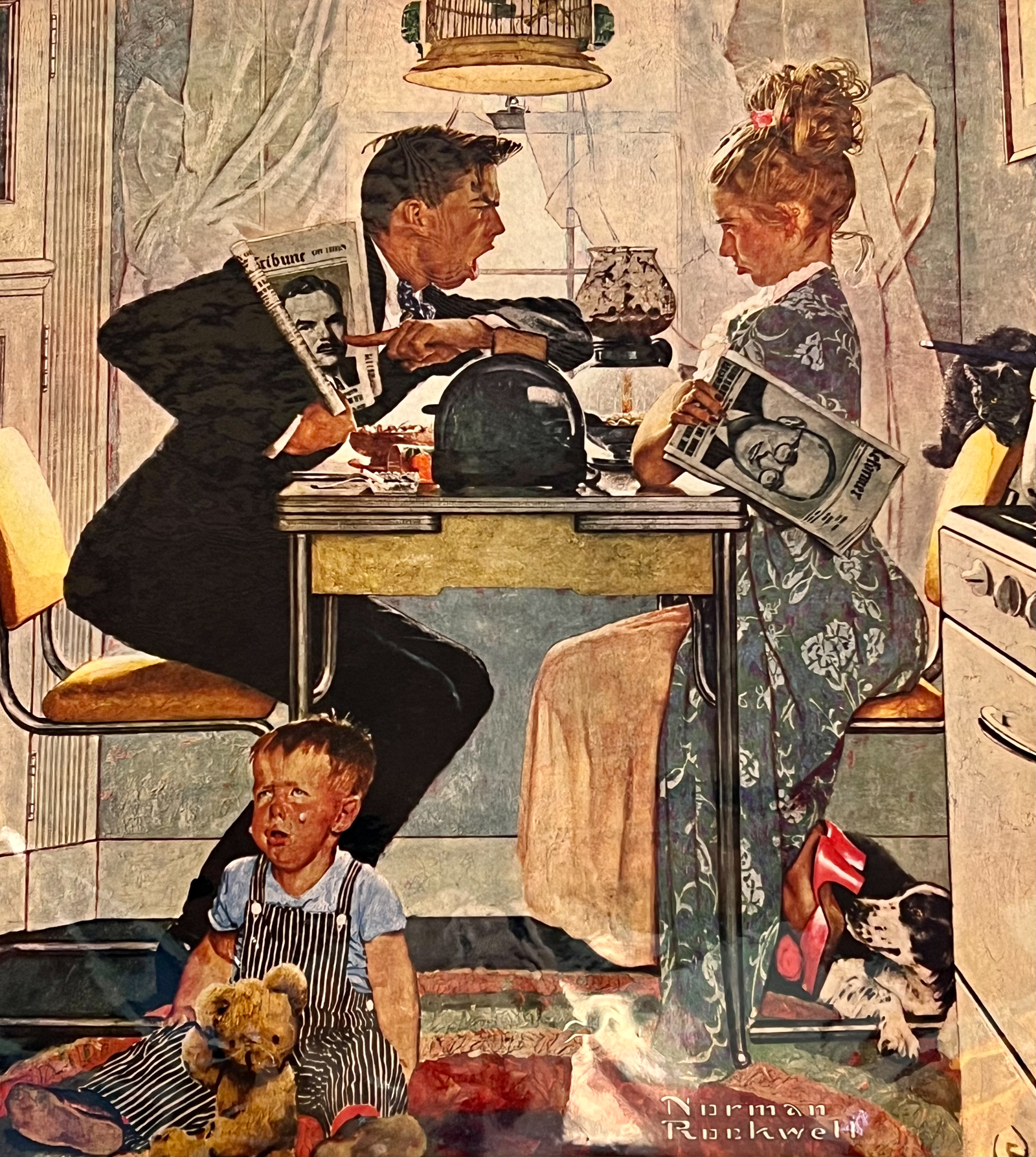
I had always wanted to visit the home and Presidential Library of Harry S. Truman in Independence, MO. The Museum was massive and very well done but we wound up moving quickly through most of it for lack of time. But we vowed to return someday to better soak up the life of this unexpectedly consequential President. It was good to see a Norman Rockwell painting showing that our election today was not the only hotly contested one. In the bobble-head doll collection of Presidents, it was nice to see someone had thoughtfully turned the Trump doll backwards. That is certainly his best side!
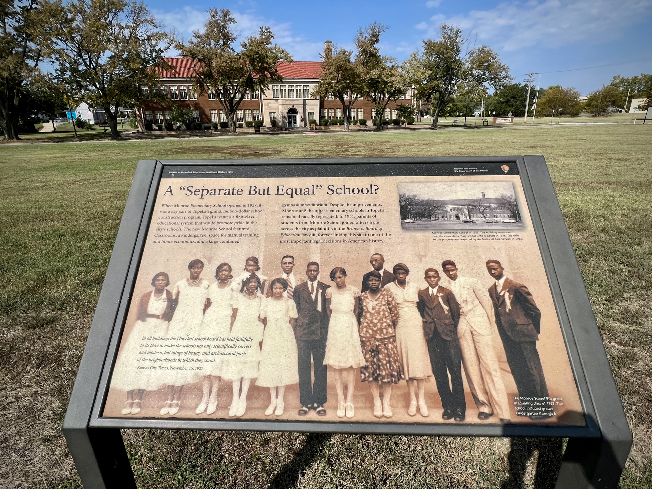
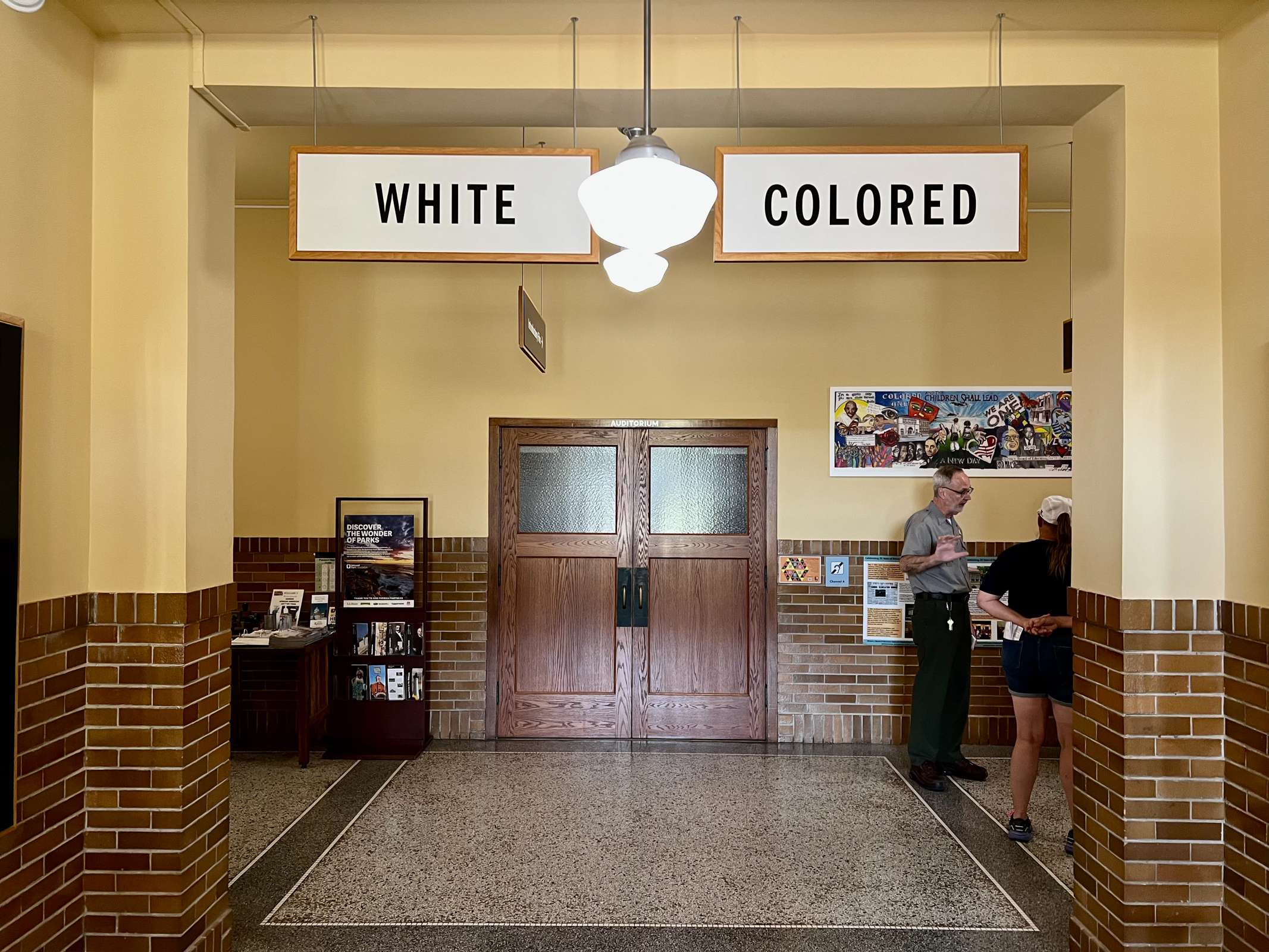
The Brown vs. Board of Education National Historic Site in Topeka, KS was surprisingly emotional. Situated in the old Monroe Elementary School this national park celebrates the historic Supreme Court decision that ended legal segregation in our country. It is considered one of the most important legal decisions in American history. This humble schoolhouse continues to teach us all many lessons.
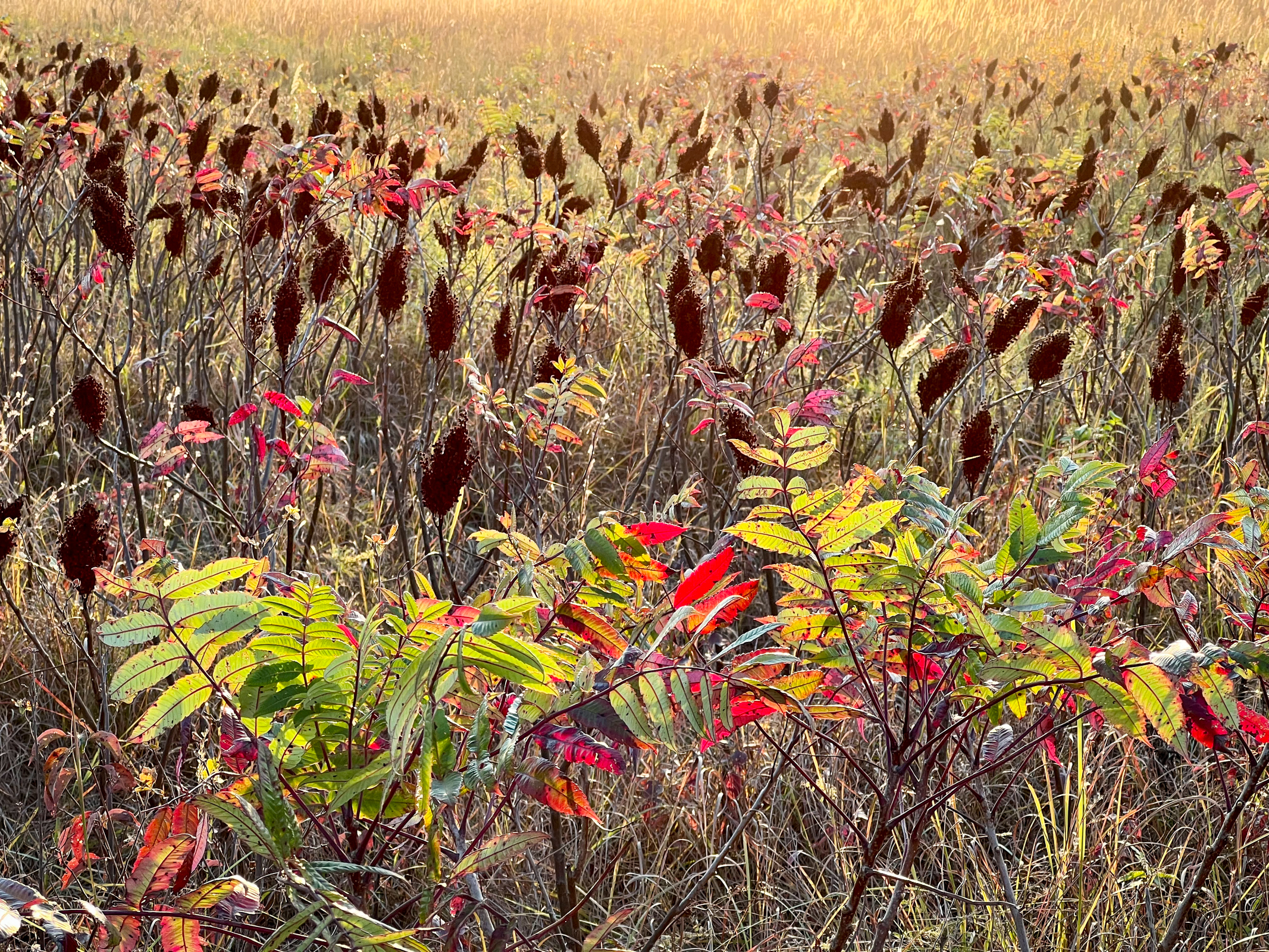
We continued west to Manhattan, KS. where we entered the Flint Hills which are considered one of the most threatened ecological regions in the US. It lies mostly in eastern Kansas and has the densest intact tallgrass prairie in North America. It is the best opportunity for sustained preservation of this unique habitat that once covered the vast Great Plains and was only saved because of its rocky, flinty soil. We continued south traveling the Flint Hills National Scenic Byway through amazingly beautiful small, rural Kansas towns eventually making our way to the Tallgrass Prairie National Preserve at sunset. It couldn’t have been a better time of day or season to visit. We were stunned by the silence and the beauty and saw no other visitors while we were here. Like our journey last year through Mississippi’s Natchez Trace National Scenic Parkway, we felt that all Americans should experience this essential part of our national heritage.
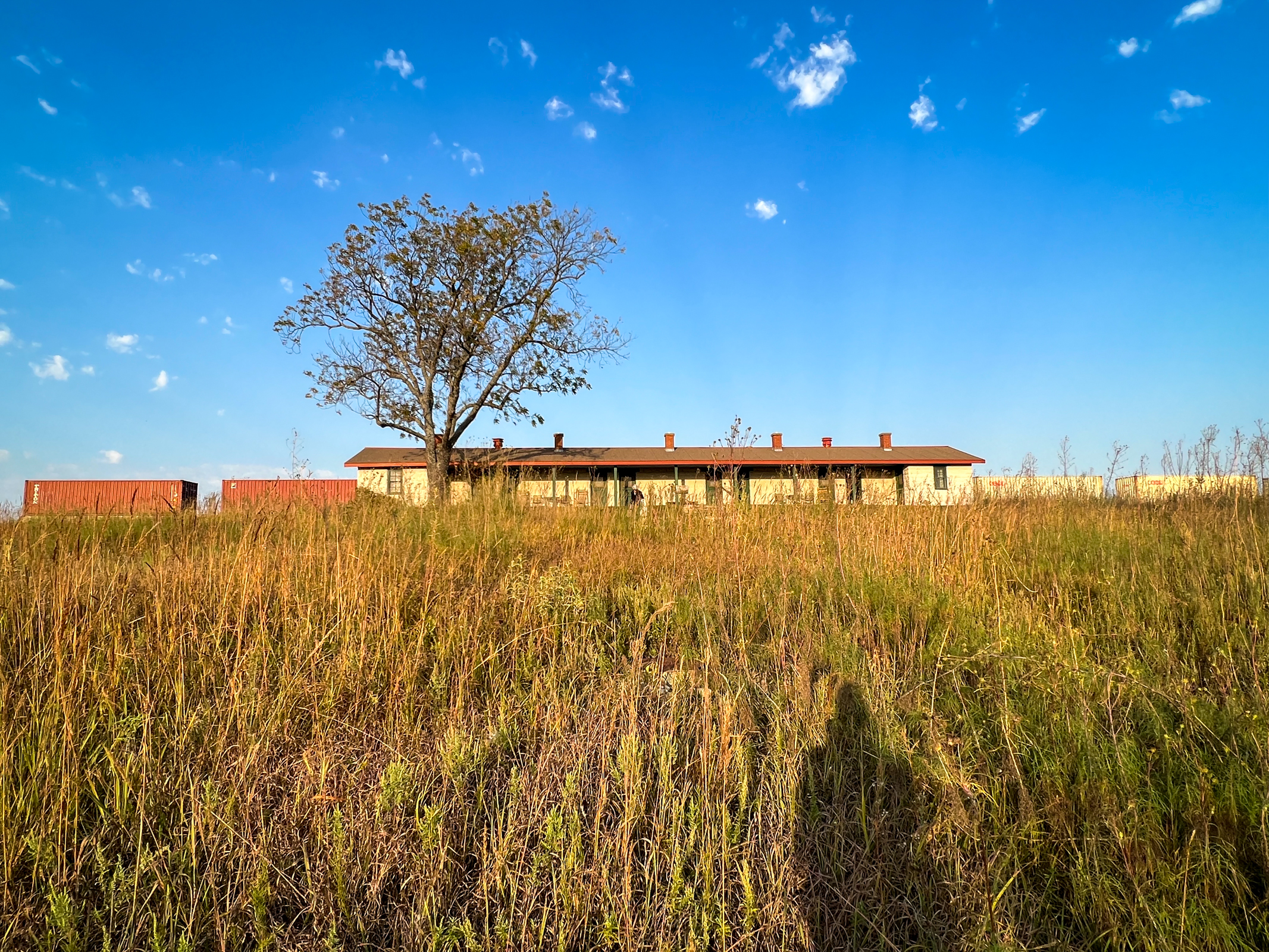
We spent the next two nights at a place called Matfield Station near the tiny, reinhabited town of Matfield Green. The property was first built 100 years ago as a bunkhouse for ten railroad workers. It has been beautifully restored as lodging for visitors and an artist-in-residence program by retired Chicago architect Bill McBride and his wife Julia who live next door. They were inspired by the pioneering work of American geneticist Wes Jackson who founded the Land Institute in Kansas in 1976. Part of Jackson’s work has been to re-envision American agriculture and our relation to the prairie. All these people have been part of a cultural and environmental flowering of new thinking about our sense of place. We have known about this work for years through our friend and photographer Terry Evans. It was nice to be back here again.
When we arrived, we were thrilled to see a train traveling behind Matfield Station only 50 feet from our room. What we didn’t realize was that the trains ran all night. We didn’t sleep much that first night, not because of the noise, but because the bed and room shook every time a train passed. However, the second night was fine as we must have gotten used to it. Ah, life in the prairie!
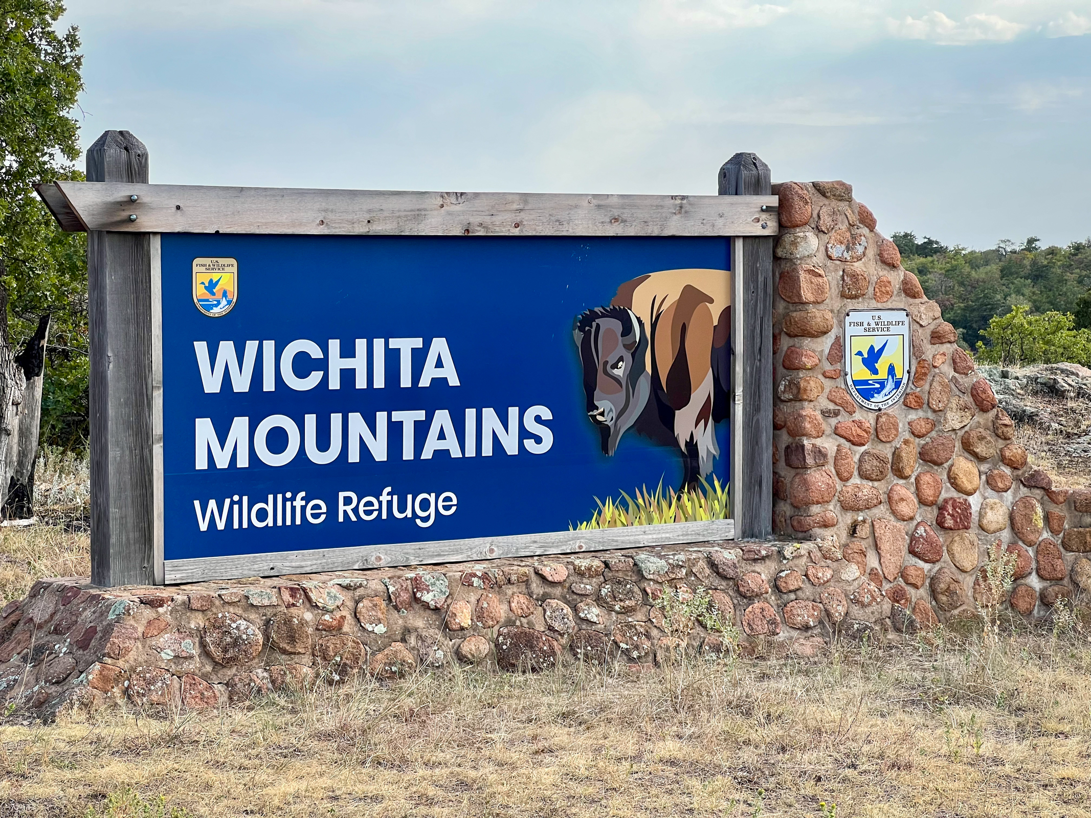
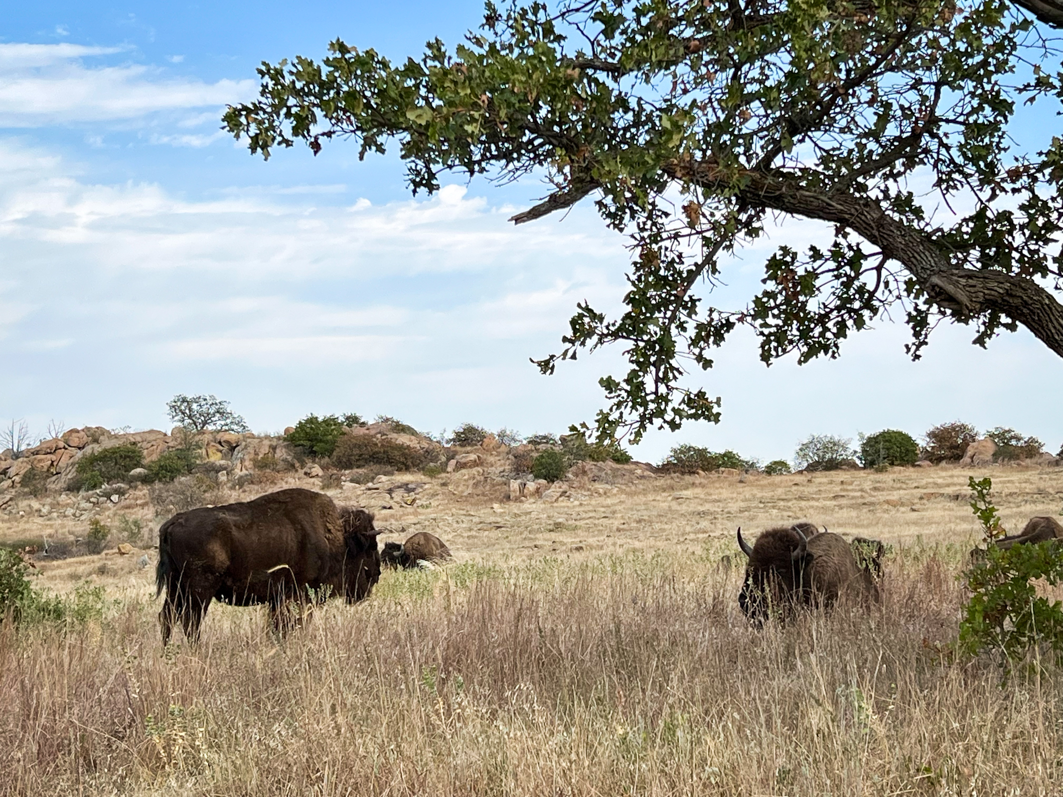
The Wichita Mountains Wildlife Refuge in southwestern Oklahoma near the Texas border was fascinating. It is geologically unique with areas of undisturbed mixed grass prairie that makes it an important conservation area. It houses a huge diverse range of endangered plants and animals including American Bison. The area is considered sacred to Native Americans. The conservation of bison here was important in saving the American buffalo from extinction. In 1907, after bison had been extinct on the southern Great Plains for 30 years, 15 bison were imported here from the Bronx Zoo which are the ancestors of the herd in the Refuge today. This population is being used to help repopulate bison back into other parts of North America. We were thrilled to spend time in this special, little-known part of the mid-West.
We spent the night in Wichita Falls, TX which prides itself in being home to the “world’s littlest skyscraper”. This region is prone to devastating tornados which have wreaked havoc here over the last sixty years. The local economic problems were seen in one of the largest shopping malls on the planet being almost entirely abandoned. This area is also a conservative stronghold for Trump.
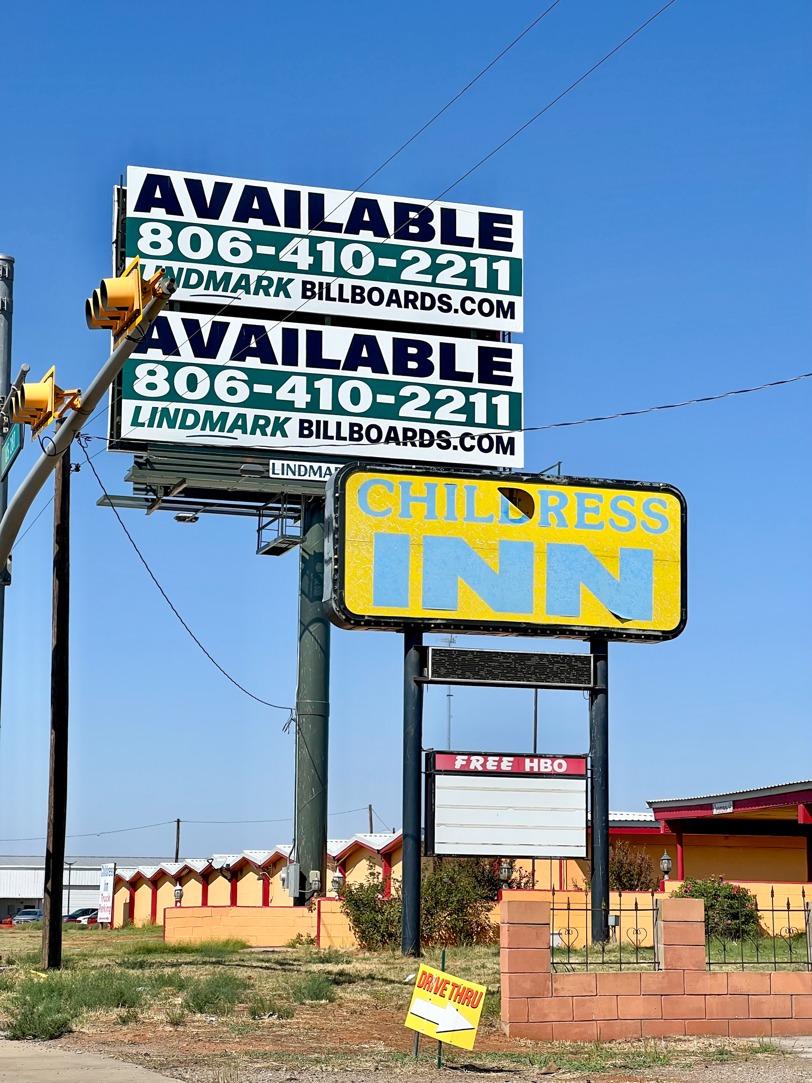
The next day we were excited to drive through the Texas Panhandle town of Childress. In 1938, famed FSA photographer Dorothea Lange made one of her iconic images “Tractored Out, Childress County, TX”. It showed the devastation of corporate farming practices on the struggling farmers of the Texas Dustbowl. Today, the small town of Childress continues to try hard to survive.
It was a relief to finally leave the hard-scrabble towns of the Panhandle and arrive in the New Mexican towns of Santa Fe and Galisteo. We stayed the first night with our friends Caroline and Angie in their delightful adobe home. Caroline was finishing her book project of photographs and ideas from the Arctic and Angie had just published a book entitled Eleanor Roosevelt on Screen. The intellectual talent here was exciting and our conversations knew no limits.
The second night was spent with our old friend Meridel and her partner Ben. Meridel is finishing a massive photography and environmental restoration project in southern Iraq while Ben is teaching film studies at the Institute of American Indian Arts in Santa Fe. He is one of the few people I know that has received an Oscar for one of his documentaries. Again, the conversations at dinner that night were inspirational and boundless.
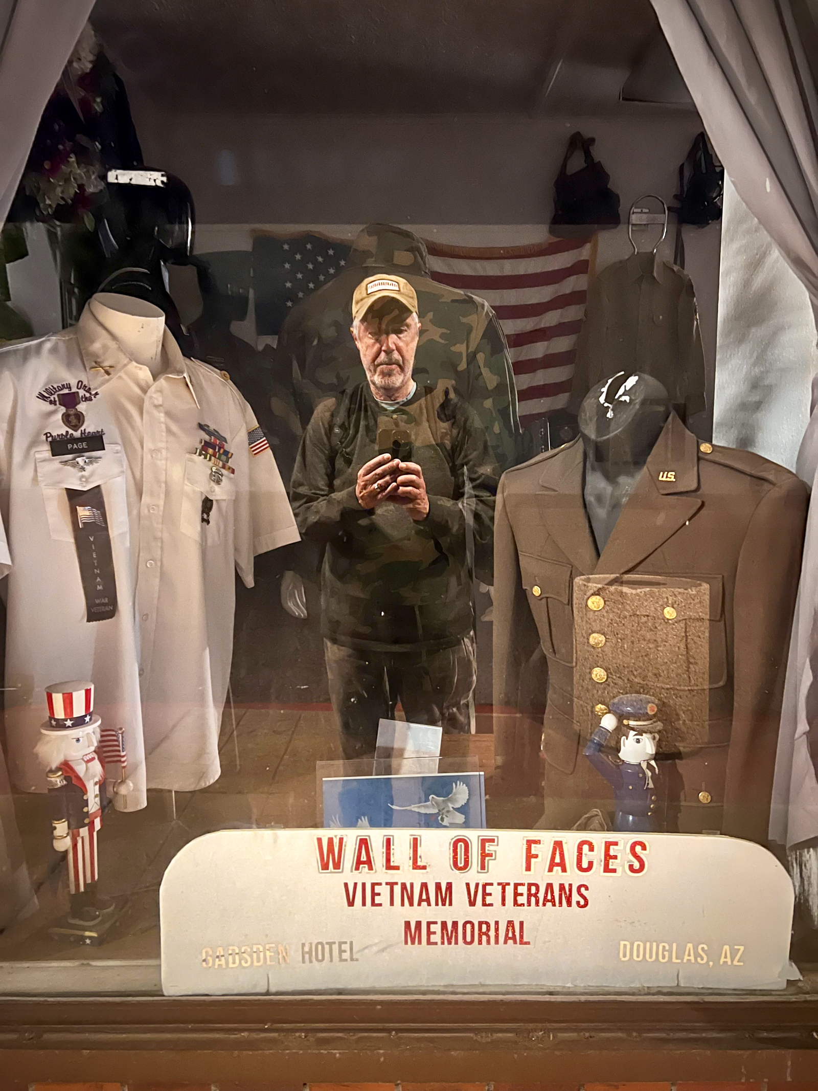
A few nights later we stayed in the famous and opulent Gadsden Hotel in the border town of Douglas, AZ. According to some, during the Mexican Revolution the infamous Mexican revolutionary/solider Pancho Villa rode his horse up the beautiful interior marble steps of the Gadsden, chipping the seventh one. The chipped step in front of the Tiffany glass window has never been repaired.
Douglas was once a thriving smelting town for the copper mining in Bisbee, AZ. The old downtown is pretty blasted out now, but we could see the first inkling of artists beginning to re-inhabit Douglas’ beautiful but depressed urban core. Hopefully, the Gadsden can hang on long enough to be the center of that renaissance.
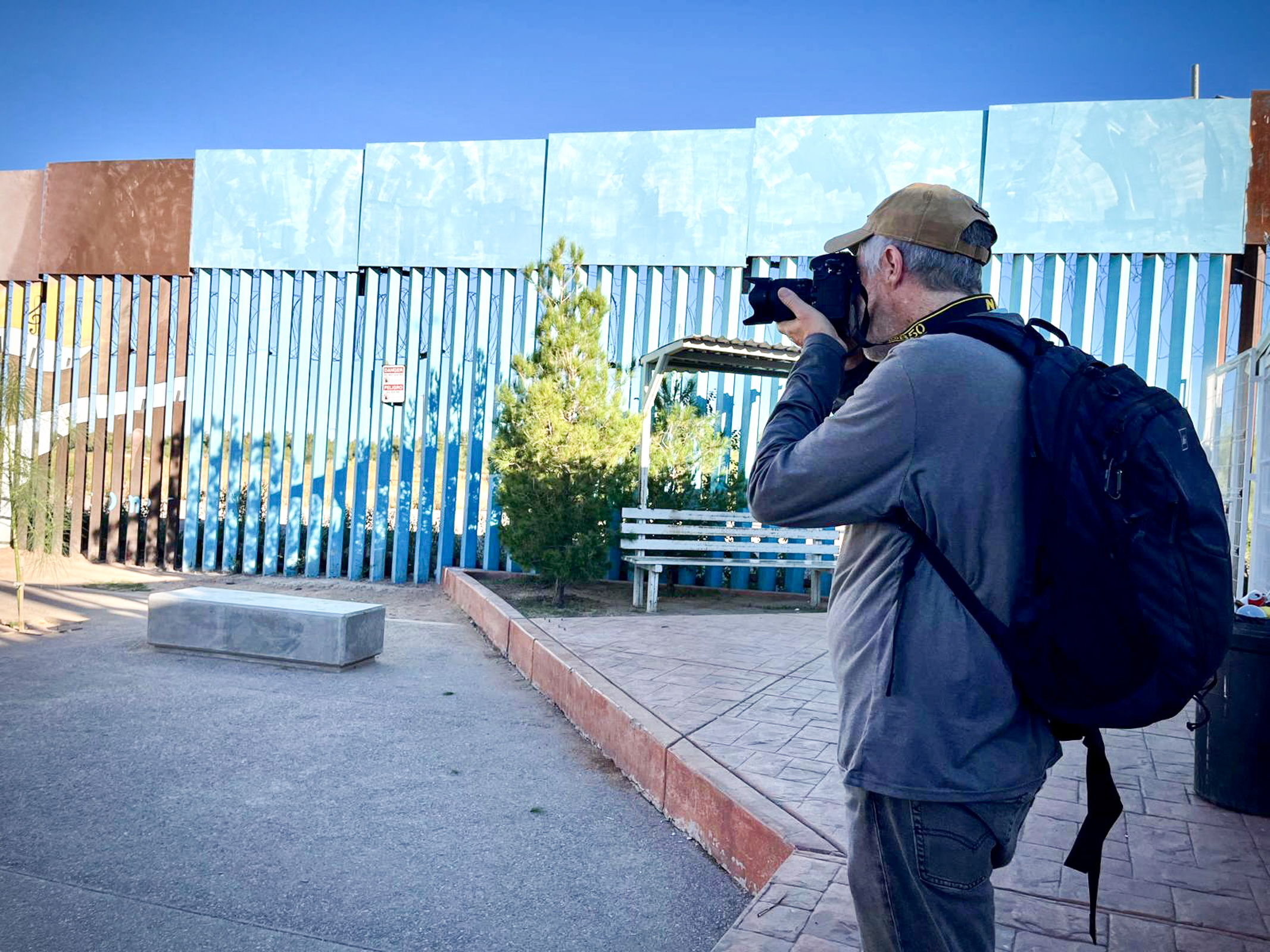
Agua Prieta is a Mexican town right across the border from Douglas. In 1989, El Chapo and his Sinaloa Cartel dug a tunnel under the border here to smuggle drugs and weapons. Later, the Mexican government chose to build a starchitect designed library here to counter the prevailing poverty and hopelessness. It was such an unusual thing to do that The New York Times even published an article about it a year ago, which is how I found out about it. It seemed to capture so much of our interest in libraries as a place of healing in tough conflict zones.
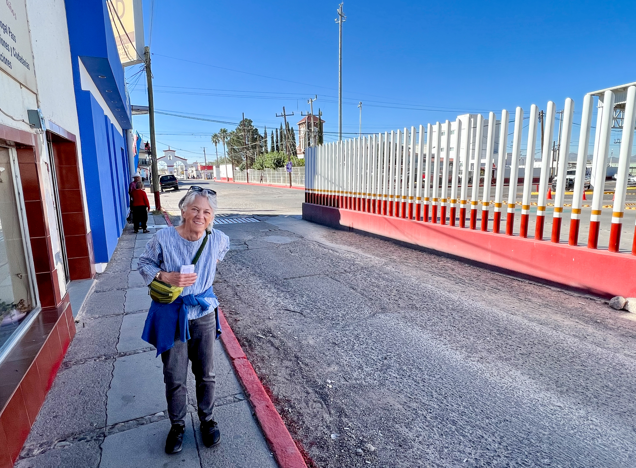
At dawn’s ugly crack, we groggily walked from our room in the Gadsden down to the border crossing station and then to the Agua Prieta Public Library. We were a little nervous walking into this contested space, especially since the Sinaloa Cartel is currently engaged in a major turf war with other cartels. Fortunately, the center of the war is in Culiacan which is far to the south from the Mexican/American border. As Ellen watched my back, we cautiously photographed the library always aware of its proximity to the looming border wall. We were glad when we made it back to our side of the border.
As we drove to Tucson, AZ we drove through the famous mining town of Bisbee. It reminded me of many of the small, hill towns we encountered on our library road trips to Italy and Greece. We didn’t expect to run into an exceptional library here, but the Copper Queen Library was something else. It reflects the one-time wealth and exuberance of this copper boom town that eventually went bust. Bisbee is making a comeback now as a tourist and gay-friendly community in a spectacular setting. The library is considered one of our country’s great small-town libraries.
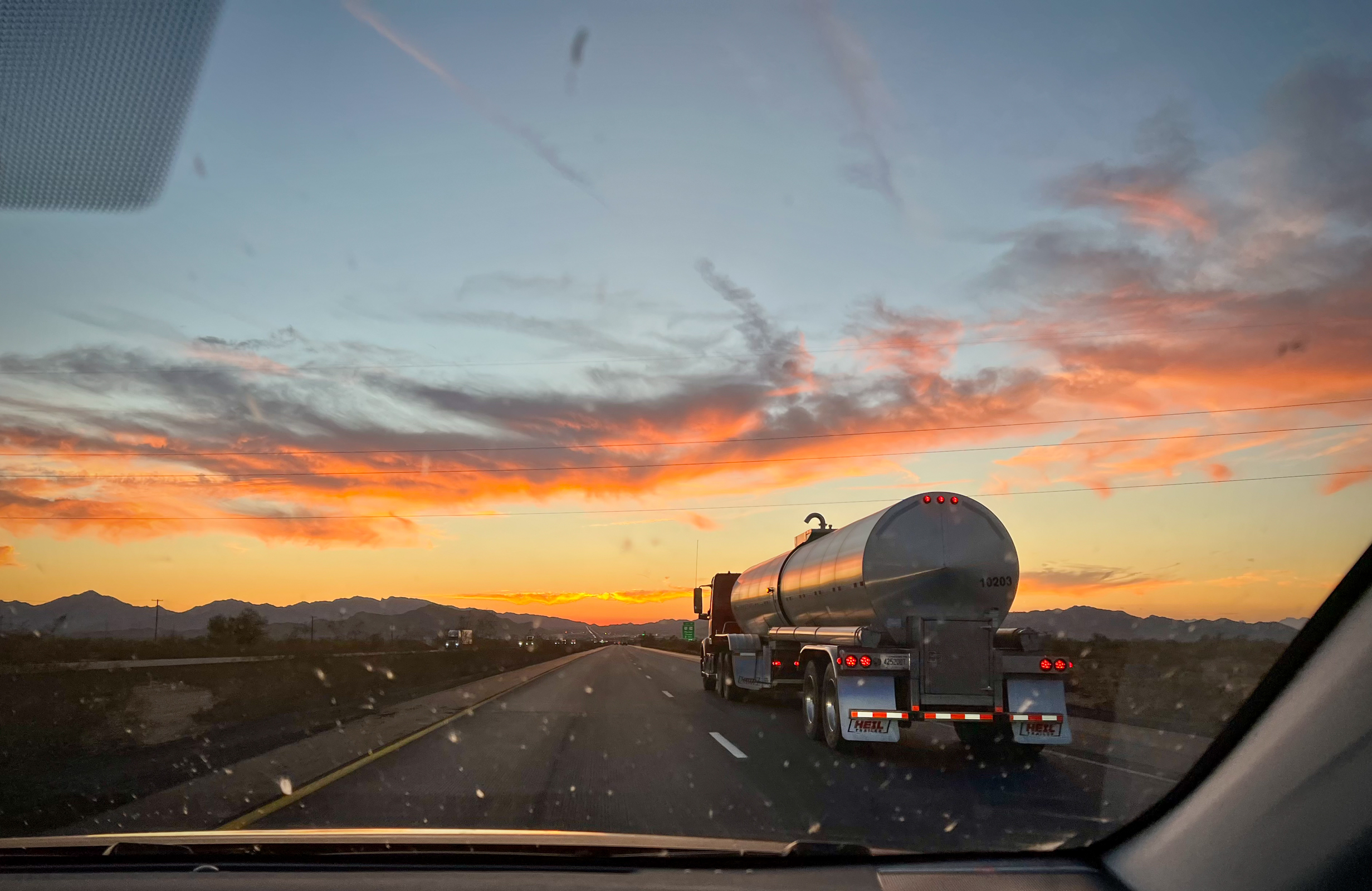
The open road across America is long and full of surprises. Through our bug-splattered windshield we have seen the good, the bad, and the ugly. Heartbreaking sunsets and sunrises over golf courses in Palm Springs have kept us attuned to the beauty that is always around us.
Our last exit down the endless hallways of corporate American road culture will not be missed and we keep repeating to ourselves “There’s no place like home.”
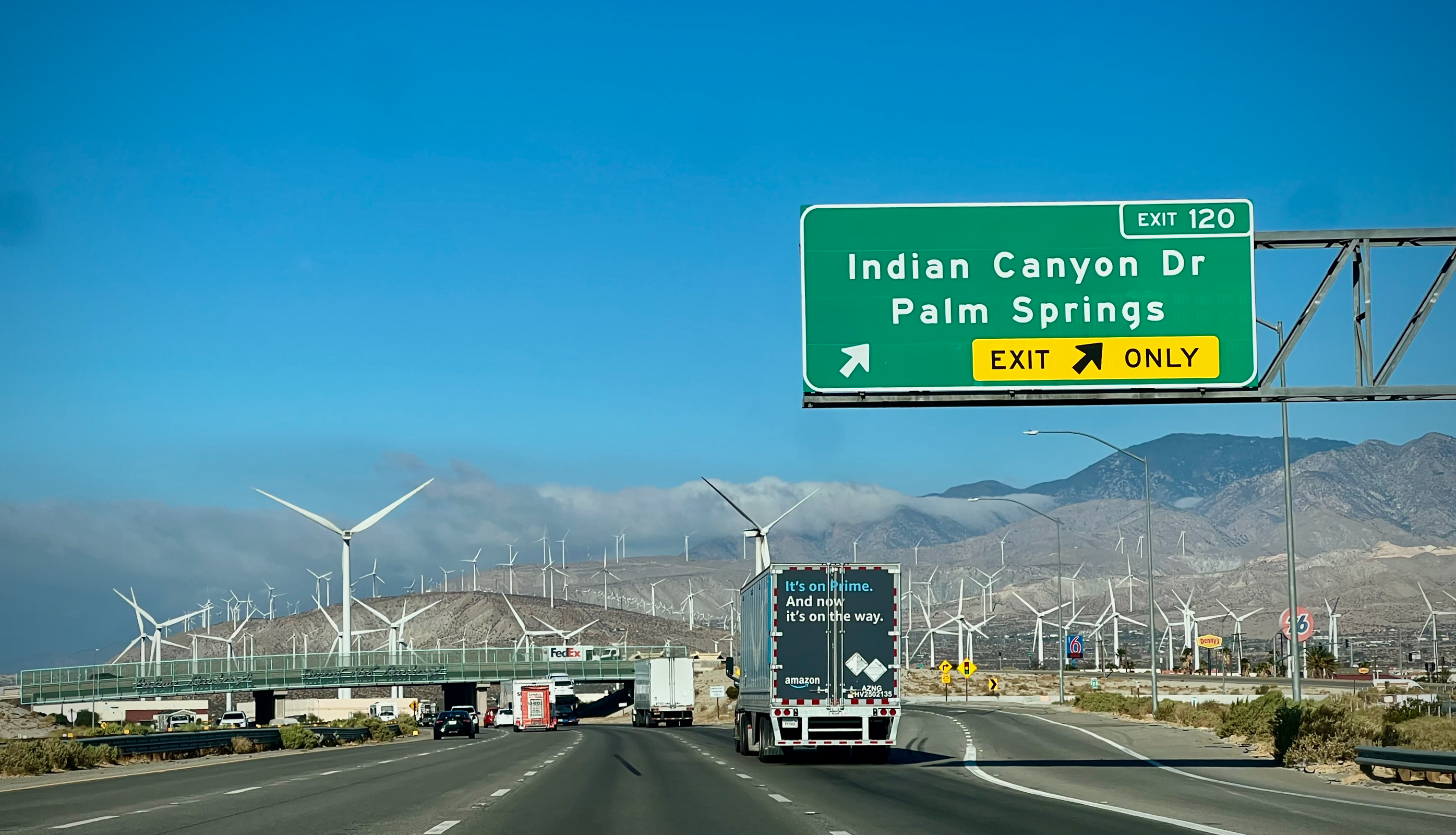
We were so glad to be back in California. As we left Palm Springs, we happily plunged into the highways, and windmills, and fog banks, and desert mountains of that crazy region. We knew that after driving across and seeing America whole, we were coming back to the state that contains it all, and more. It has been said that California is the future of America. That can be seen as both as a good thing, and bad. But it felt great for us to return to the future.
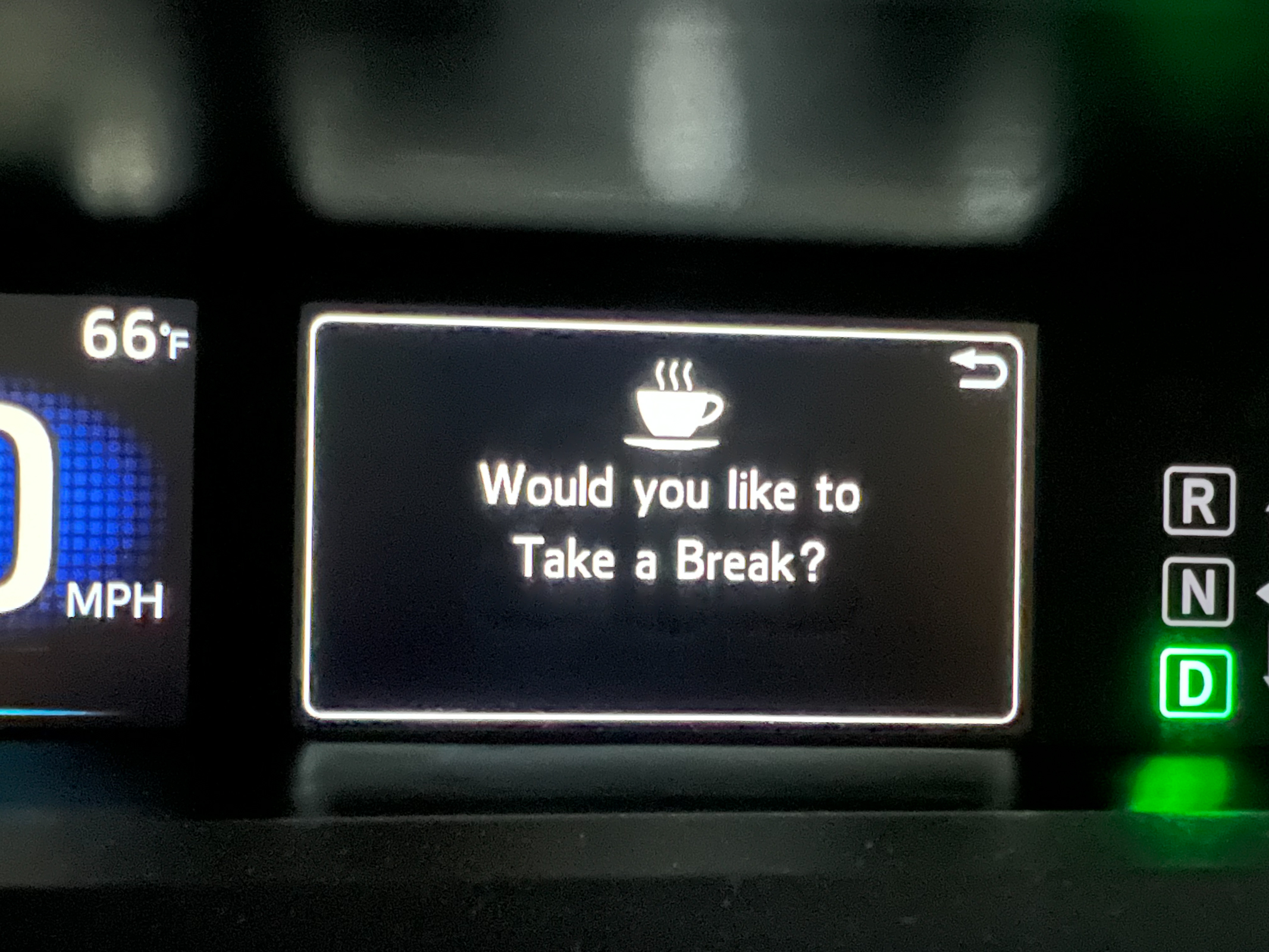
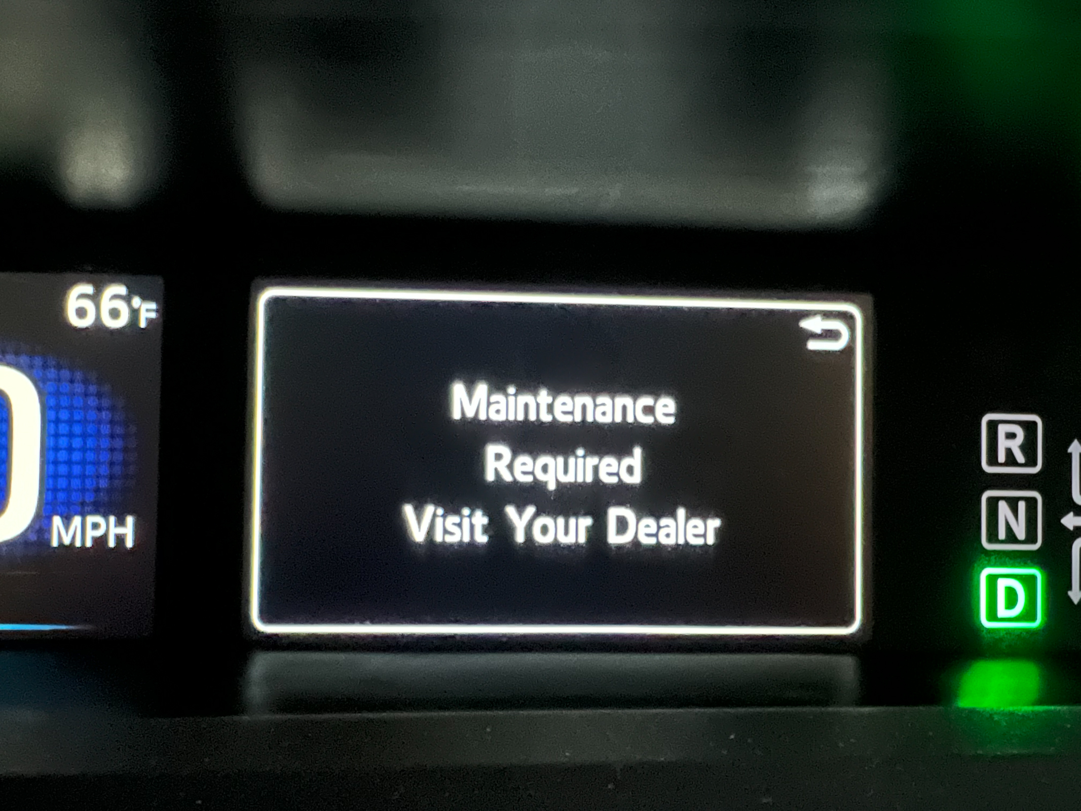
As we neared completion of our nearly 10,000-mile drive back and forth across our country, we noticed a warning message on our car’s dashboard asking “Would you like to Take a Break” along with “Maintenance Required. Visit Your Dealer”. Somehow those signs perfectly summed up our feelings at the time.
We arrived in San Francisco just as the sun was setting over the city and the Pacific. There is no place like home, and we are so glad to be back. Thanks for coming along for the ride. We’d love to hear from you. See you soon.
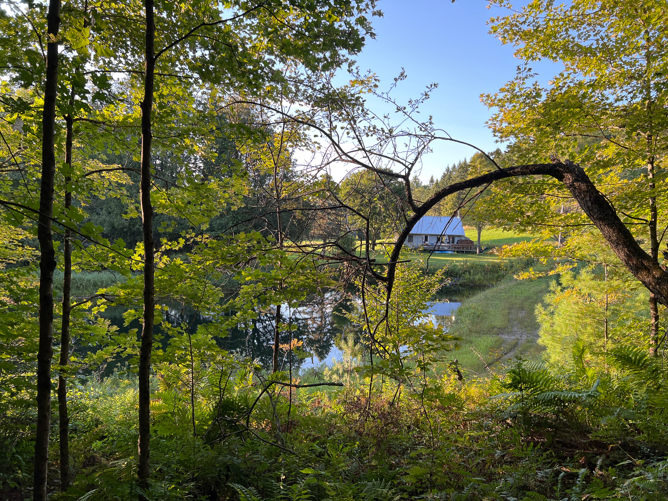
For twelve days, we drove over 3,700 miles with our pedal to metal zooming across the country. Then we stopped at our place in Vermont, for six weeks! Going from full speed to full stop takes a little adjustment. But we quickly appreciated leaving behind the corporate American road culture and savored the beauty of the New England landscape.
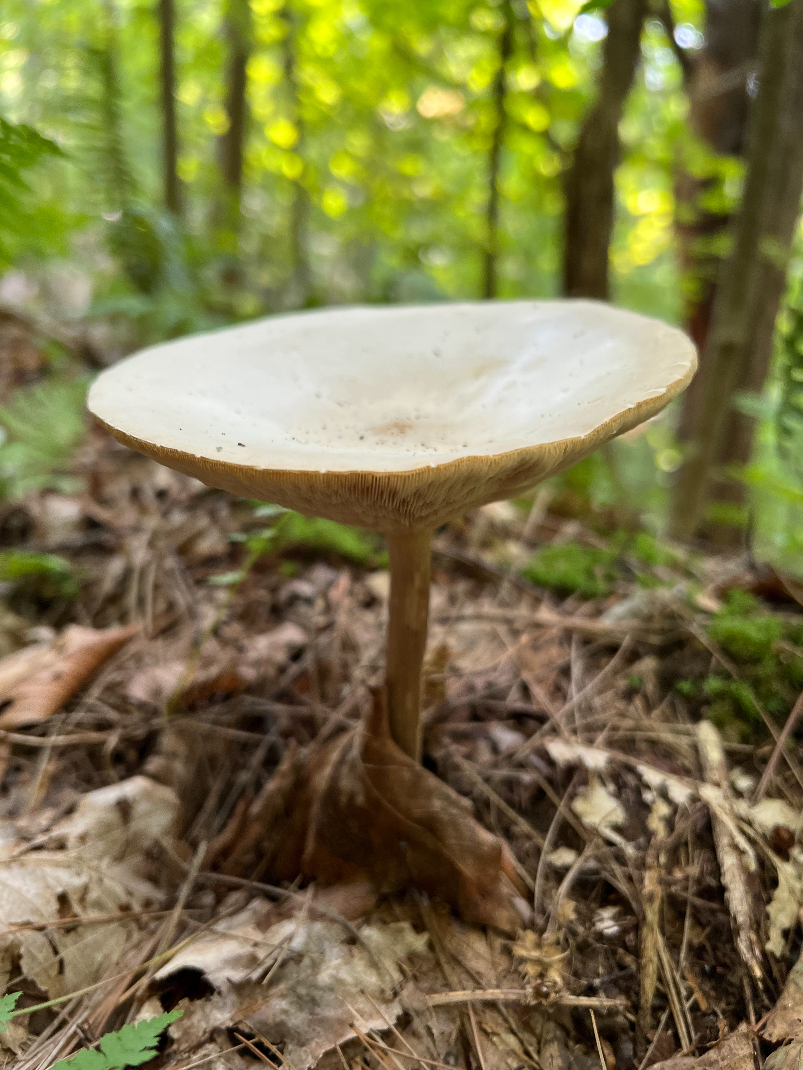
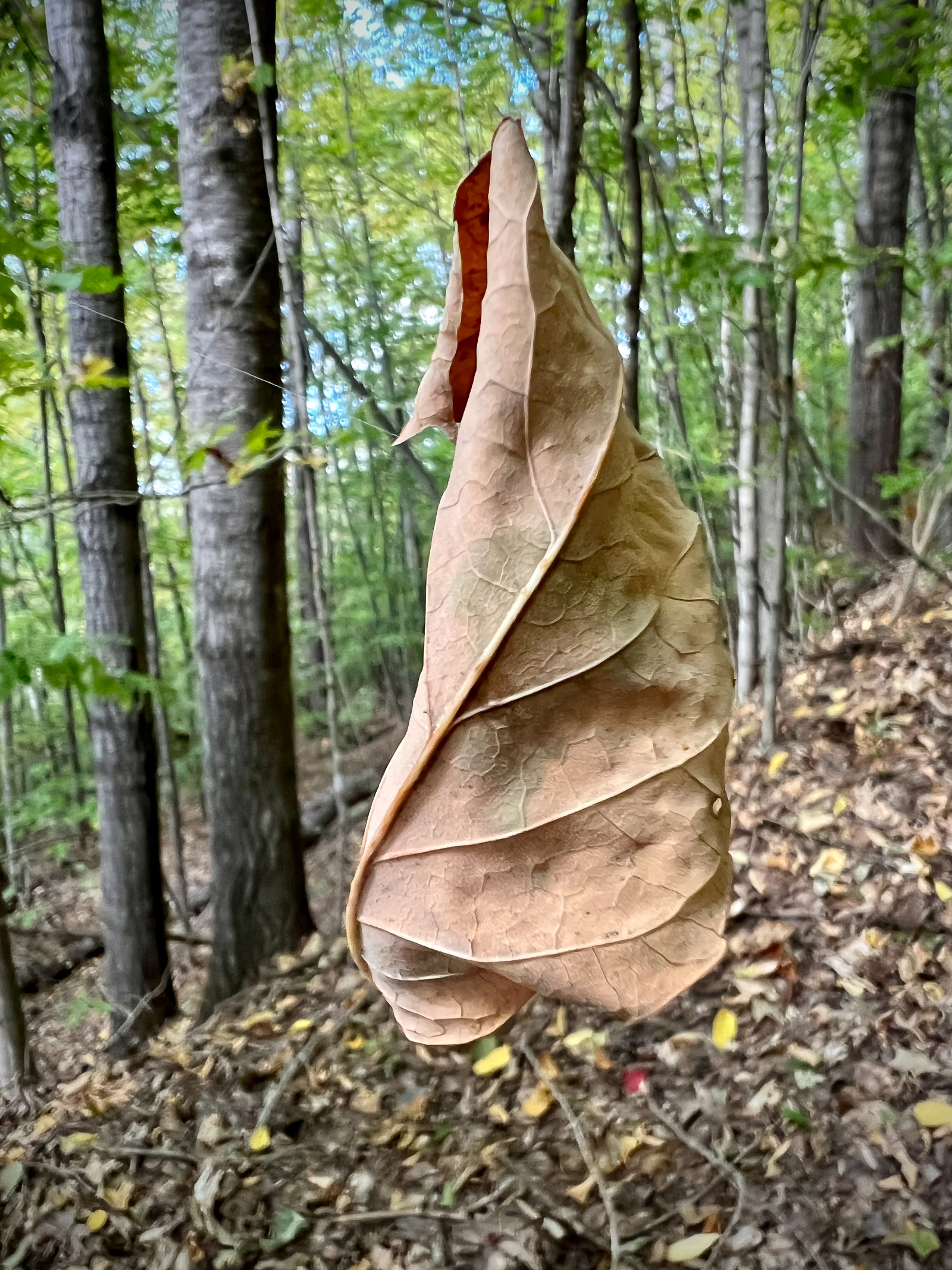
We share 53 acres and a small cabin with two other families in the Vermont woods on a dirt road off a dirt road off a dirt road. One of the great pleasures for a life-long Californian like me is plopping myself into this totally different world. Vermont is a biological transition zone between the boreal forests of the north and the southern deciduous forests. Seventy-eight percent of the state is forested, and that land contains a huge number of animal and plant species. One of the first things we did after arriving was to go hike in the woods. Every year, I am always surprised by the abundance and diversity of life in these woodlands.
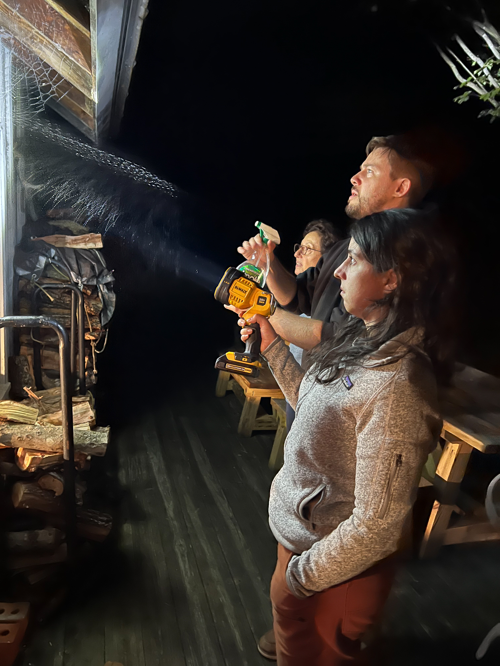
Sometimes nature’s exuberance can be a little annoying. One year we arrived from California just after a colony of wasps had built a GIANT nest right under the wooded deck that we used to enter the house. We can laugh about it now, but at the time it was no fun. This year, a large group of orb weaver spiders decided to spin their webs outside one corner of the cabin. Their prodigious work was astonishing to see. We read that spraying vinegar was a sure-fire way to get rid of them. Unfortunately, the spiders had not read that memo and stuck around for several more nights until they got tired of being drenched.
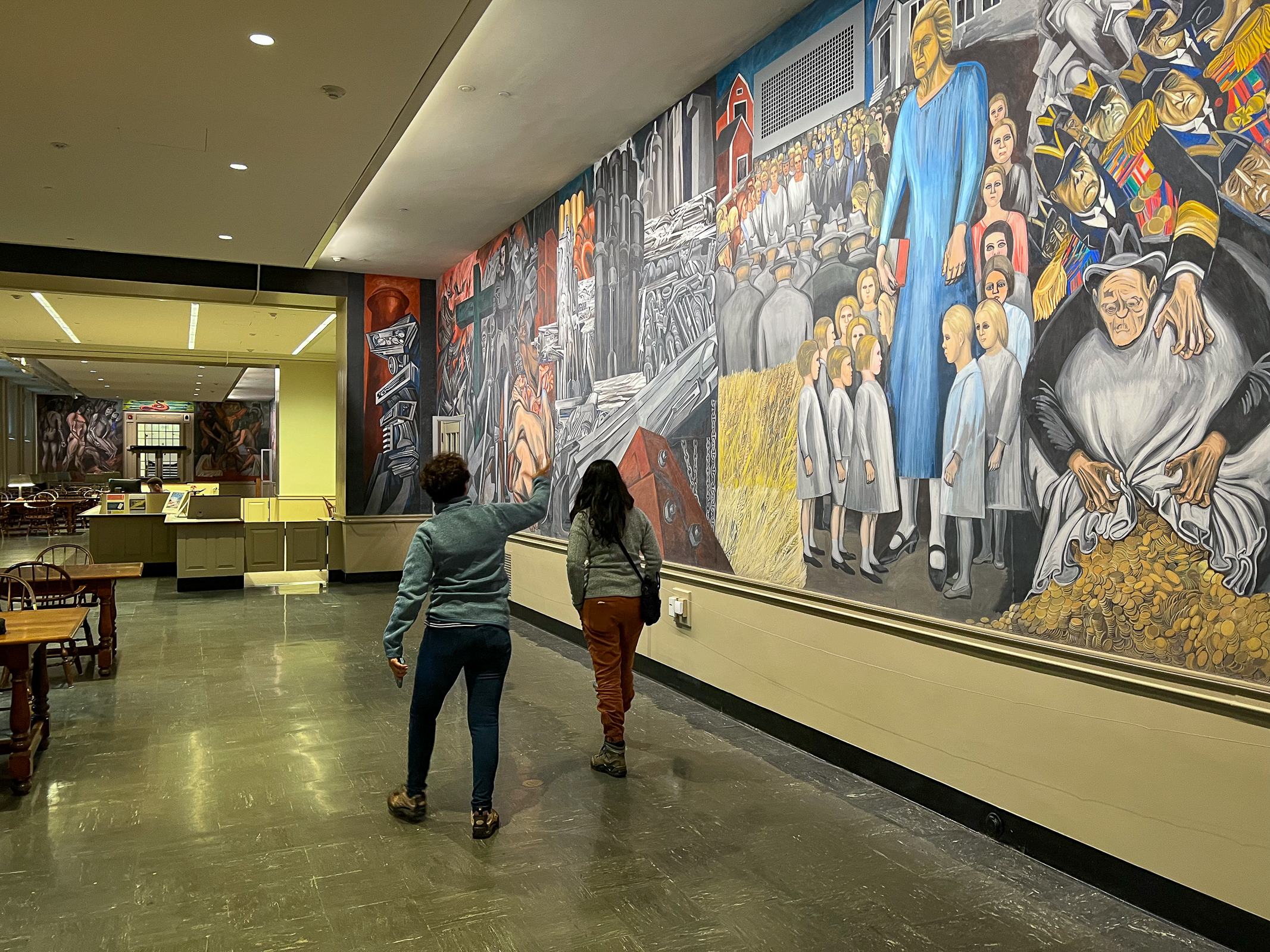
Shortly after we arrived, Walker and his girlfriend Rosa arrived from San Francisco and Rosa’s Mom Paulina arrived from Mexico City. It was Paulina’s first time in this part of New England, and we felt honored to show her around here after she had shown us around parts of Central Mexico and the Yucatan in 2023. One of the great cultural highlights in this region is Dartmouth College in nearby Hanover, NH. One of the great sites on campus is the Orozco Mural painted in the 1930s by the famous Mexican muralist Jose Clemente Orozco. It is now a National Historic Landmark.
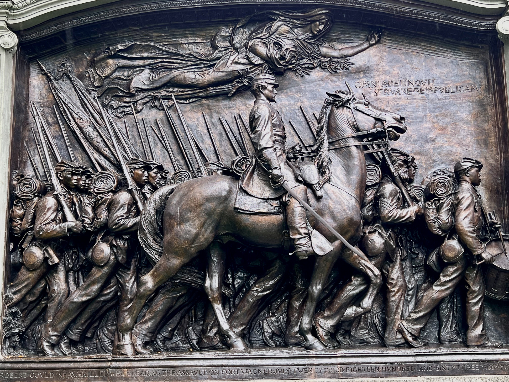
We also traveled to New Hampshire’s Saint-Gaudens National Historic Park which preserves the home, garden and studios of Augustus Saint-Gaudens, one of America’s foremost late 19th and early 20th century sculptors. It too is a National Historic Landmark. We also wanted to show Paulina some of the unknown parts of New England such as a small, abandoned early 19th century cemetery near our property. It was moving to see the headstones of children that had died almost 200 years ago.
Mostly, we wanted to share the astonishing beauty of the New England forests. We spent many days being surprised and awed by nature as we hiked around the woods of Vermont.
After our epic day hikes, we would come back and watch the Democratic National Convention at night. Our heads were still spinning at all our country’s recent political developments, and it was fascinating to hear Paulina’s take on the state of American politics from a Mexican perspective.
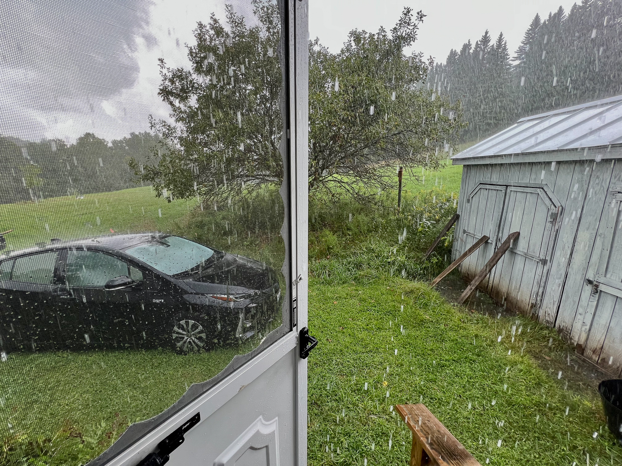
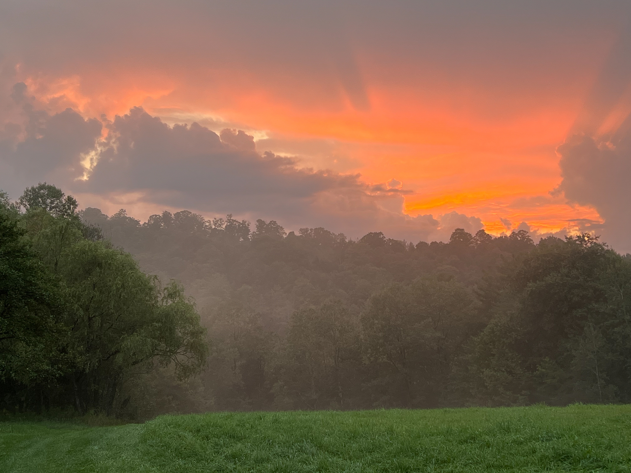
After everyone left, we had the time to observe the small things that mark the time between visits with friends and family and Presidential elections. For a moment, the pounding rain outside turned to hail and piled up like snow before quickly melting. The sky burned red over the fog left by the rain and New England’s recent summer drought seemed broken.
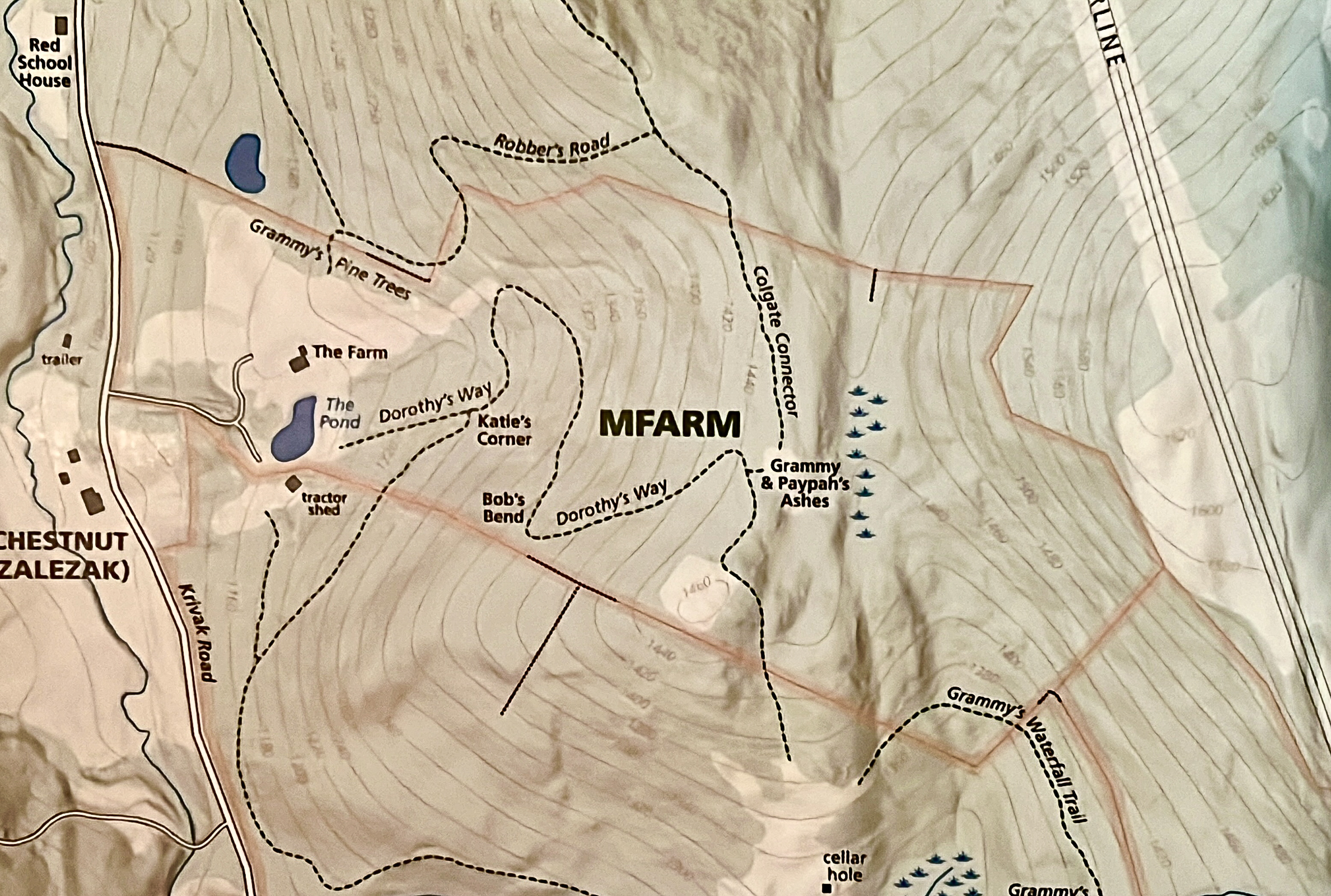
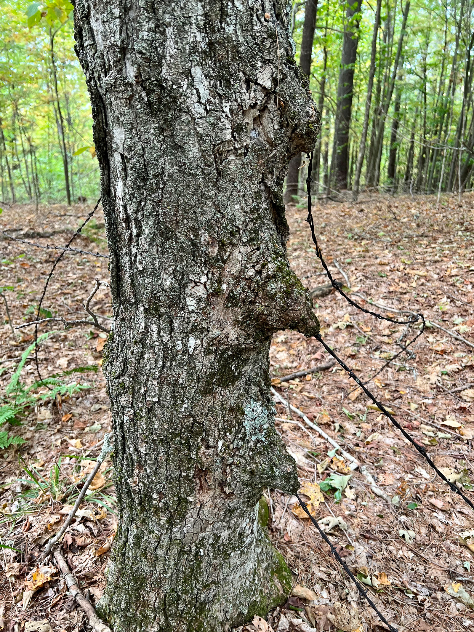
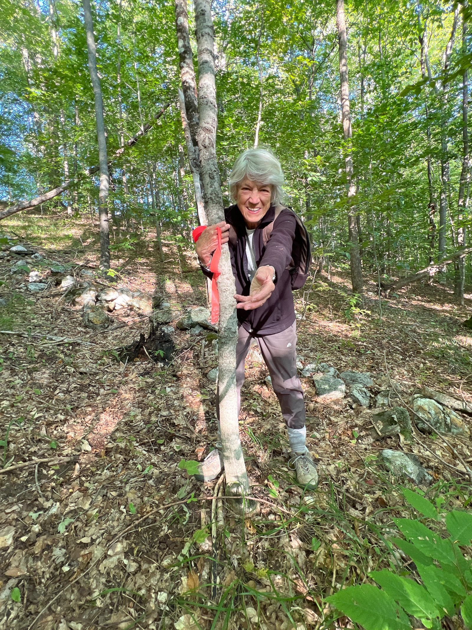
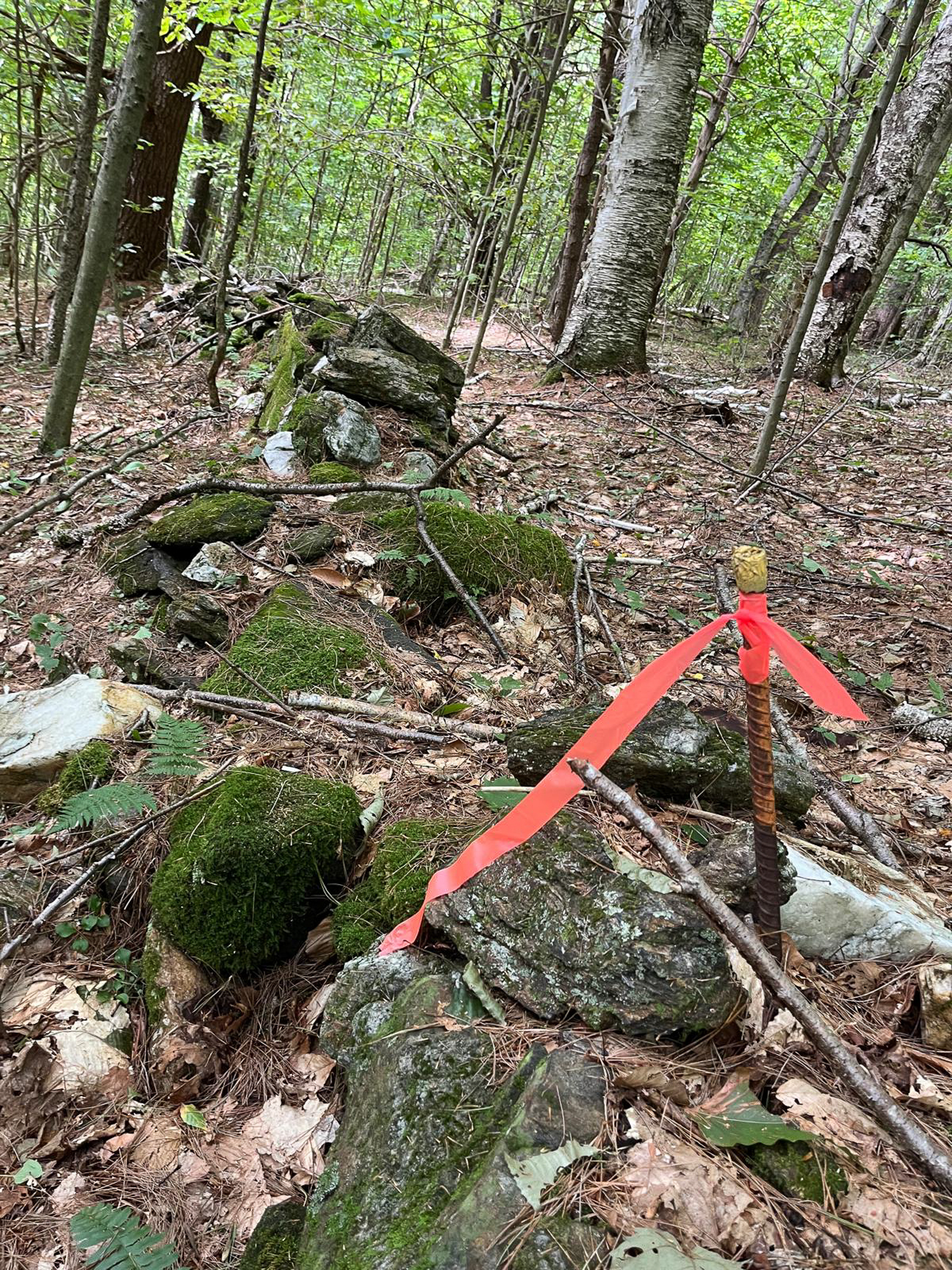
One of the projects that Ellen and I did together was to walk, mark, and map the property line all the way around our 53 acres. It took many days to complete, and it was one of the most inspiring and satisfying projects that we have done here at the Farm. We spent our time following lines on a two-dimensional map in a three-dimensional forest. We were aided by a professional map of the property made by our nephew Bart as well as old property deed maps and aerial photo maps. Sometimes, we were aided by discovering old stone walls that followed the property lines. We guessed that some of these walls were, possibly, 200 years old. Barbed wire replaced some of the stone walls in the latter part of the 19th century and often, we would find old trees that had grown around the wire.
An additional challenge was the terrain itself. This part of Vermont is very hilly and hiking this lumpy landscape required strong legs and a lot of motivation. Fortunately, we’re from hilly San Francisco and we hike there every day. Sometimes, we had to ski down the dirt slopes on our shoes and help each other up on the other side. Astonishingly, the people that built these 19th century stone walls didn’t seem intimidated by the steep hills and vertical canyons of Vermont. Hiking these walls gave us a little more insight into the rugged lives of these early Vermont farmers.
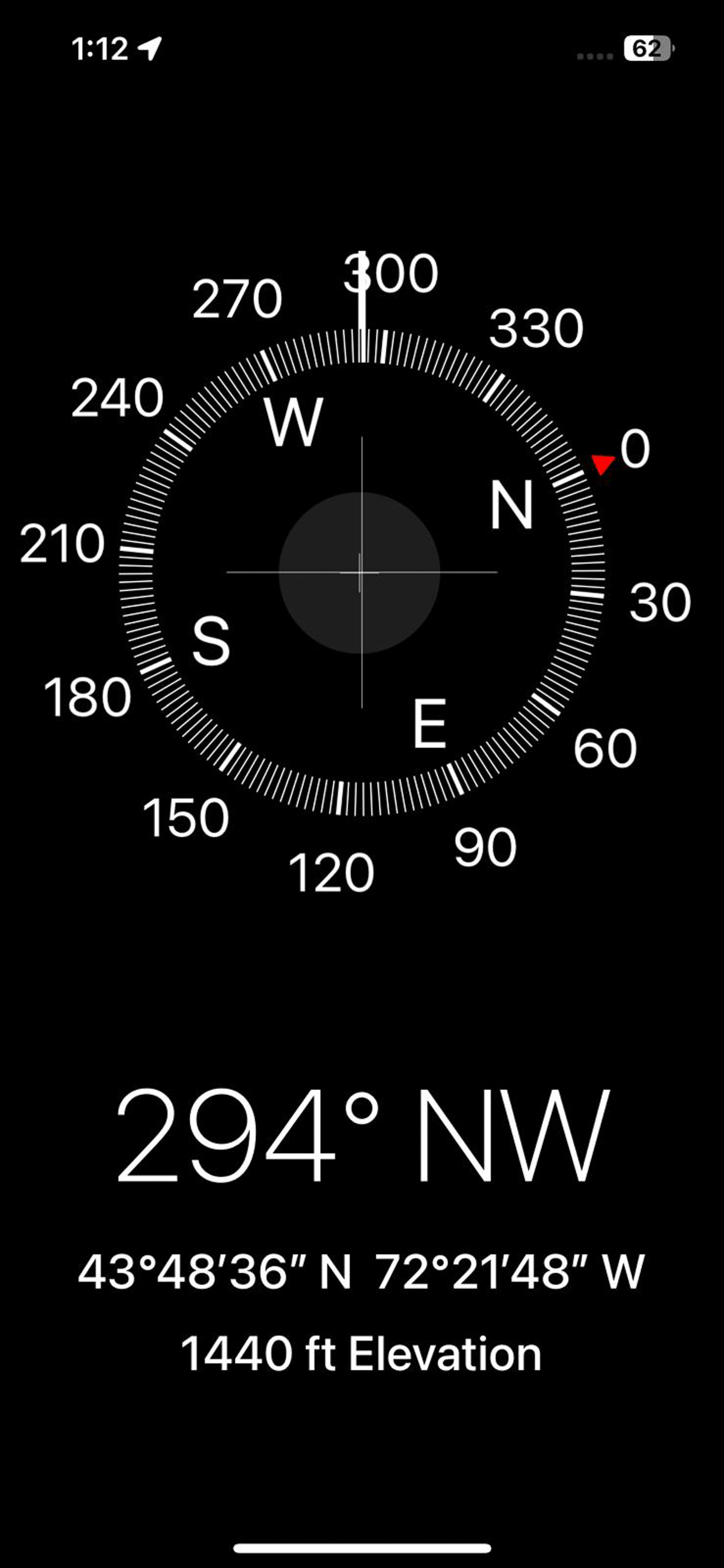
We were helped by having good maps and a compass on our phones which allowed us to accurately wander the hills and valleys without getting lost. We were also aided by the app GaiaGPS which allowed us to map our route while being offline. Pink ribbon was how we marked our way on this incredible journey.
Screenshot
As we followed the lines of the property, we were also following lines of history and geography. We deepened our own connection to this place by our current journey over it which also helped us better understand its buried past. As we made our way across the landscape, we also became more a part of it. The land itself became our teacher and our roaming became our solace.
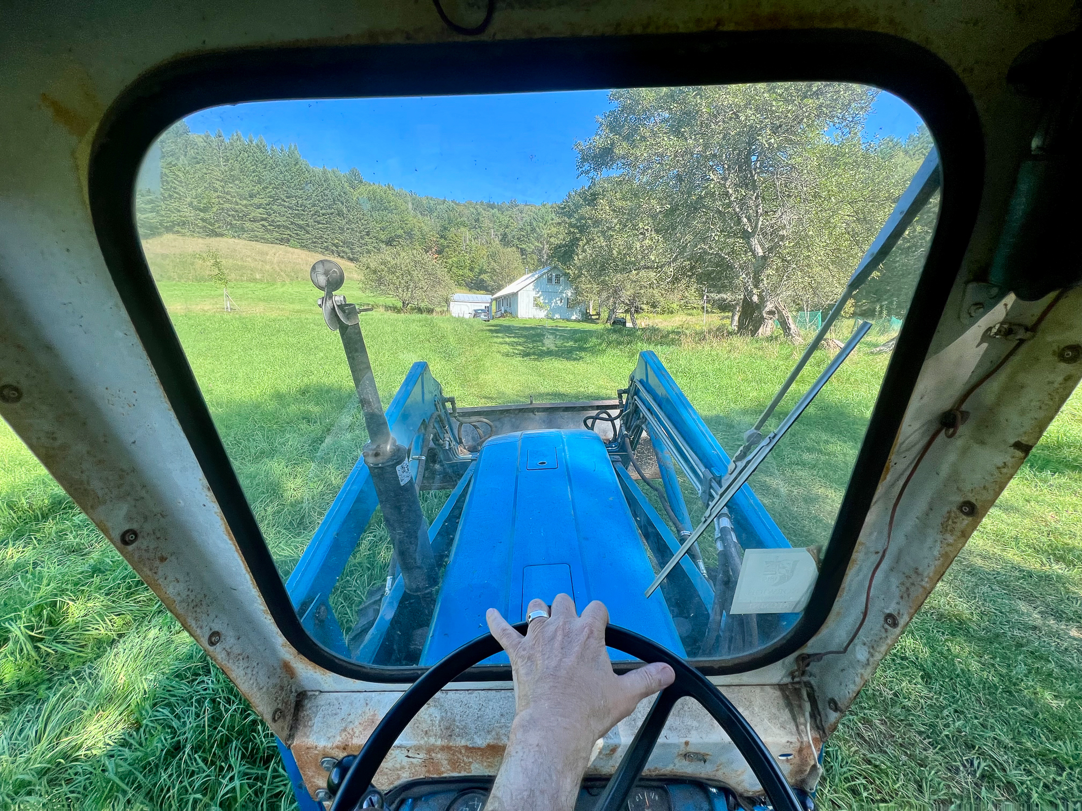
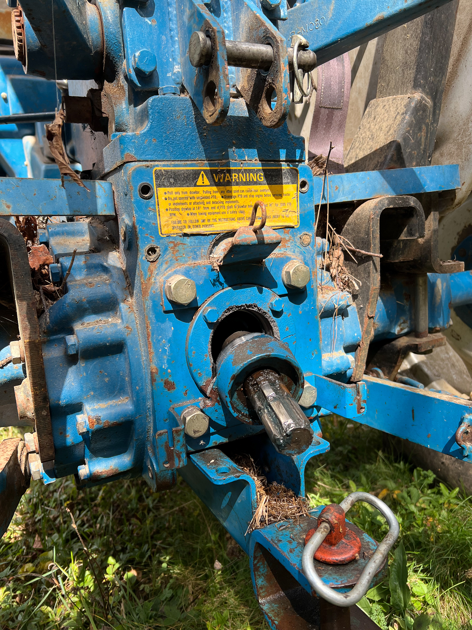
When Ellen’s brother John visited, we quickly got to work doing the chores that need to be done to keep our place going. John taught me how to drive his old tractor and cut the grass in one of the outlying fields. It took more than an hour to do this as the tractor traveled at a very sedate pace fitting its ancient age. I really enjoyed doing that chore as it gave me time to think about the dignity of manual labor, the separation in our country between people working with their hands versus people who work on their screens, Presidential politics, and what to make for dinner that night. Unfortunately, the next time I fired up the tractor, a coupling in the back broke and leaked out all the hydraulic fluid, ending that chore. Undeterred, I jumped on the old sit-down lawn mower to continue mowing but after a few minutes it stopped dead in its tracks with a broken belt. At that moment, I decided I was through with breaking things and went off to read a book.
Between chores, reading, and hiking, we were lucky to have several visitors throughout our time at the Farm. We see Virginia and Michael every year as they live near Hanover, NH. We had a small party at our place celebrating her retirement from teaching photography for many years at Dartmouth College. They brought their friend and celebrated journalist/ war photographer Jim Nachtwey. His career has spanned the globe over decades and the conversation that night was epic. We feel lucky to know them all.
A few days later, Ellen’s best friend from first grade, Deb, flew in with her husband Elliot. She is a retired professor, and he is still a practicing eye doctor who flew his own plane from Rhode Island. We had a non-stop conversation with them for two days and enjoyed every minute of it.
Finally, we first met our friend Lisa during our Fulbright Fellowship in Jerusalem in 2019. She was a US diplomat working at the American embassy and has recently retired. She took a 10-hour train ride from her home in Washington, DC up to Vermont and we spent four days hiking, cooking, site seeing, talking world events and politics, and never running out of fascinating things to discuss.
We only got the internet at the Farm last year. Although we resisted it for a long time, it was a good addition because it allowed us to watch Kamala Harris put down the bully Trump in an amazing political event. This will be the only Presidential debate, and it was good to see how much of a looser he really is. So much depends on this election, but that night Kamala made us proud.
Since Walker’s recent visit to the Farm, he has been on assignment for CBS in Alaska (twice), on the border with Mexico, and in Brazil covering a newly discovered slave ship story. Fortunately, we stay in touch and follow his amazing globetrotting adventures.
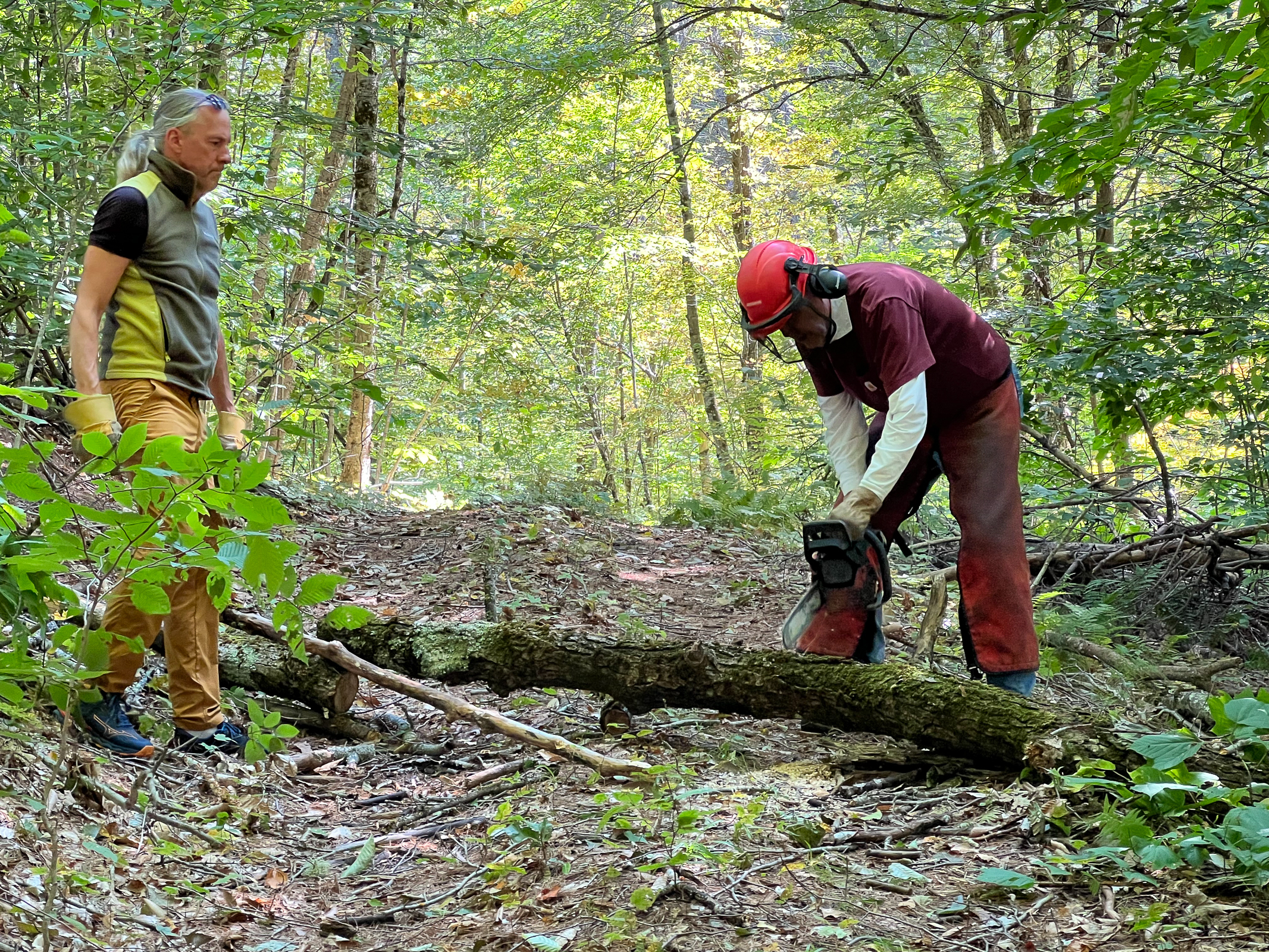
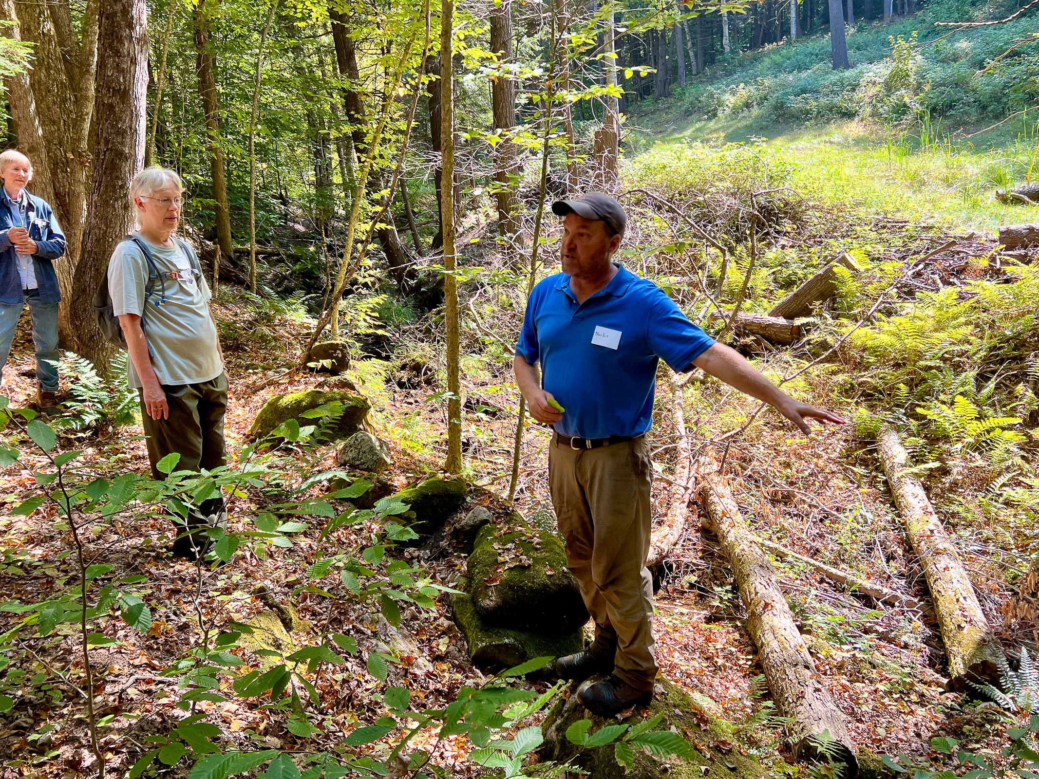
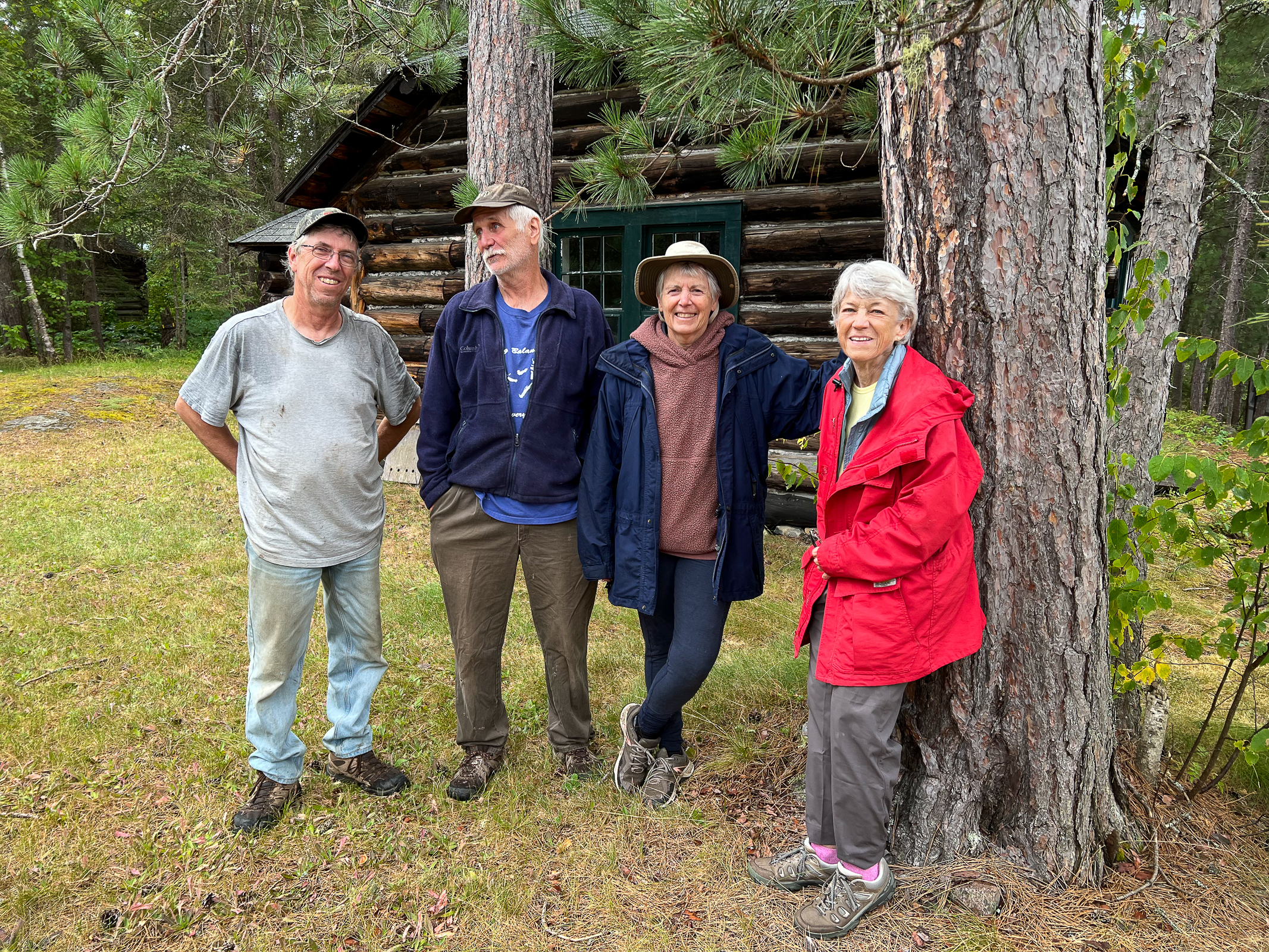
The chores never end at the Farm. But one of the benefits is that it gives us a chance to spend time with Ellen’s brother John. Cutting trees and planting trees is a non-stop necessity. John is part of a group called the Vermont Woodlands Association which helps Vermont landowners conserve their forests. We held another delightful Walk in the Woods event with a group of neighbors highlighting John’s sustainability work on his property.
As we were nearing the end of September, the Autumn colors were appearing in the Vermont forests. Soon the leaf peepers would be out in force and the backcountry roads would be thick with tourists. After this long and delightful stay, we experienced the hardest time leaving. After bonding so completely this time with this rural place, it would be difficult to drive back through the corporate American road culture to California. But fortunately, along the way we have several friends we will meet and miles to go before we sleep.
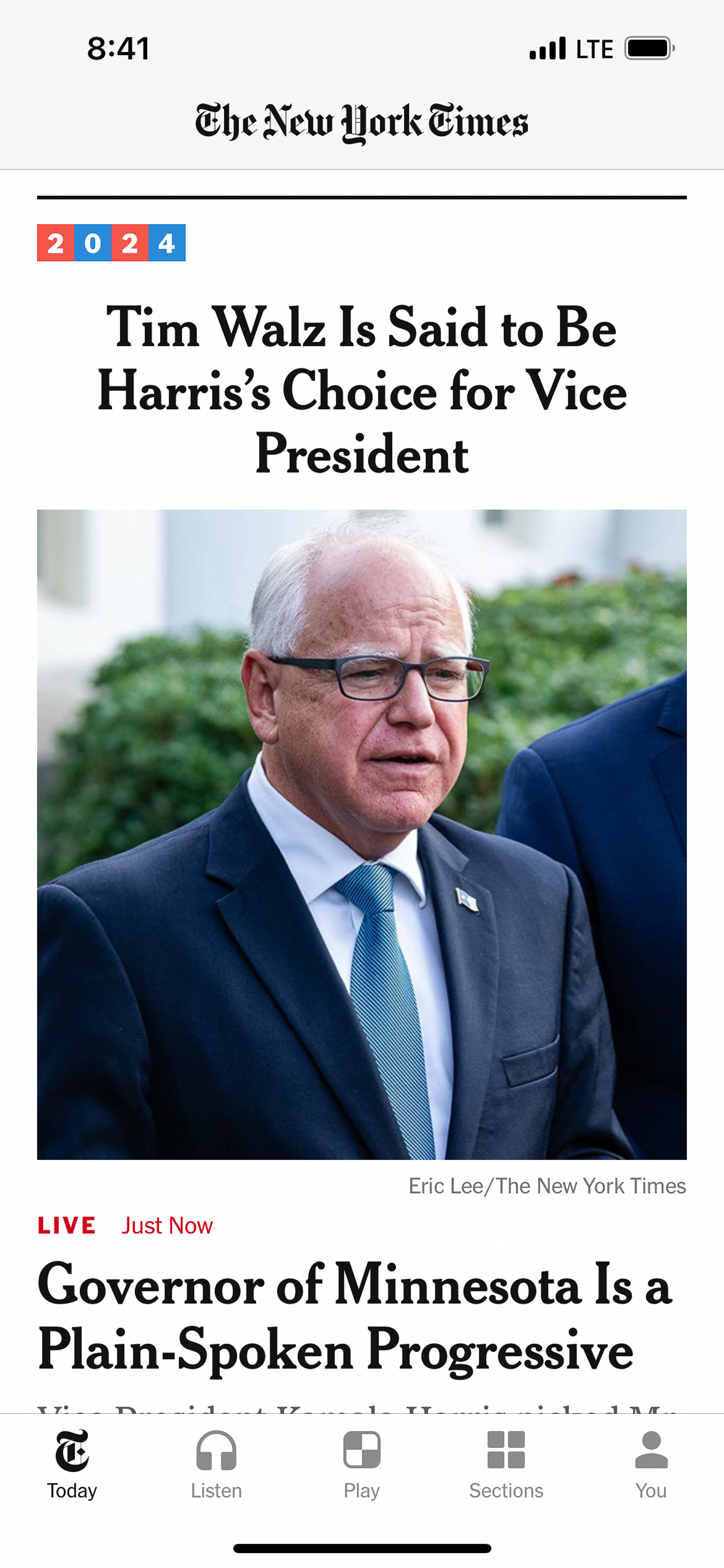
We postponed our departure by one day to watch the Vice-Presidential debate between Tim Walz and JD Vance. I think Vance was a better debater but there was no question that Walz should become the next VP. To be continued…
While driving from the West into the mid-West, we heard the stunning news that Minnesota Governor Tim Walz was picked by Kamala Harris to be her running mate for the upcoming election. It was especially interesting as we were driving through the upper mid-West when we heard the story. We also listened to a great interview of him on the Ezra Klein podcast and came away very impressed with his character and strong grasp of the issues. Being a white guy from a small mid-Western rural town also provided a nice balance to Kamala’s San Francisco urban background. The last month has been one of the most consequential in recent American political history and the election is just beginning.
One of the great advantages of driving across the country is being able to binge on news stories and podcasts. On this drive we have been glued to the radio listening to the transformation of our country during this time of great stress. None of us could have imagined what has happened this past month but we are relieved that the Democrats now seem to have a great team campaigning against Trump. We hope that Harris and Walz can run on competence and joy against MAGAs snarling snarkiness. I think the nation is ready for a change from Trump World. I know I am!
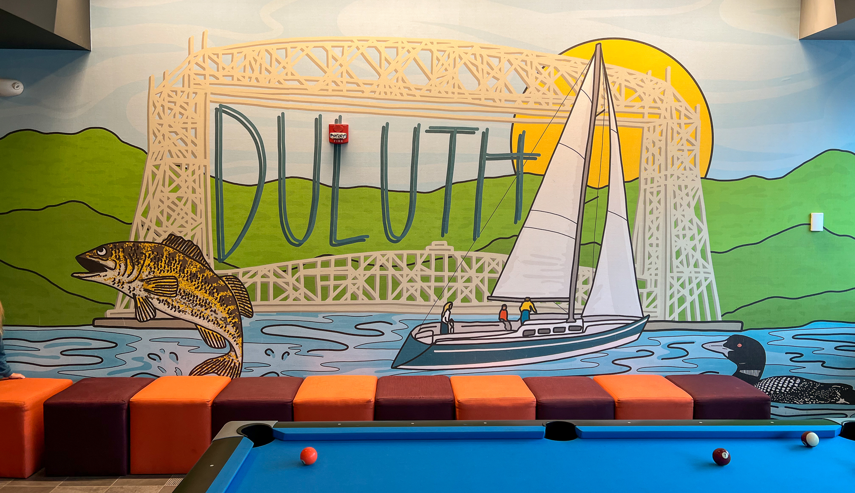
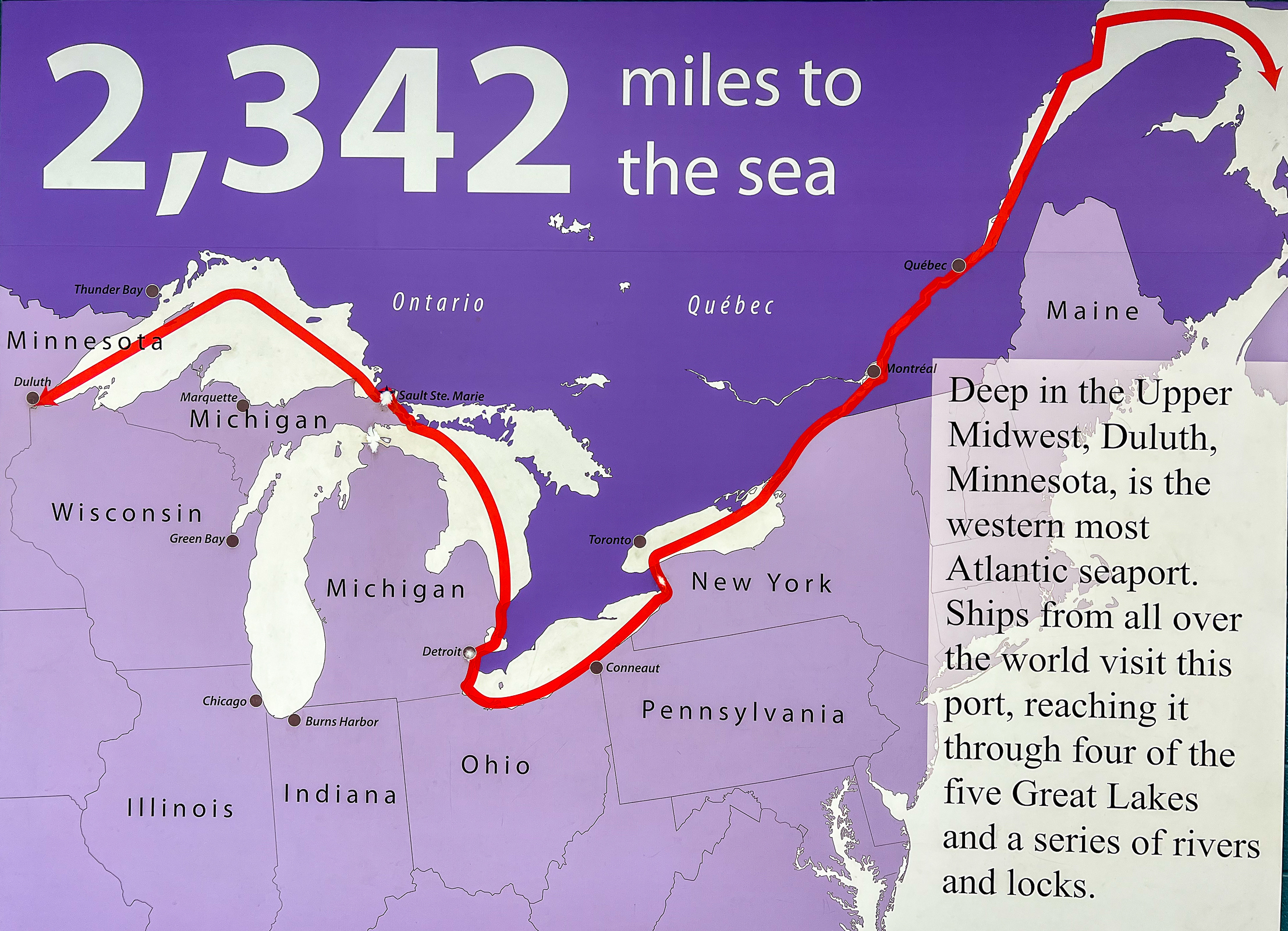
We arrived late in the evening on the shores of Lake Superior in the city of Duluth, MN. It is the western most point of the Great Lakes and is the world’s farthest inland port accessible to oceangoing ships. Promoters of the city have called it the “San Francisco of the mid-West” because of its steep hills with beautiful old buildings next to an enormous body of water. But as we looked out over the post-industrial landscape, we saw what had once been a rich city struggling to emerge from economic hard times and bad urban planning. Like the 1980s in San Francisco, we saw the seeds of renewal in the young people revitalizing the downtown with coffee shops, cafes, and bike shops. We hope someday they will make Duluth great again!
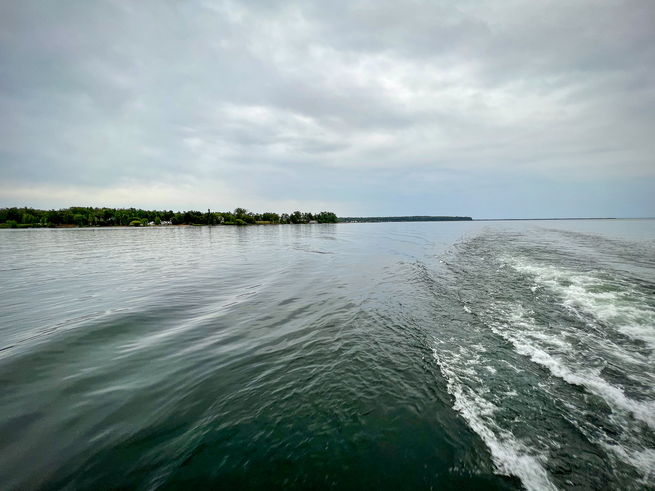
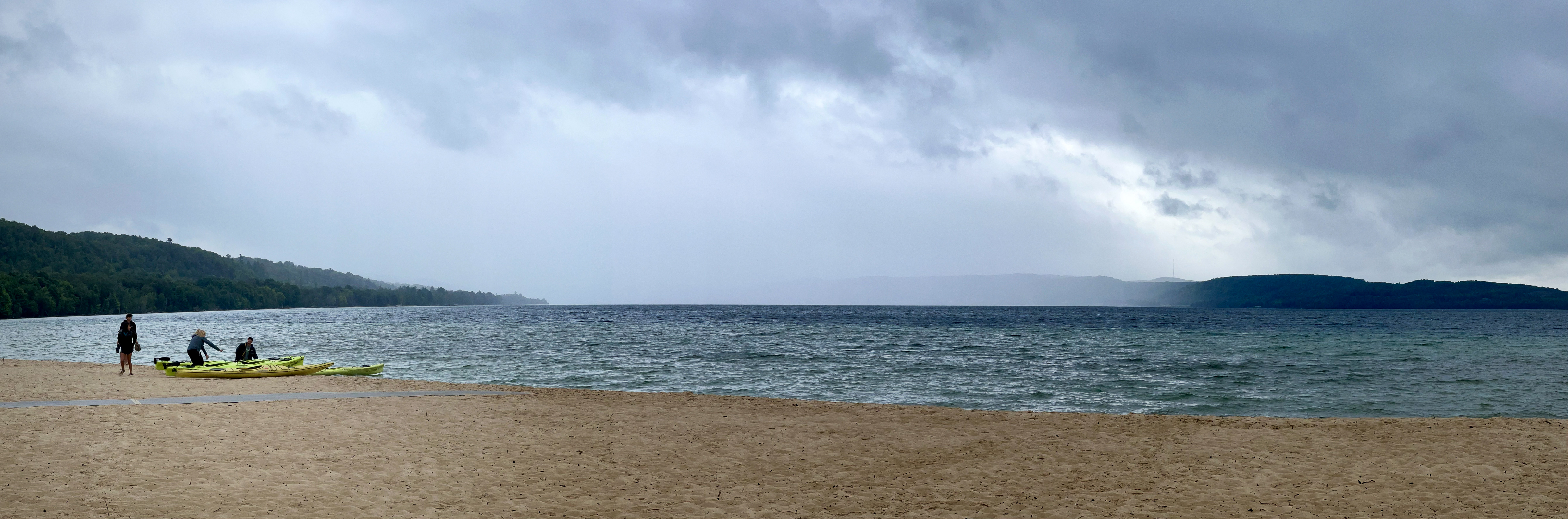
The Apostle Islands National Lakeshore is Wisconsin’s beautiful gift to the world. On a hike on the mainland lakeshore, we walked on a long, crazy wooden walkway to the Sea Cave Overlook and were surprised to see kayakers paddling beneath us! We also took a ferry to rain swept Madeline Island where we hiked to a unique bog dune ecosystem with an enclosed lagoon. I knew little about this Lake Superior ecology and what we saw was fascinating.
We headed into the Porcupine Mountains along the shore of Lake Superior in the Upper Peninsula of Michigan. We had never been here and were surprised by the incredible beauty. This area is home to one of the largest stands of old growth northern hardwood forests in North America.
The Keweenaw Peninsula sticks out of Michigan like a finger pointing at Canada. The area was home to the first major copper mining boom in the United States from the 1840s to the 1960s. It contains the only place on Earth where large-scale economically recoverable 97 % pure native copper is found. It is the only place in the US with evidence of prehistoric aboriginal mining of copper. As well as the natural beauty, the effects of mining and logging could be seen throughout the area. We headed along the north shore to the appropriately named community of Copper Harbor. We enjoyed a long hike through a crazy mixed ecology of sand, forest, tree roots, rock, and the infinite horizon of Lake Superior. The next morning, on our way to coffee in the town of Houghton, we discovered that their beautiful, old library and become a beautiful, old tavern called The Library.
Pictured Rocks National Lakeshore was another wildly beautiful spot on the shore of Lake Superior. It was designated the first National Lakeshore in 1966. Our hike along Twelvemile Beach through a white birch forest was like what I imagined the coast of Scandinavia must be like. It is known for its crazy, sculpted lakeshore cliffs and caves. If the immensity of Lake Superior wasn’t enough, a sign reminded visitors that it contains 10% of the Earth’s fresh water. Another reminded hikers that the biting flies here are brutal and even bug spray won’t work.
As we checked in to our motel in Sault Ste. Marie, MI we were surprised to see an enormous red flame coming from a refinery in Sault Ste. Marie, Ontario just across the border in Canada. Up to now, much of our trip had been spent in relatively pristine places of natural beauty. This view was a vision of something else.
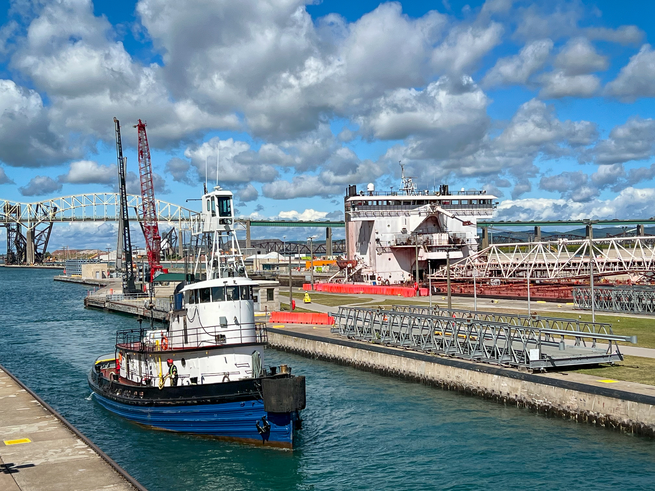
The next morning, we visited the Soo Locks built and run by the Army Corps of Engineers. It is one of the busiest lock systems in the world and makes it possible for ocean going ships to travel over 2,000 miles from Lake Superior through locks and rivers all the way to the Atlantic Ocean. We arrived just as a 1,000-foot ship was entering the locks and we stood spell bound watching this huge object slowly and silently glide by on its way to the sea. It was weirdly fascinating. The surrounding tourists witnessing this expression of power and technology all stood silently transfixed as well. It reminded me of visiting the massive Grand Coulee dam years ago in Washington. Our 19th and 20th century obsession for controlling nature did a lot of terrible damage but occasionally, like here, created something literally bigger than ourselves that approached the sublime.
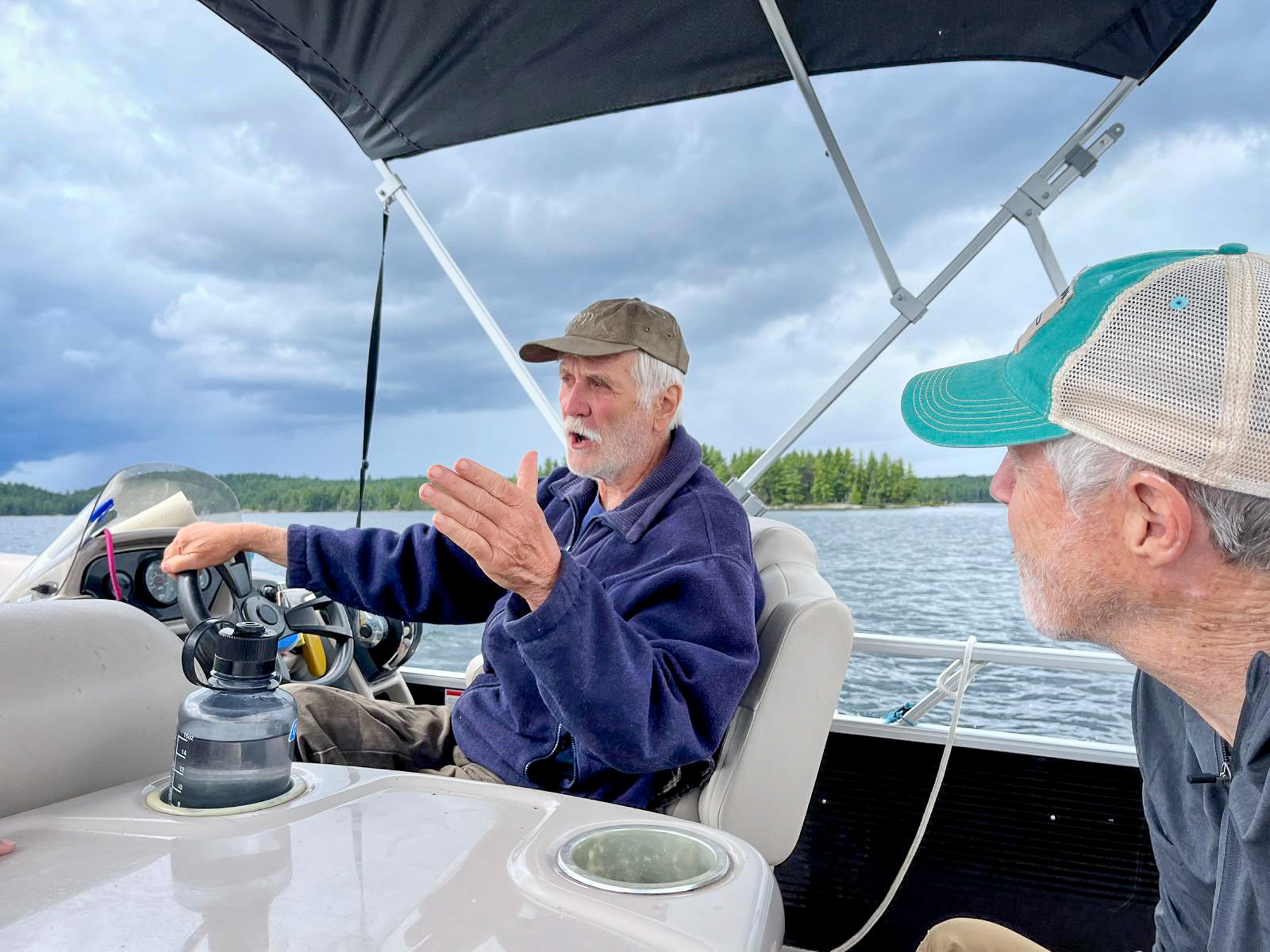
In the tumultuous late 1960s, I went to the University of California in Santa Cruz. Later, I helped found a commune and lived an alternative life in the area. This was when I began my passion for photography that gave a focus and meaning to much of the rest of my life. One my friends who shared my interest in photography was Viki and we have stayed in touch over the years. In the 1970s, she had inherited a rustic lodge deep in the woods on the Canadian Shield of Ontario. I had always wanted to visit her and her husband Allan, so we now headed east from Sault Ste. Marie on Canadian highways and dirt roads and more dirt roads until we arrived at their little bit of paradise on a lake in the forest.
It was fascinating to see someone after 50 years and to think of the choices and circumstances that got us to where we are today. Viki and Allan’s life is very different from ours. We wound up using photography to follow our passion to explore our country and the world. We have also lived a very urban life in San Francisco. They turned their life into running a lodge that was so remote that visitors could only cross-country ski into it in the winter or take a boat to the lodge in the summer. Their love and understanding of the place came from a lifetime looking at the details and witnessing the passage of time in a timeless place. They were both inspiring and I felt so grateful to be able to renew an old friendship.
While we savored the solitude of the Canadian backwoods, our son Walker sent a photo of himself covering a news event with Gavin Newsome and Nancy Pelosi in California. It is hard to leave that world behind for very long.
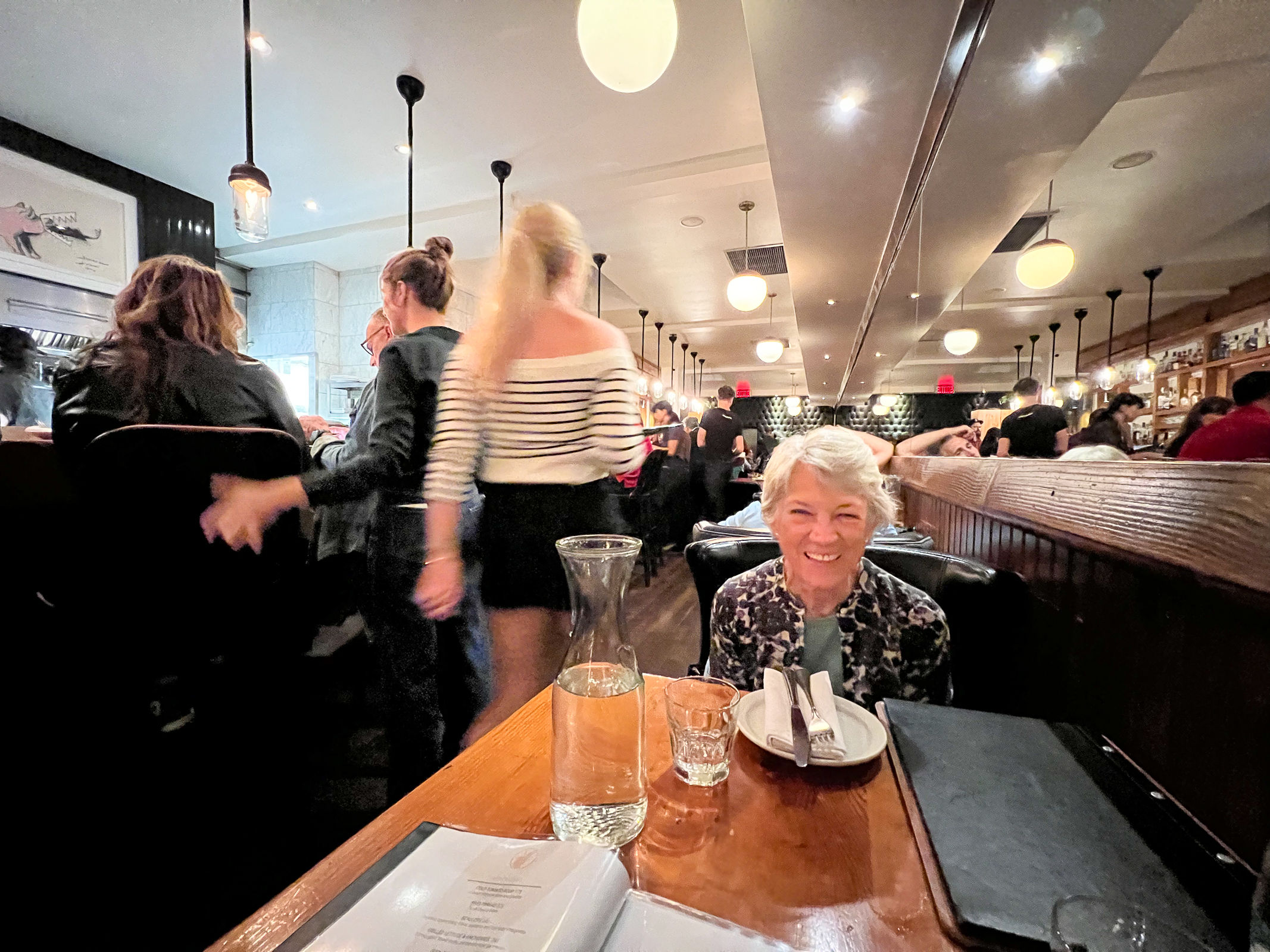
After almost two weeks on the road, we spent our last night in the wonderful city of Montreal in Quebec. Last May, Walker had taken me to an amazing French-Canadian restaurant in Montreal called Au Pied de Cochon. Food critic Anthony Bourdain described it as one of his favorite restaurants in the world. It deserves that reputation, but it is heavily meat-centric, and Ellen is a vegetarian. Fortunately, the very friendly staff put together a wonderful salad with a side of French fries. Add some great French wine and Ellen was a happy camper.
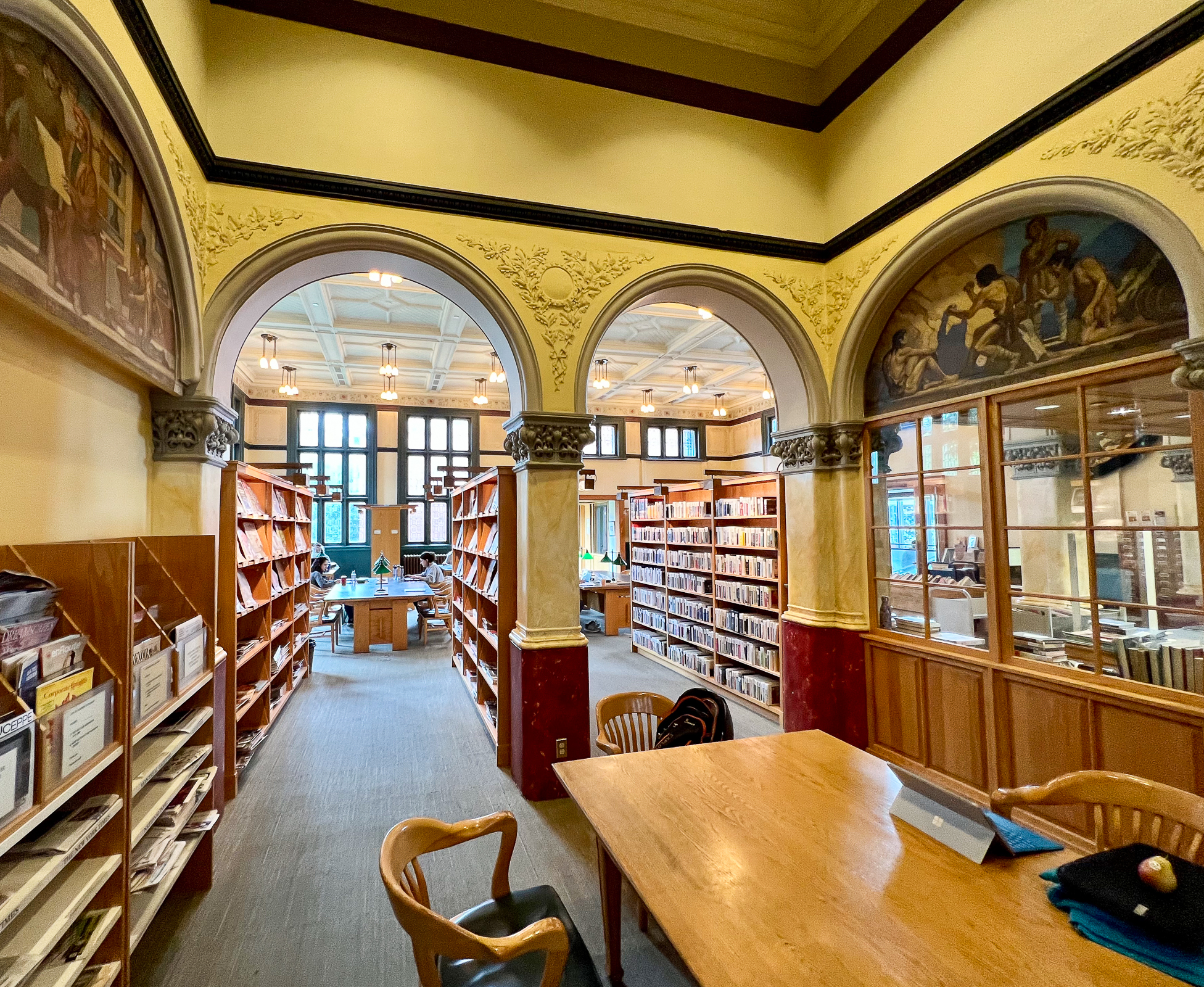
Since the Library of Congress recently purchased the last part of our Global Library project, we are supposed to done with this work. But, of course, one is never done until you are really done. One of the libraries I wanted to photograph last May in Montreal was the Westmont Public Library. It was built in 1897 to commemorate the Diamond Jubilee of Queen Victoria in a very English-centric neighborhood in the French province of Quebec. Its design was inspired by New England public libraries and is a beautiful and unusual place with a vaulted entrance, gabled roof, and a tower and turrets on the outside; and coffered ceilings, decorative moldings, strong arches, and faux marble columns on the inside.
We finished our cross-country road trip buying our groceries from a community co-op in the quaint little college town of South Royalton, VT. It was a relief to be done with the drive and we were so happy to be back in New England. To be continued…
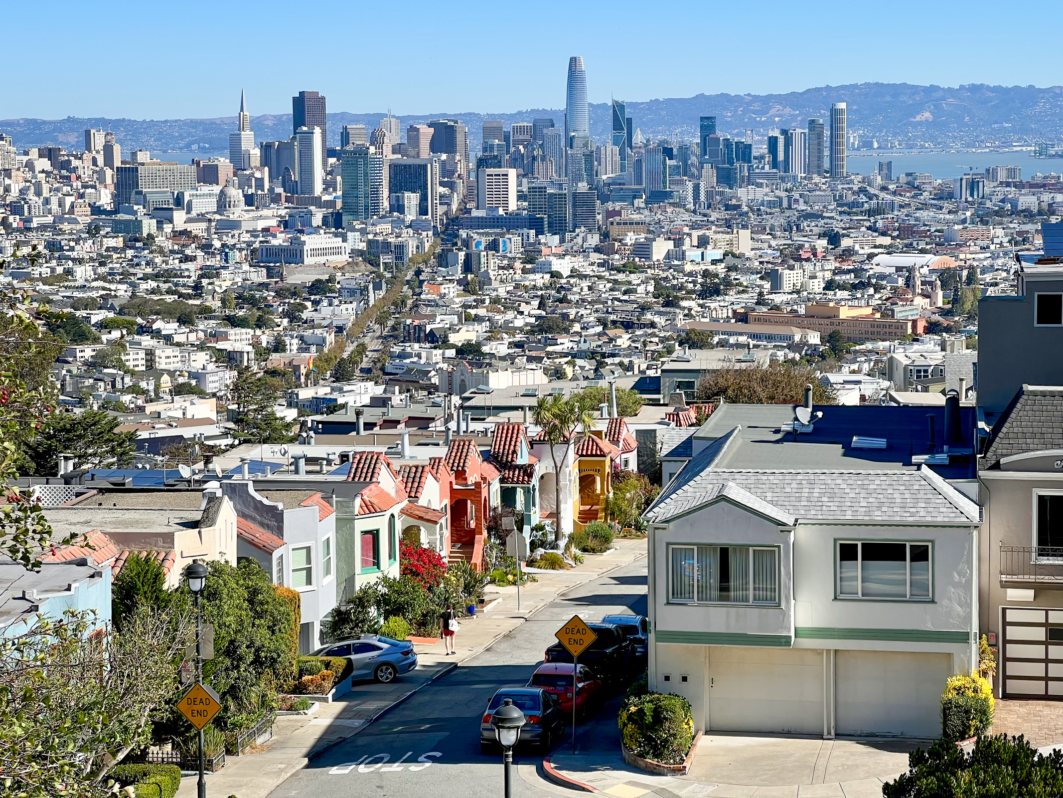
I realize that we live in a bubble in San Francisco. In many ways, including our politics, our city is just a little different than much of the rest of America. One of those differences is our weather. This summer, while most of the country has been sweltering in a brutal, climate-change heat wave, we have been shrouded by our old friend the fog. Calling summer our June gloom, gray sky July, and of course, Fogust is our way of overcoming our chilly summer weather. We did have a mini-heat wave beginning in July when the temperatures got up into the 70s and people were almost passing out in the streets. But on the 4th, just as the fireworks were exploding above the city, our natural air-conditioner kicked in and Karl the Fog came rolling back through the Golden Gate. Most years we never see the 4th of July fireworks because of the fog but this year people were cheering as we watched the fog roll in and the temperature plummet.
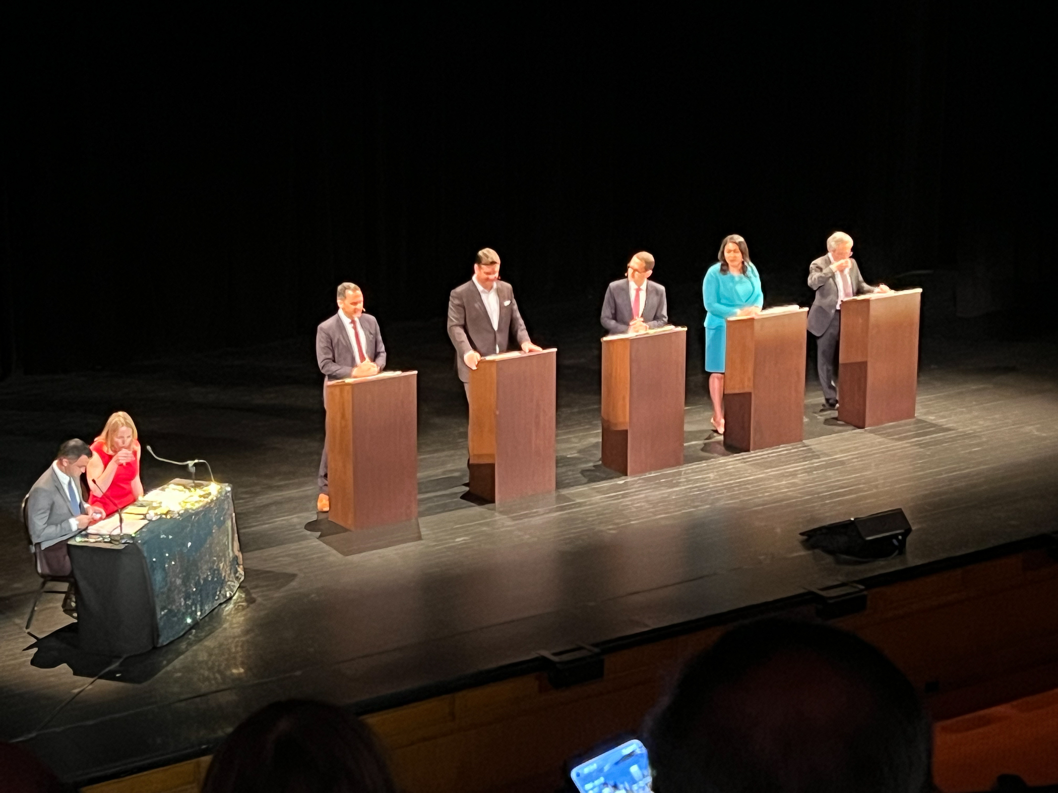
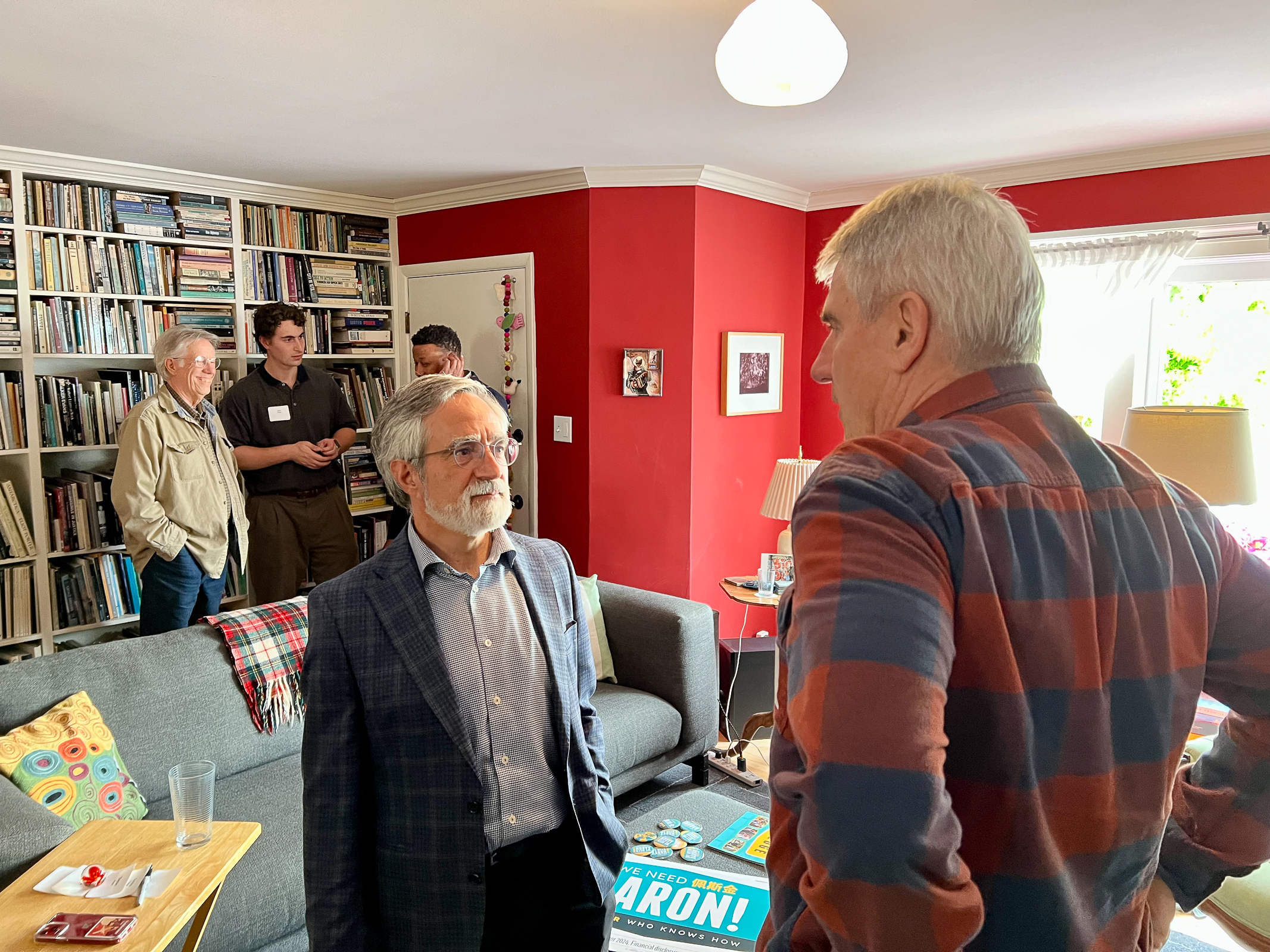
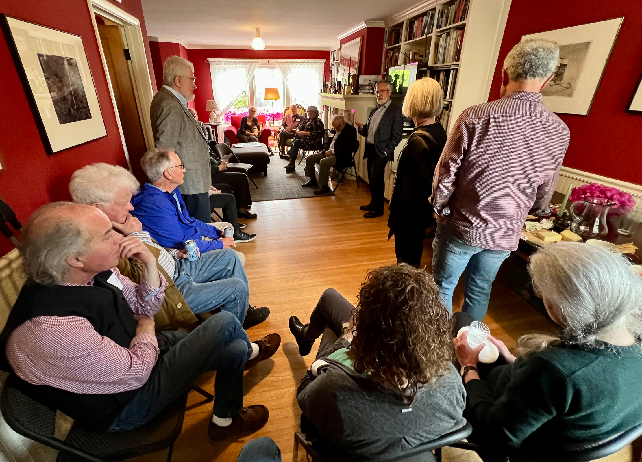
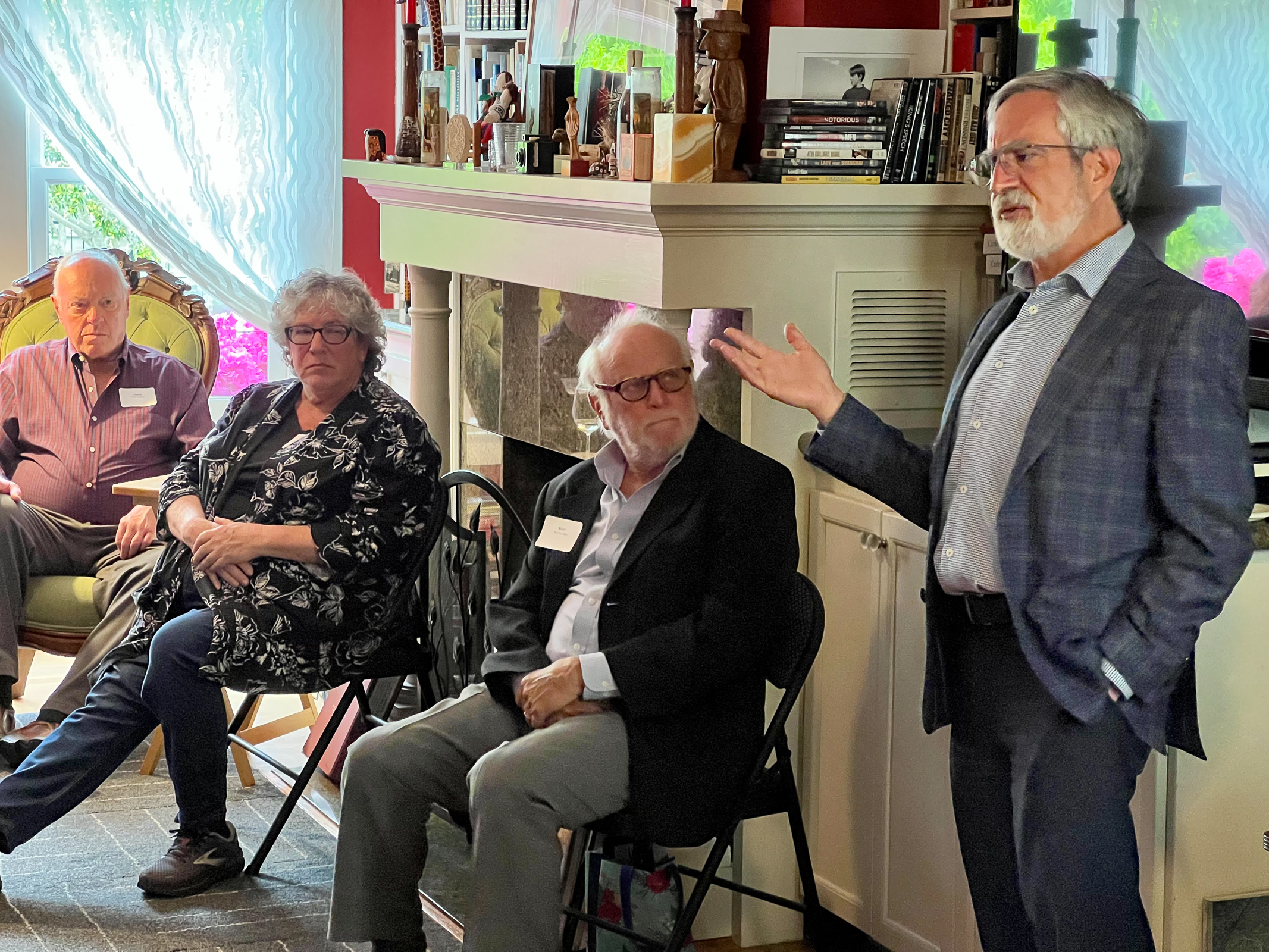
Politics has always been a part of our lives, and this strange year is no exception. On the national level, the Democrats seemed to be doing a slow march over a cliff. So, it felt like a good time to get involved in local politics. The political environment in San Francisco is often described as a knife fight in the phone booth. But whomever emerges is often very savvy and tough and some go on to national leadership such as Nancy Pelosi, Gavin Newsom, and Kamala Harris. We attended an evening with the candidates for Mayor with a very smart, respectful, and engaged audience. We went to some neighborhood talks by some of the candidates.
We finally decided to support an old acquaintance of ours, Aaron Peskin. Our way of getting involved was to host a house party for Aaron, invite our neighbors and friends, and engage in a discussion with our community. It turned out to be a remarkable event that generated a lot of donations for the Peskin campaign and allowed us all to participate in an important way with democracy.
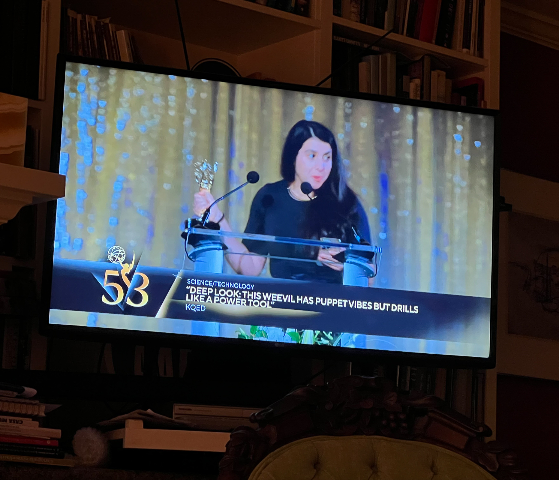
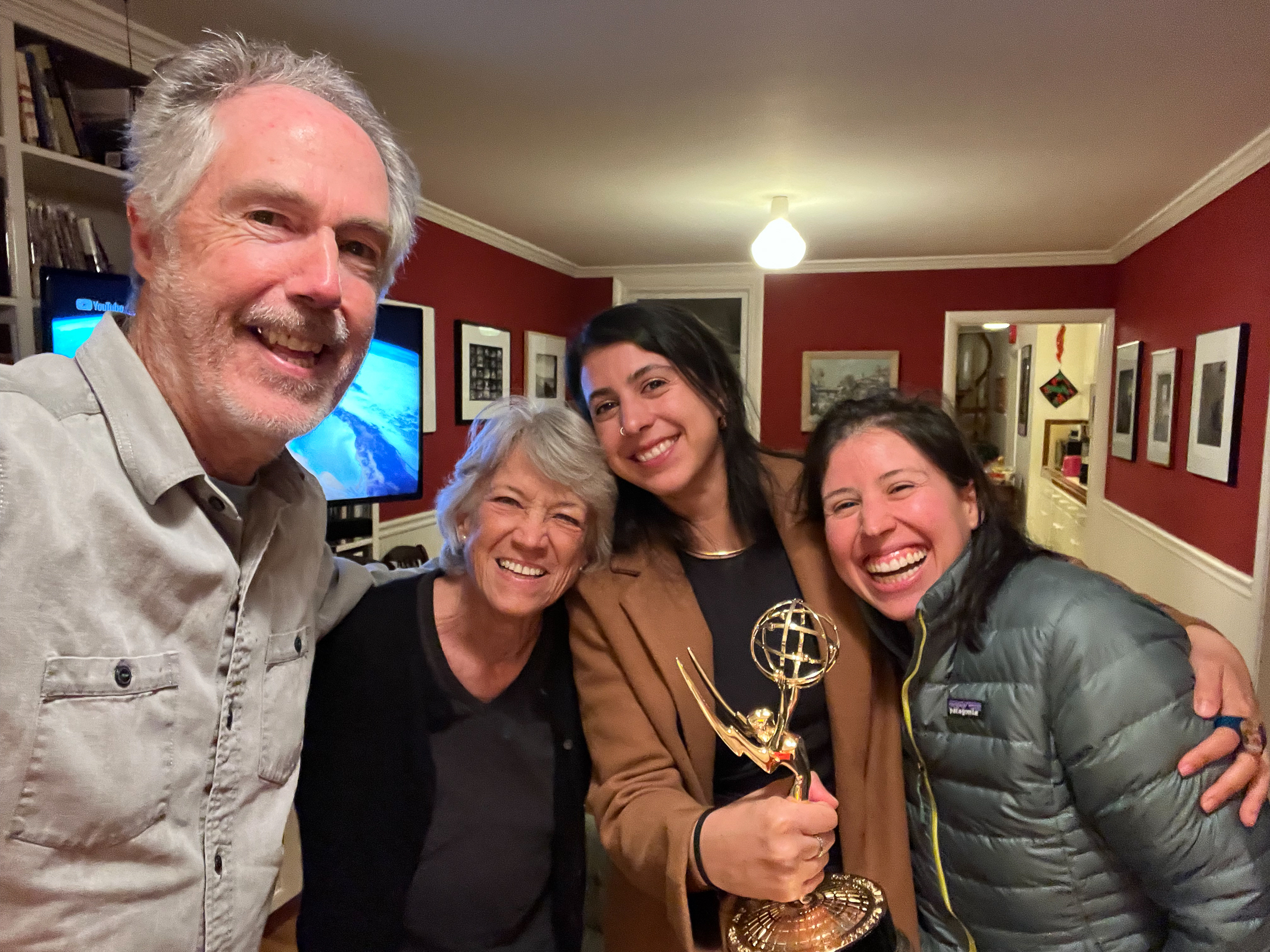
Another remarkable event was when Walker’s girlfriend Rosa received an Emmy for her PBS science program called Deep Look. We cheered her on with her sister Ana as we watched the awards ceremony. Rosa came over after the ceremony and showed us the statue. Impressive!
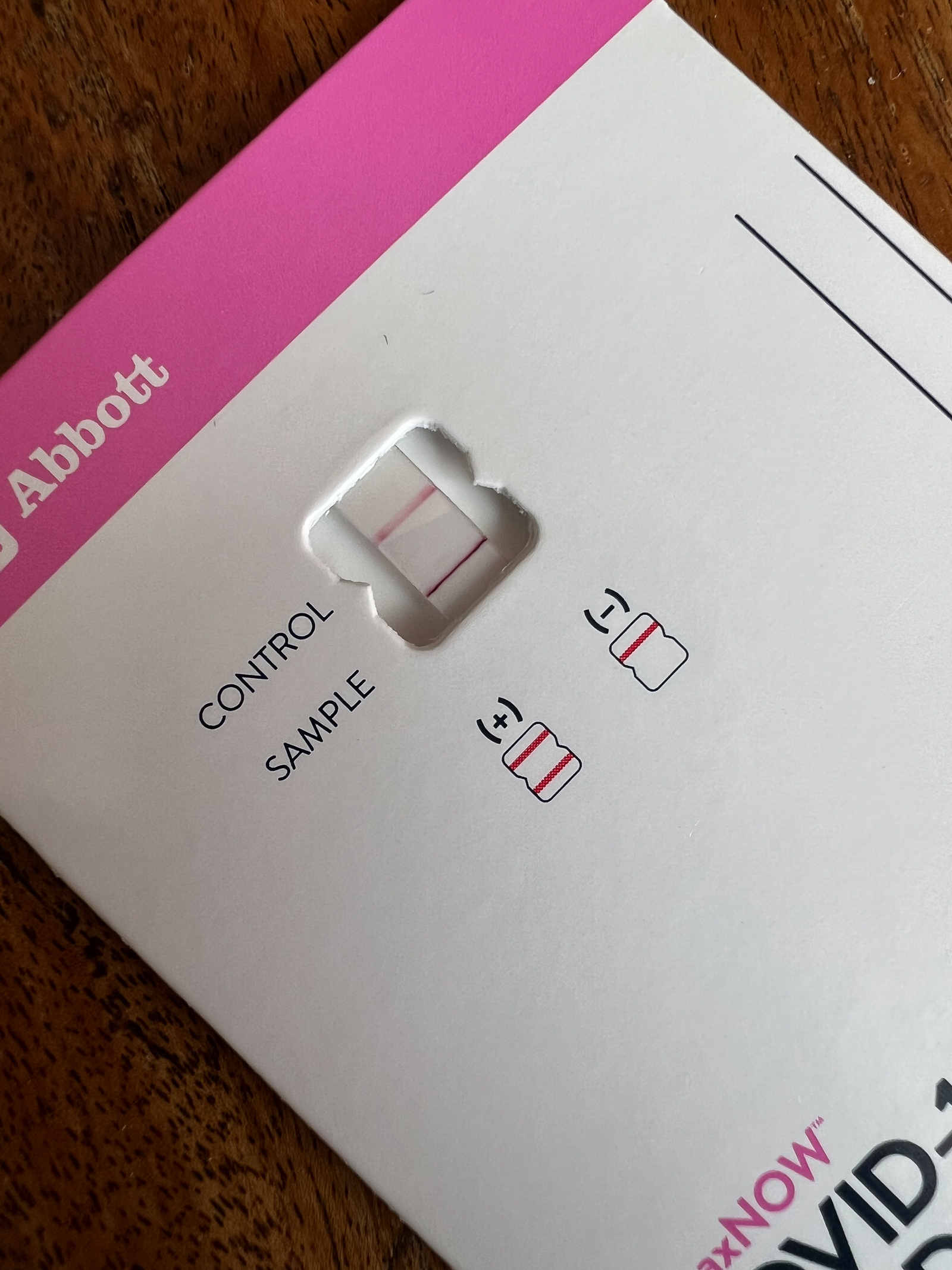
Two years ago in Nova Scotia, I shared by first case of Covid my darling wife Ellen. Now, she returned the favor. We share everything. It’s true love!
The big push of this summer was producing the last installment for the Library of Congress of our American and Global Library projects. This was all the work we have been doing starting in 2019 of libraries throughout Canada, the US, and Mexico. The North American Global Library work will be added to the work the Library of Congress already has of our European Global Library work that they purchased in 2022 and the American Public Library work that they collected in 2015. Printing and cataloguing the new work took up most of the summer. We are utterly exhausted but totally happy to have finished this mammoth effort. And we are proud to have all this work now permanently archived at the Library of Congress.
We were very excited about seeing the Presidential Debate at the end of June. But it turned out to be like watching a horrible bully beating an old, defenseless man to the ground. And this shocking event was only the beginning of a month unlike any other in American politics. Next, Trump barely escaped assassination from an insane gunman. Then, the Republicans staged a hyper macho-man, Las Vegas-like convention to nominate Trump. After that, President Biden (with a little help from his friends) decided he would not continue his campaign for President and threw his support behind his Vice President Kamala Harris. At that point, I happily put in my order for my Kamala for President t-shirt! This was a historic, mind-boggling series of events that we all lived through and are still trying to understand. Can’t wait to see what the Democratic convention will be like in August.
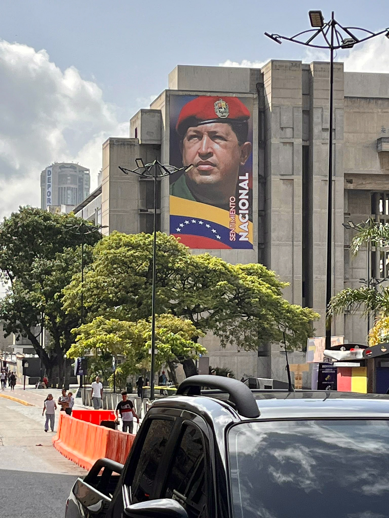
While this was going on, Walker got an assignment to cover the election in the troubled country of Venezuela. This was a particularly difficult one because our government has no diplomatic relationship with Venezuela. After the election, the US accused Venezuelan President Maduro of stealing the election and we recognized his opponent as the winner. To call the situation tense would be an understatement. And Walker and his CBS crew had real concerns that they wouldn’t be allowed to return to the US. There was even a photo published in the New York Times of Walker working on the edge of massive crowd. Violence was beginning to erupt throughout the country. But like a miracle, Walker and his news team finally made it out at the last minute to Columbia. We all breathed a huge sigh of relief.
Just as Walker was making his return, we made our exit from the fog of Fogust to the heat of the heartland. Driving across country is always a challenge but it always includes unexpected rewards. Elko, NV turns out to be the largest gold mining area in the world right now. We had a wonderful conversation with some mining engineers sitting next to us at a table that looked like the Last Supper. But we said we said our goodbyes when one of them started talking about defeating that “Kamala” so she wouldn’t regulate their environmentally damaging gold boom. Ah, America!
For most of the drive, the famous sparkling blue big sky of the West had been replaced by an oppressive gray caused by massive forest fires. This was only made worse by temperatures that hovered over 100 degrees every day. However, we did come upon two beautiful highlights. One was an area in the Rockies called West Yellowstone. It is an area just west of the National Park that is classic mountain West with high valleys, rugged peaks, and lots of open spaces. This was a thrilling reminder on why I love this part of the country. Unfortunately, as we got closer to Bozeman, MT, the unplanned ugly urban sprawl made me wonder about the title of Montana as the Last Best Place.
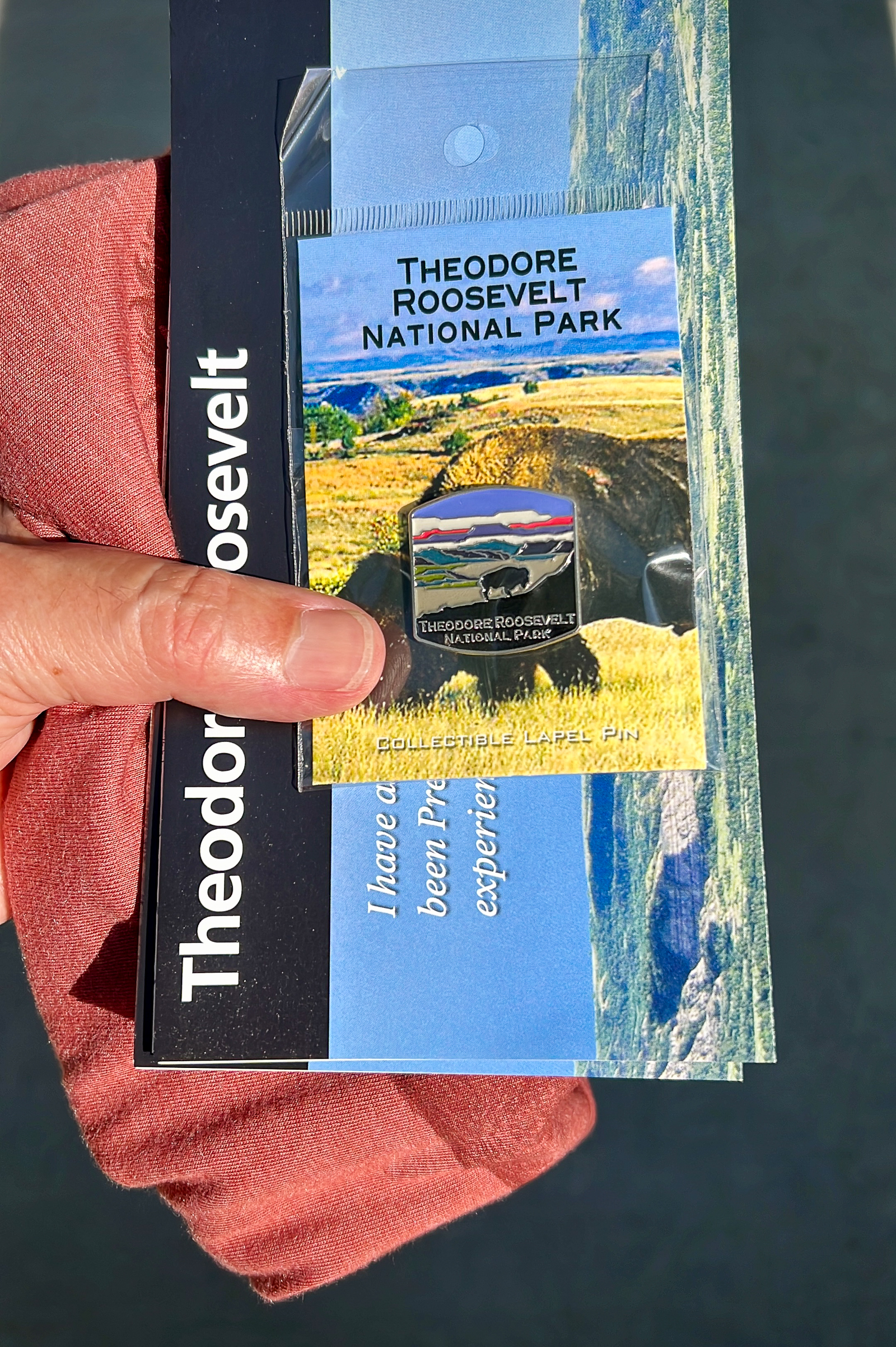
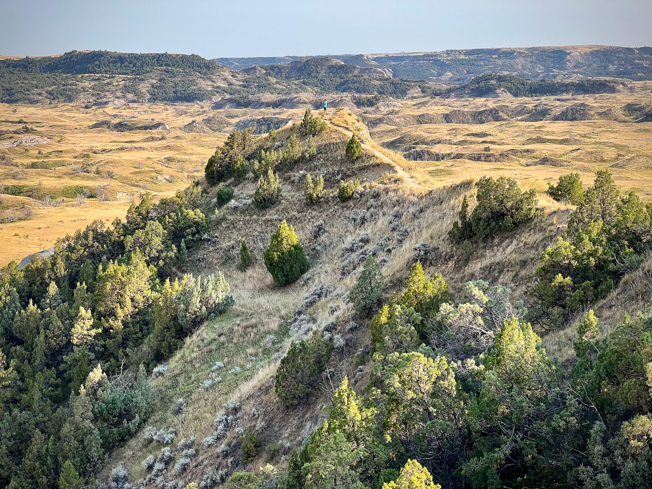
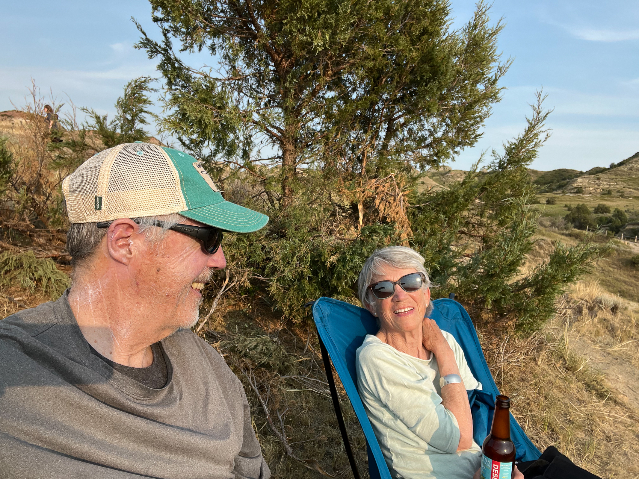
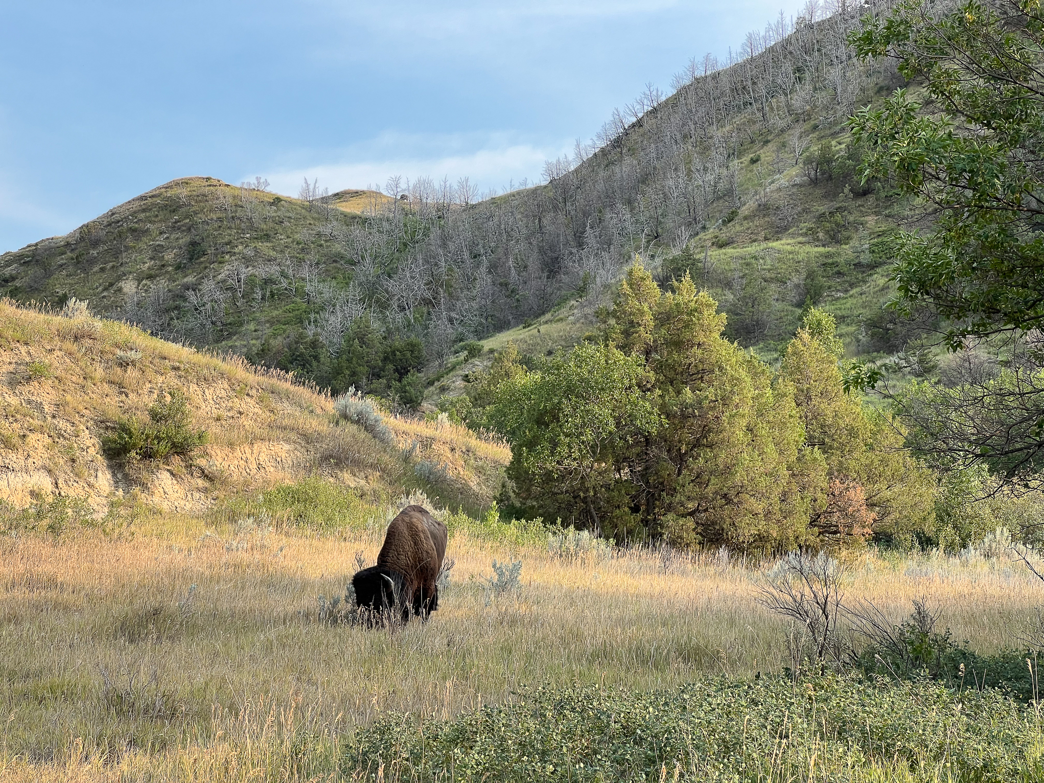
The other spectacular place we enjoyed was Theodore Roosevelt National Park in western North Dakota. Over a hundred years ago, this was the home of Teddy Roosevelt where he sought solace in its open spaces. Today it is home on the range for lots of buffalo, antelope, and prairie dogs. And, as it turned out, lots of tourists. Twelve years ago, Walker and I marveled at how empty this National Park was compared to most. But it was easy now to leave the crowds behind and we spent a blissful afternoon enjoying the big sky, the buffalo and a beer by a slowly meandering river. It was worth the whole trip just to be here.
After years of hauling our son Walker along on our travels around the American West and other parts of the world, Walker is now hauling his dad along on some of his journalism assignments. Last February, we went to frickin’ cold northern Manitoba in search of wild pigs. On this trip, we headed to the wilds of rural Québec in search of maple syrup cartels. It was fascinating for me to tag along and, of course, I photographed a few Canadian libraries along the way.
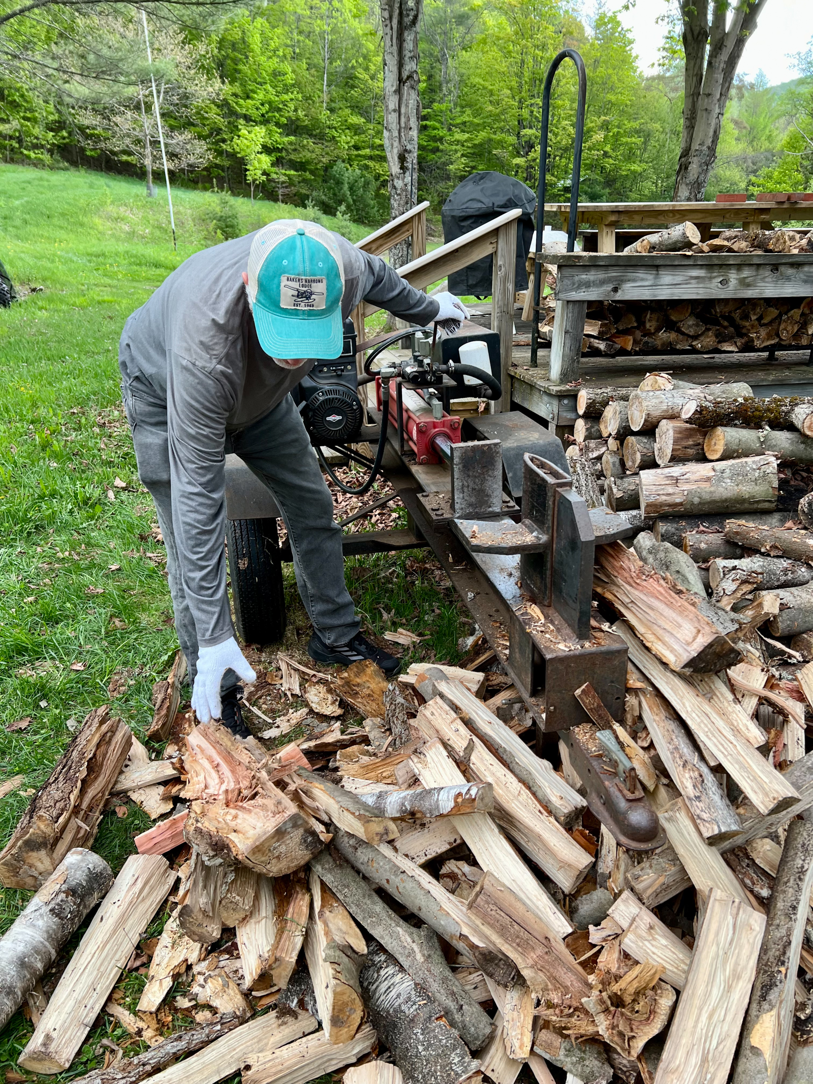
We share a small cabin and some land in rural Vermont with Ellen’s sister Martha and brother John. One of the rituals of rural New England this time of year is opening summer camps like ours. Clean out the bugs, turn on the water, mow the lawn, vacuum, make the beds, and generally make the place habitable for the families that share this place. Everyone took a chore and went to work. My assignment was cutting a huge pile of wood from last year that will be used in the Fall when things start to get cold again. With our nephew Bart and Walker, we set up an assembly line of cutting, tossing and stacking. I began to understand why Abraham Lincoln was such a great President as I blissfully spent most of the afternoon splitting logs.
After a little work and a lot of fun, we all went our separate ways with Ellen going back to Boston with her sister and Walker and I heading north on assignment to Montreal, Canada. This is one of our favorite Canadian cities and though it seems a world apart, it is only 2 ½ hour drive from our place in Vermont. Miraculously, Walker was able to get us a seat at the world-famous restaurant Au Pied de Conchon (The Foot of the Pig). It is modeled after a Canadian maple syrup sugar shack but is actually a high-end, hipster phenomenon. Anthony Bourdain did one of his episodes here and declared it was his favorite restaurant in the world. Walker showed me the video where he literally eats himself into oblivion and almost passes out on the table. We could relate as the heavy French-Canadian food was so good that we couldn’t stop. Our favorite was the Duck in a Can but afterwards we vowed to go on a fast.
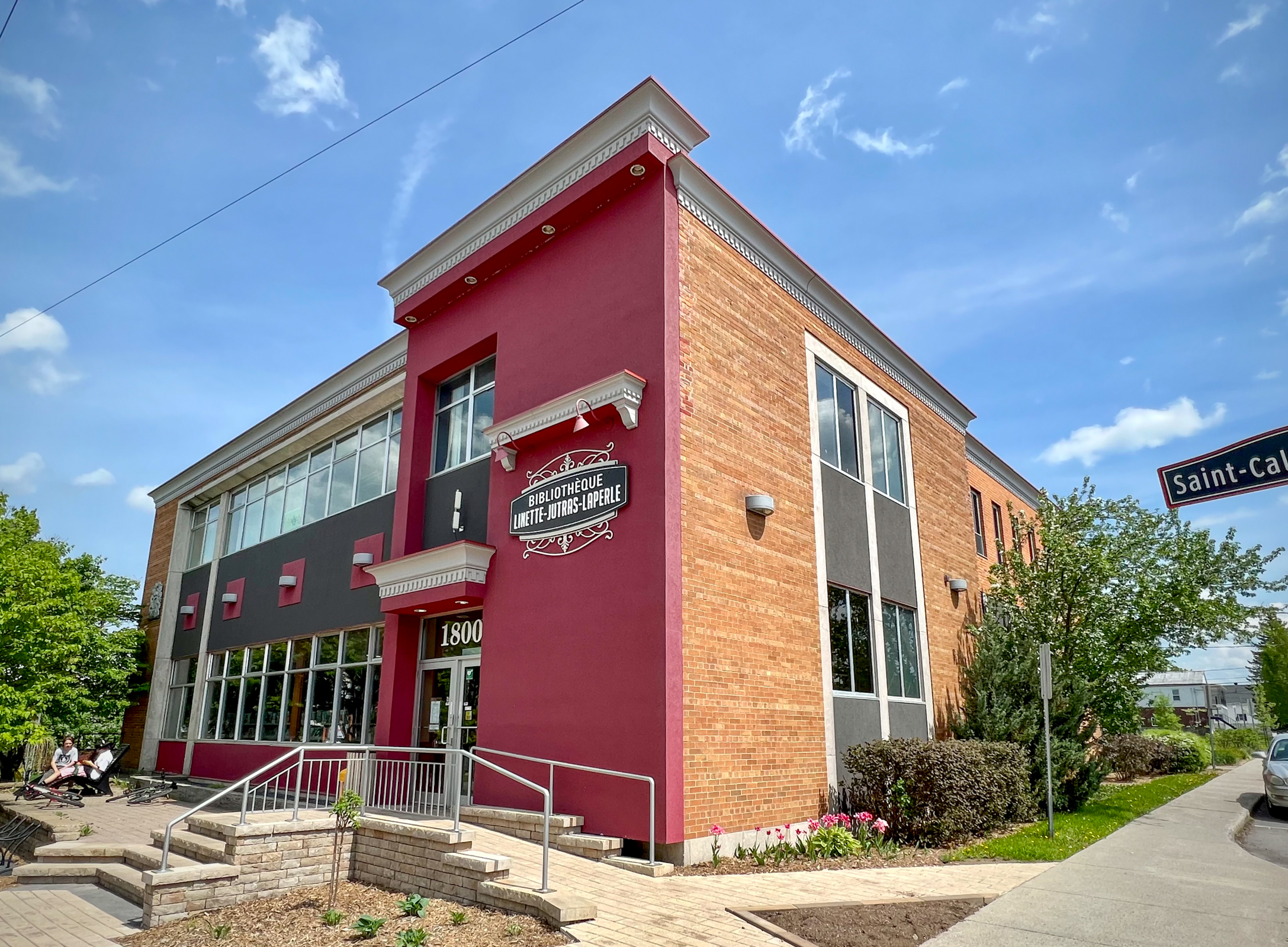
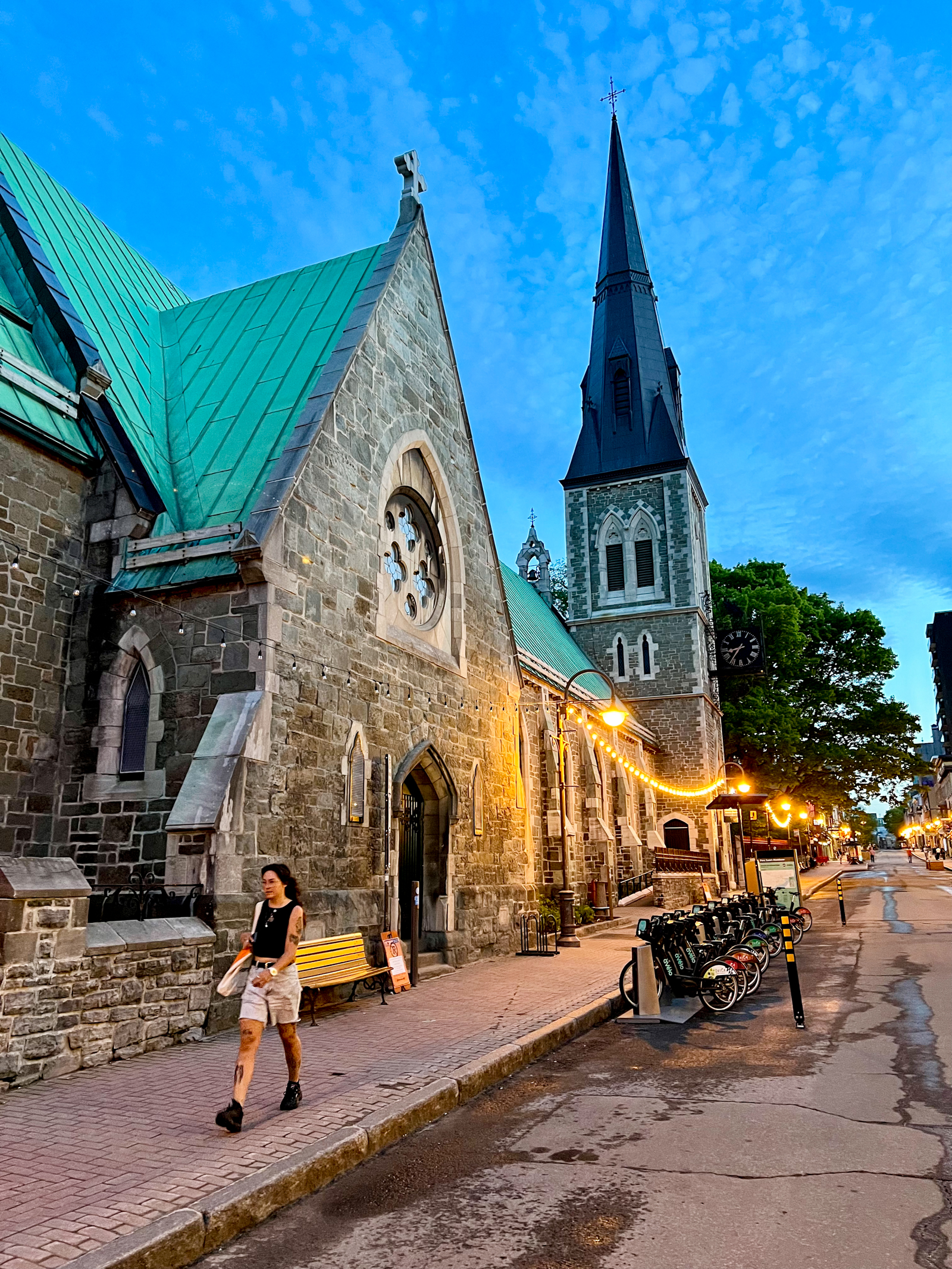
Our next day was a holiday called Victoria Day throughout Canada but is called Patriots Day in Québec. Everything was closed and Walker was not able to get an appointment for interviews. So, we focused on small-town libraries throughout the area. This included some with stunning architecture but many that were plain or weird that reflected some of the poverty in this part of the country. My favorite was in the oddly named small town of Tring-Jonction called Bibliothèque Livres-en-train which was in an old train station.
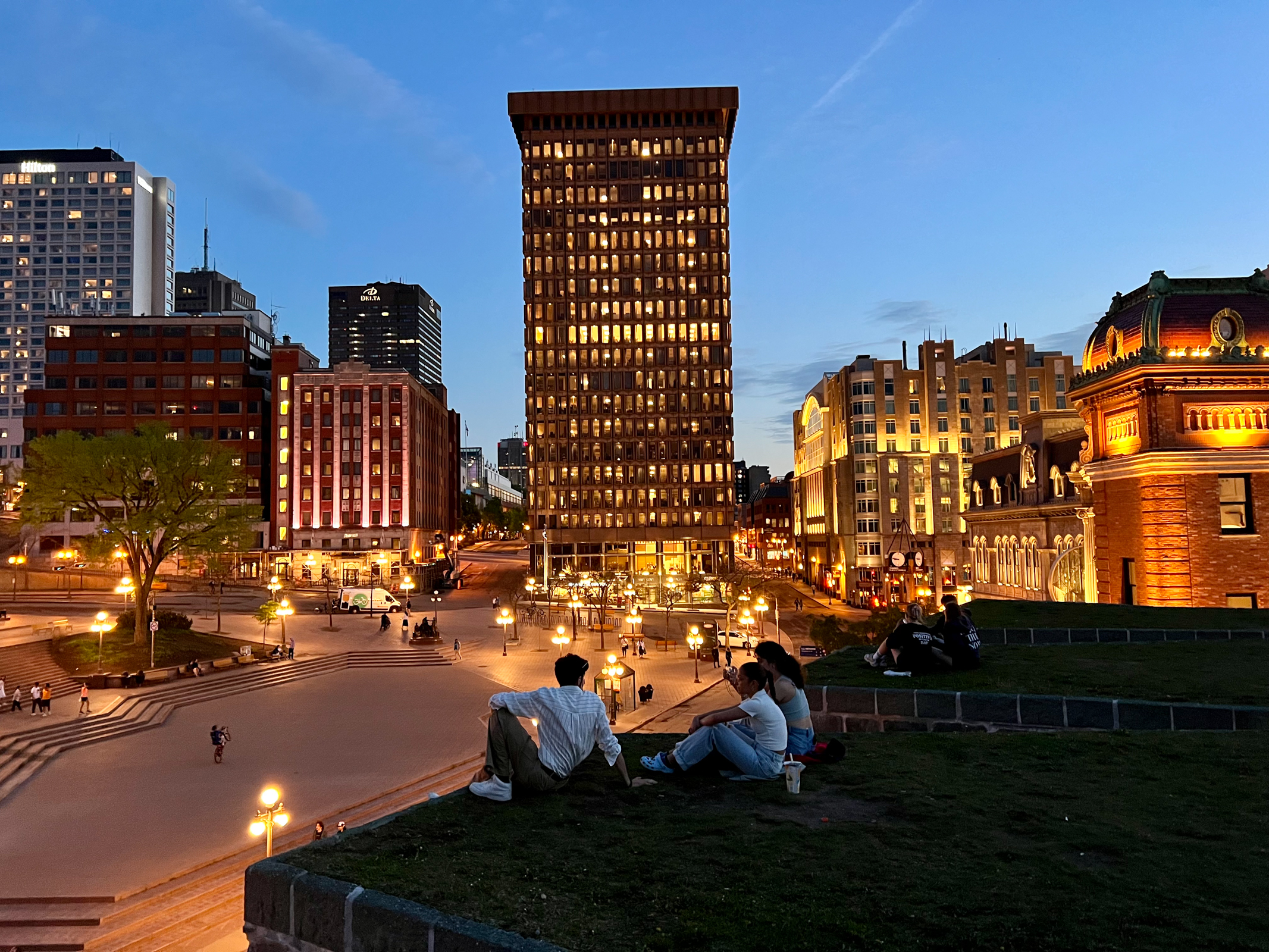
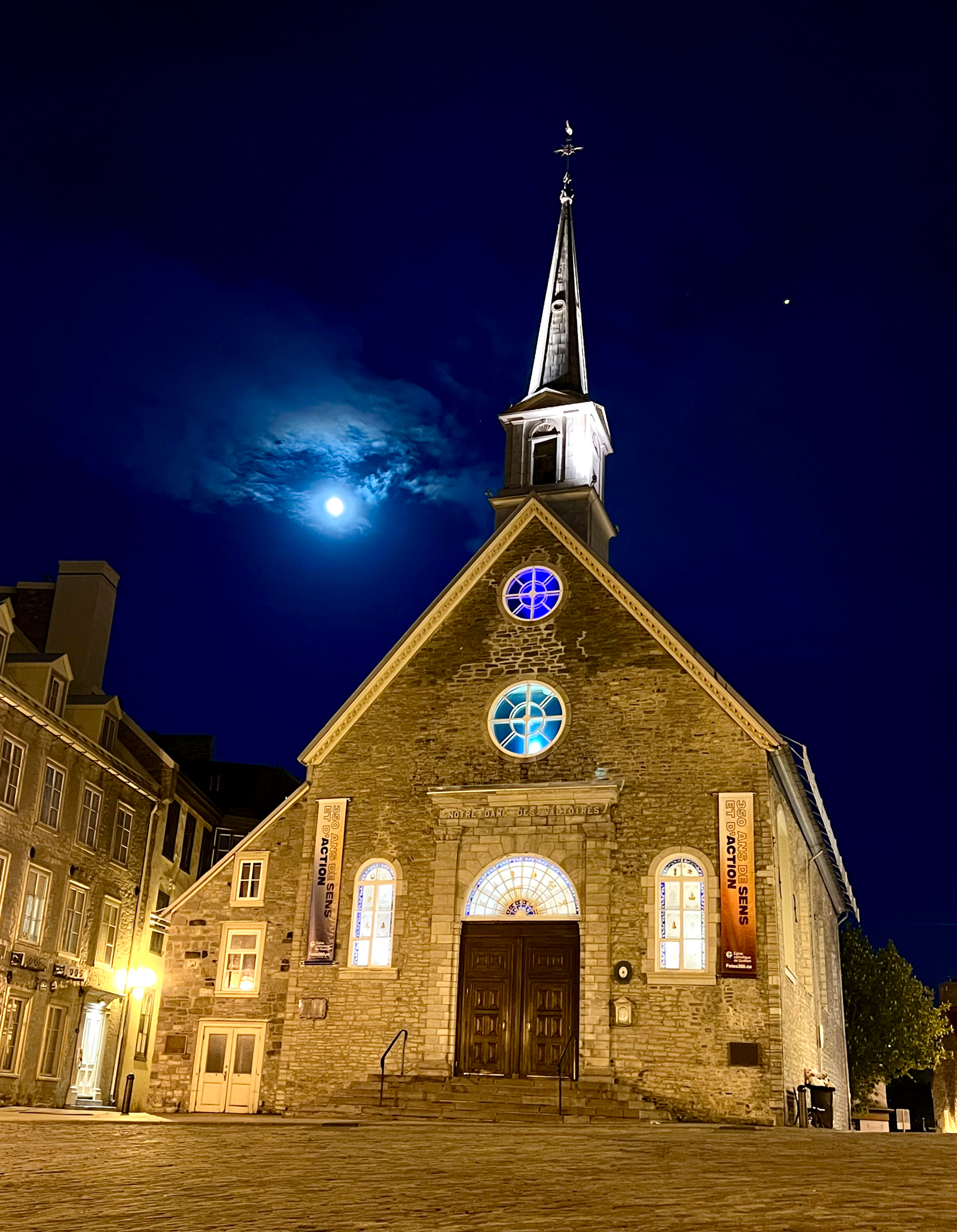
When we arrived in Québec City, we headed straight to the famous Plains of Abraham in the old fort on the edge of old city. Here, the course of history was altered in 1759 when the British Army defeated the French in a battle that changed Canada from a French colony to a country governed by the English for hundreds of years. It wasn’t until the 1960s that the French Canadians were finally able to break the English Canadian domination and create their own country-within-a-country called Québec. It was fascinating to be in this spot where history was made, and we thought a lot about the consequences.
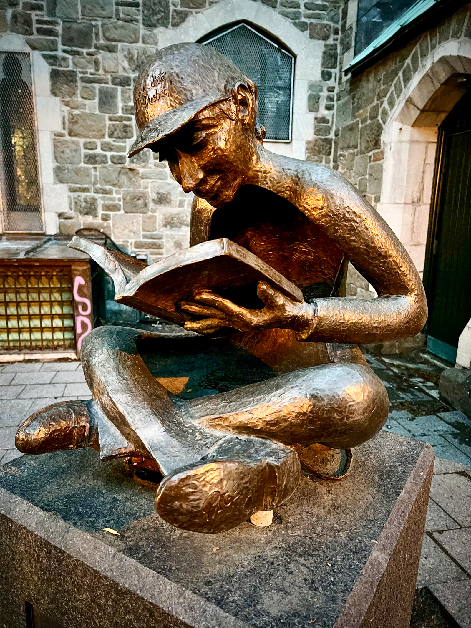
We walked off another fabulous French-Canadian meal by hiking over six miles throughout the 416-year-old city of Québec. There is nothing quite like this marvel anywhere else in Canada or the US. It is a walled-mideval town that was plopped into North America and still retains some of its ancient European ways. It was nice to revisit some of the old libraries such as the Bibliothèque Claire-Martin that Ellen and I had photographed earlier as well as discover new libraries on our hike such as the modern Bibliothèque Gabrielle-Roy.
In addition to libraries, we wanted to explore the maple sugar industry in Québec. Earlier we had seen a pretty good 2017 Netflix film called “The Maple Syrup Heist”. It tells the complicated story of the Québec maple syrup cartel and some of the producers and activists that were fighting it. We spent the next day traveling around southeastern Québec interviewing some of the stars of this documentary film including the activist Angèle Grenier and her lawyer Hans Mercier. She was the public face of the movement against the cartel but ultimately, they lost and some people like Angèle continue to pay heavy fines. We spent the night in the mid-sized town of Saint-Georges. This is a very conservative part of Québec and most of the people here speak little or no English.
Early the next day, we headed back to the USA to the tiny, quirky border town of Jackman, Maine. Finishing up his research on maple syrup, Walker investigated another final aspect of the story. Many maple syrup producers have given up on the restrictions in Québec and have set up tree farms in the US where they claim to be better able to make a living. It is hard to tell who is right in this complicated story, but many of the people we spoke with longed to move to the United States and take advantage of the opportunities available here. It is a lesson to consider for all of us that sometimes take our country for granted.
At this point we faced what I call the Gaspé dilemma. We had planned to drive from Maine up to the Gaspé Peninsula where the mighty St. Lawrence River meets the North Atlantic Ocean. At this time, unfortunately, the weather was still cold, windy and rainy. Also, the tourist season had not quite started yet and most everything was still closed. It is a spectacular part of North America and we both had always wanted to go there but now was not a good time. We had three days extra days, and our dilemma was where to go next.
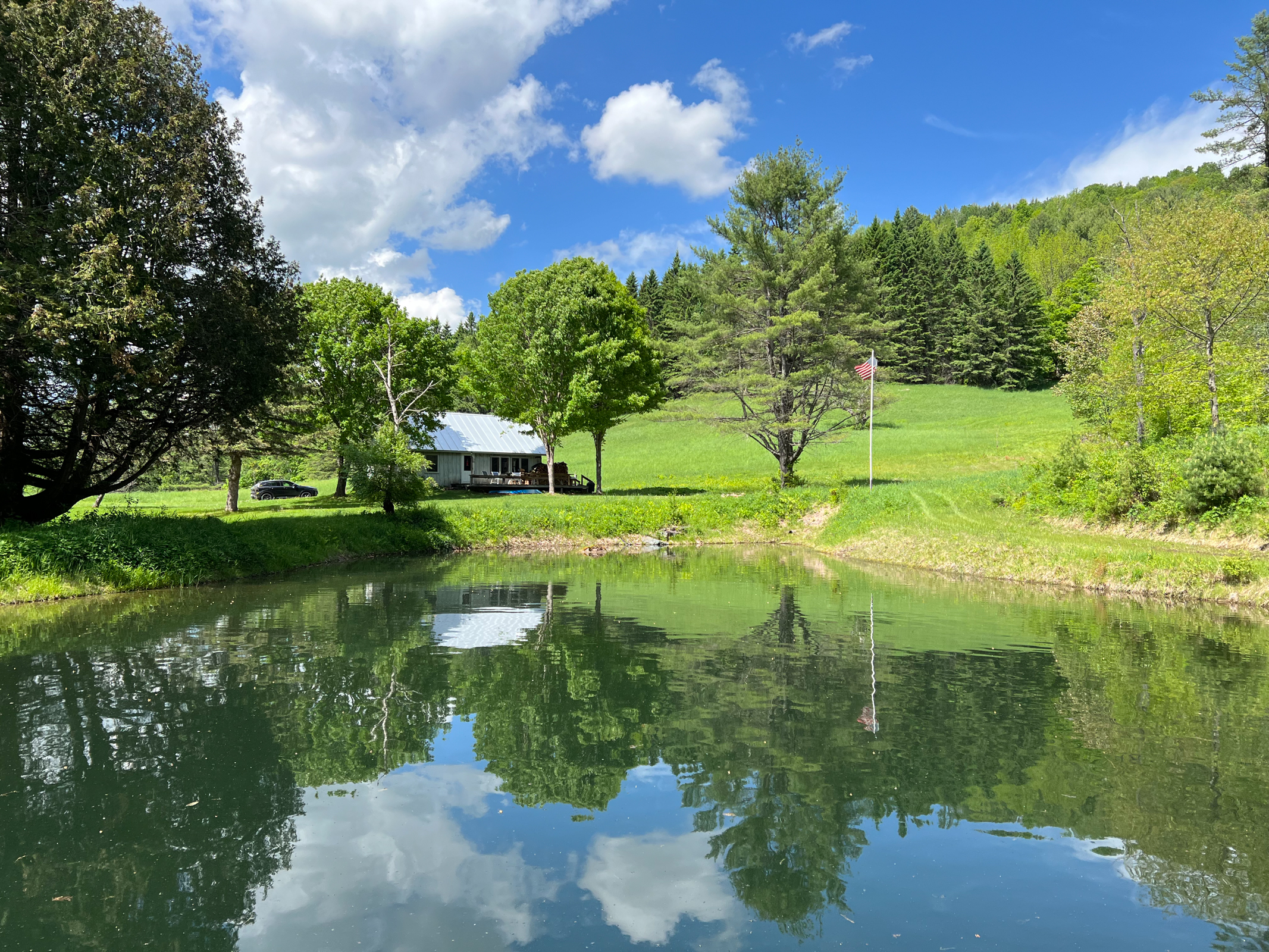
After weighing the options of all the fascinating places to go, we decided that three days back at our cabin in the woods in Vermont would be the best! What surprised us in doing nothing at the Farm, was that the place came alive. We slept, ate, hiked, mapped the forest and trails, talked, visited with John and his wife Kate, and basically relaxed. This was especially important for Walker whose hard-charging career as a journalist can sometimes be exhausting.
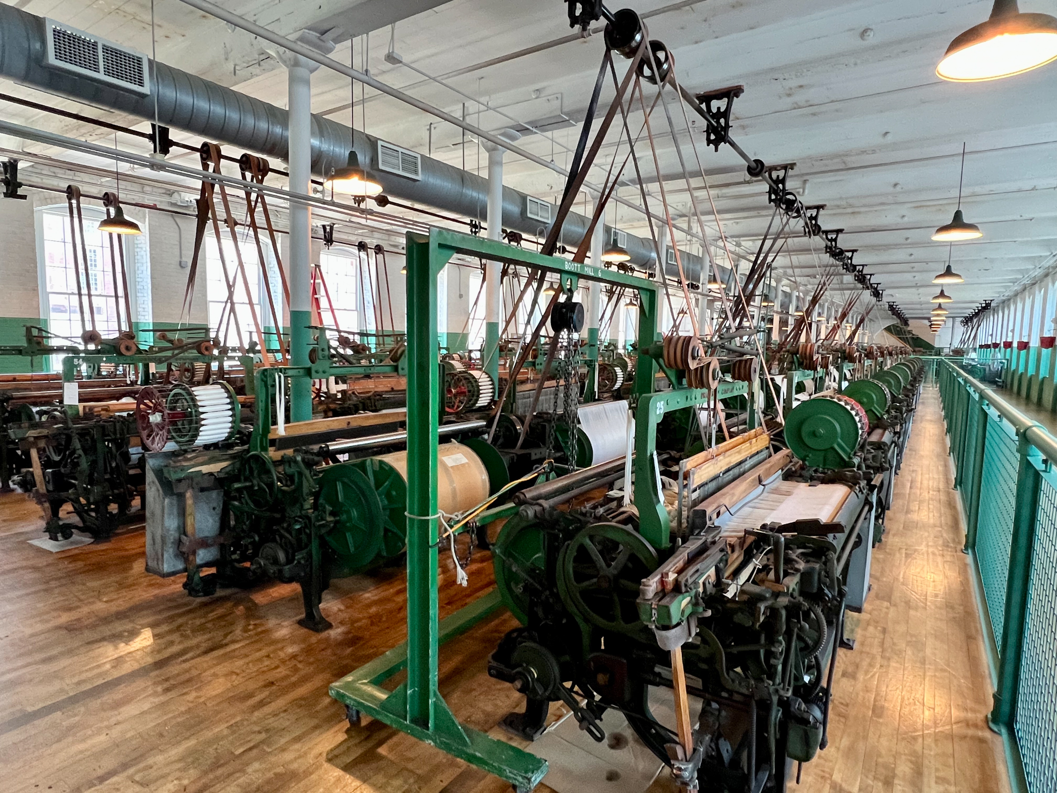
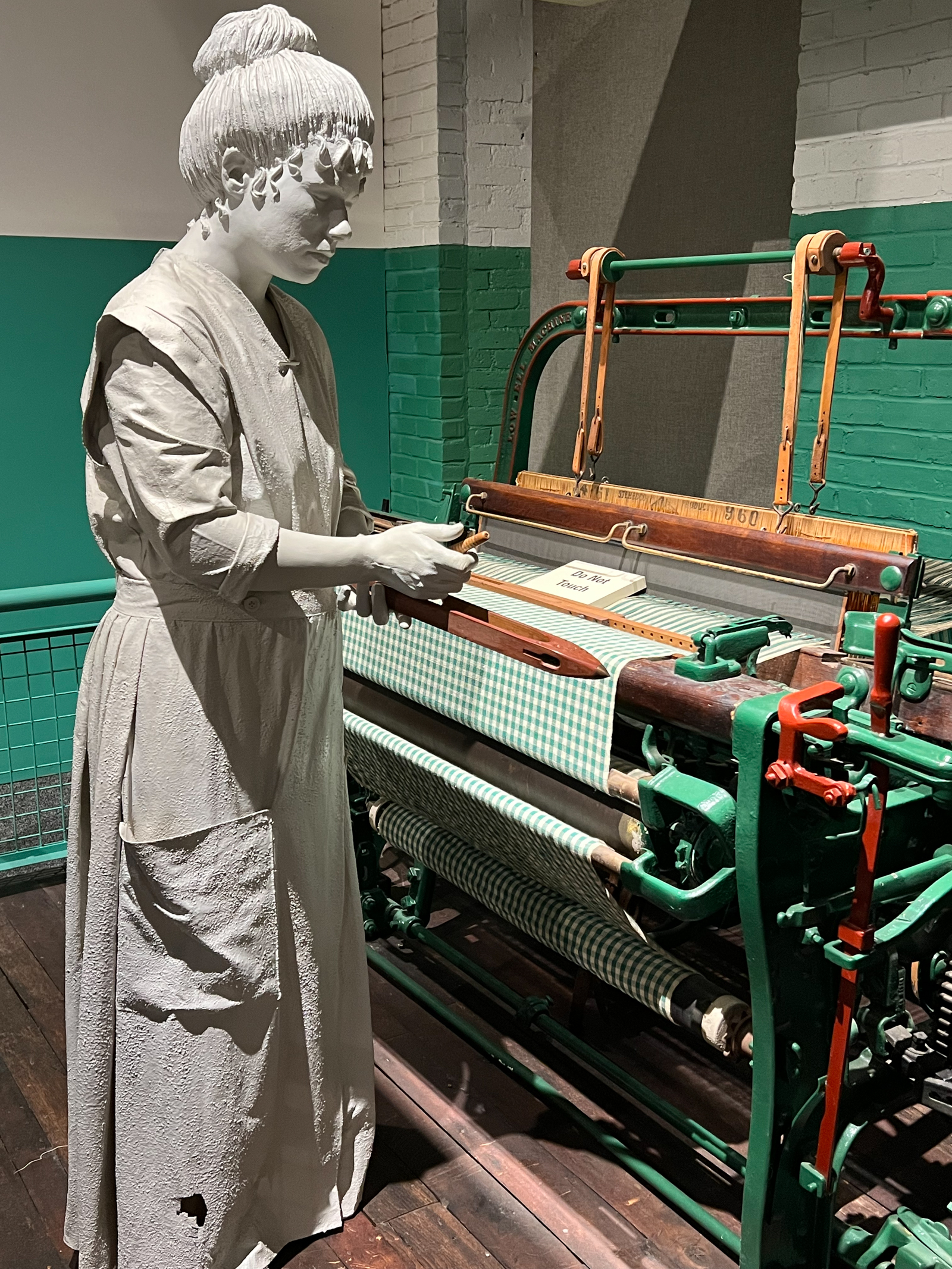
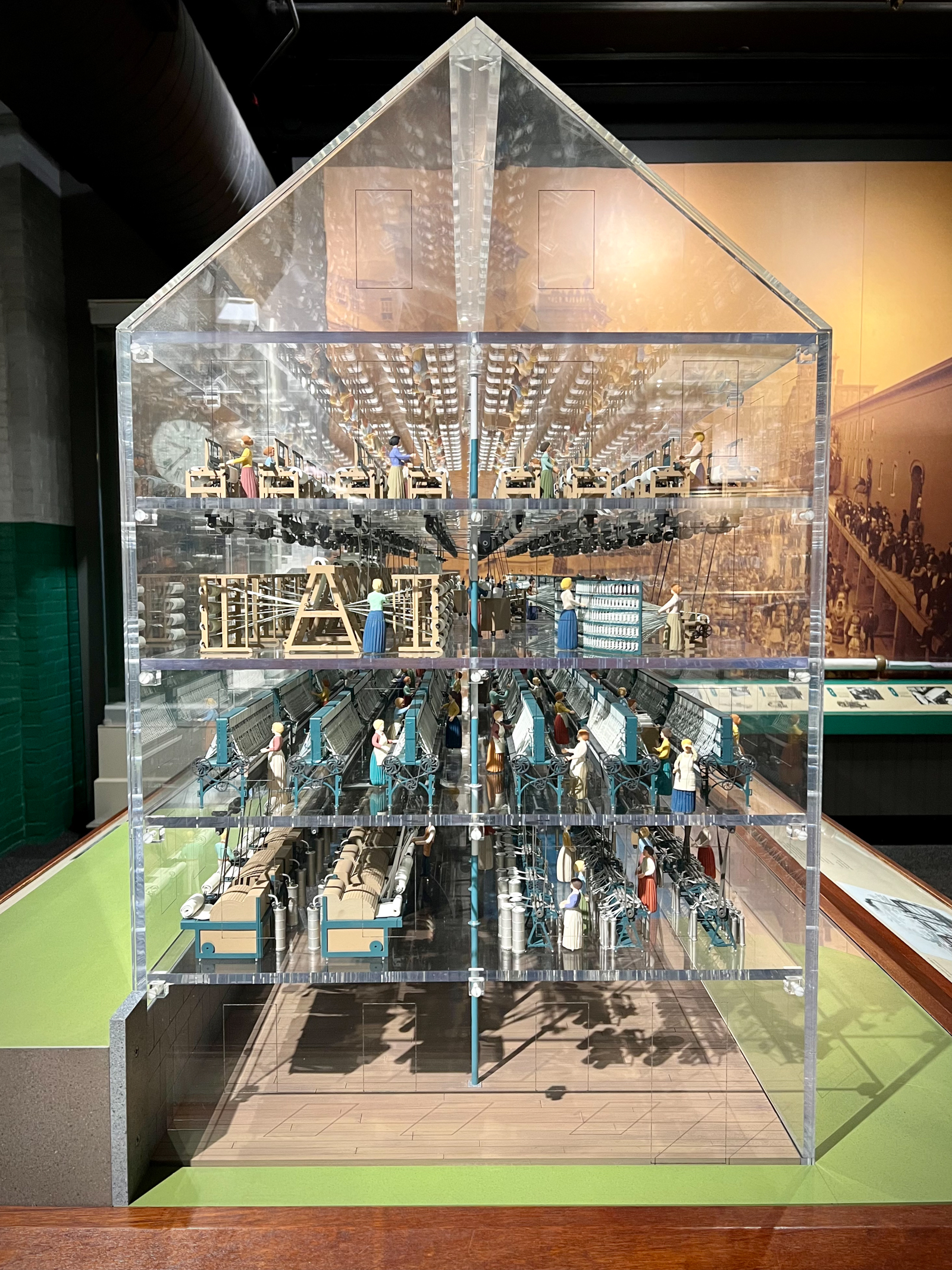
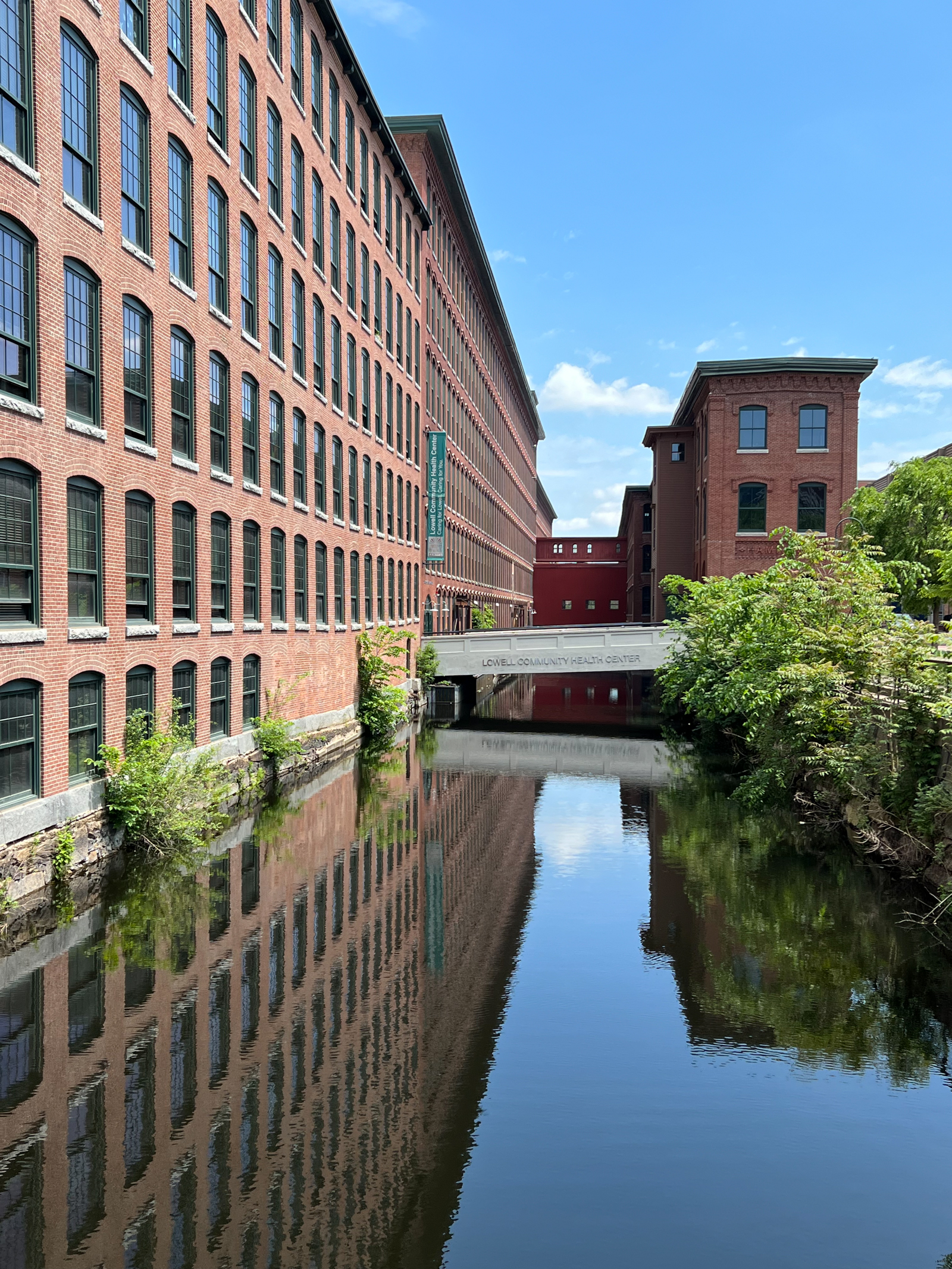
On our final day in New England, we visited four National Historic Sites. The history of this area is so foundational to our country and the National Park Service usually does a good job of interpreting what we are seeing in these sites. The Lowell National Historic Park is really an examination of the American Industrial Revolution and Lowell’s history as America’s first industrial city. In thoughtful, well-done displays it examined what it was like working in the mills, the history of labor in this industry, the connection between the cotton mills and cotton plantation slavery in the South, immigration to Lowell, technological innovation, and the prosperity and decline of the area.
After the mills closed, the economy of Lowell crashed, and it became a post-industrial wasteland. The National Park Service and the local, state and federal governments initiated a heroic effort to revive Lowell. It is still a work in progress. At the wonderful public library was a monument to the Laotian refugees that flooded the area after the Vietnam war and became the next wave of new immigrants to the area. It was wonderful to see in a coffee shop in an old mill a southeast Asian man and an Anglo woman singing bluegrass to the urban pioneer families that are trying to breathe new life into this old town.
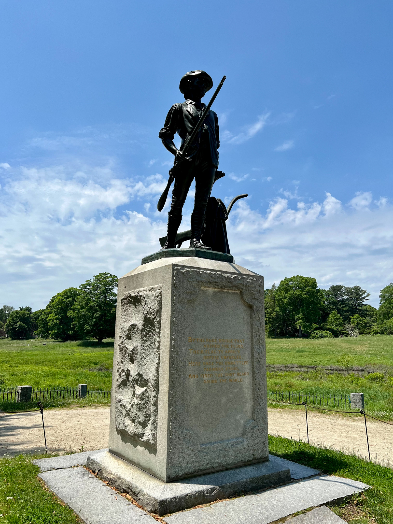
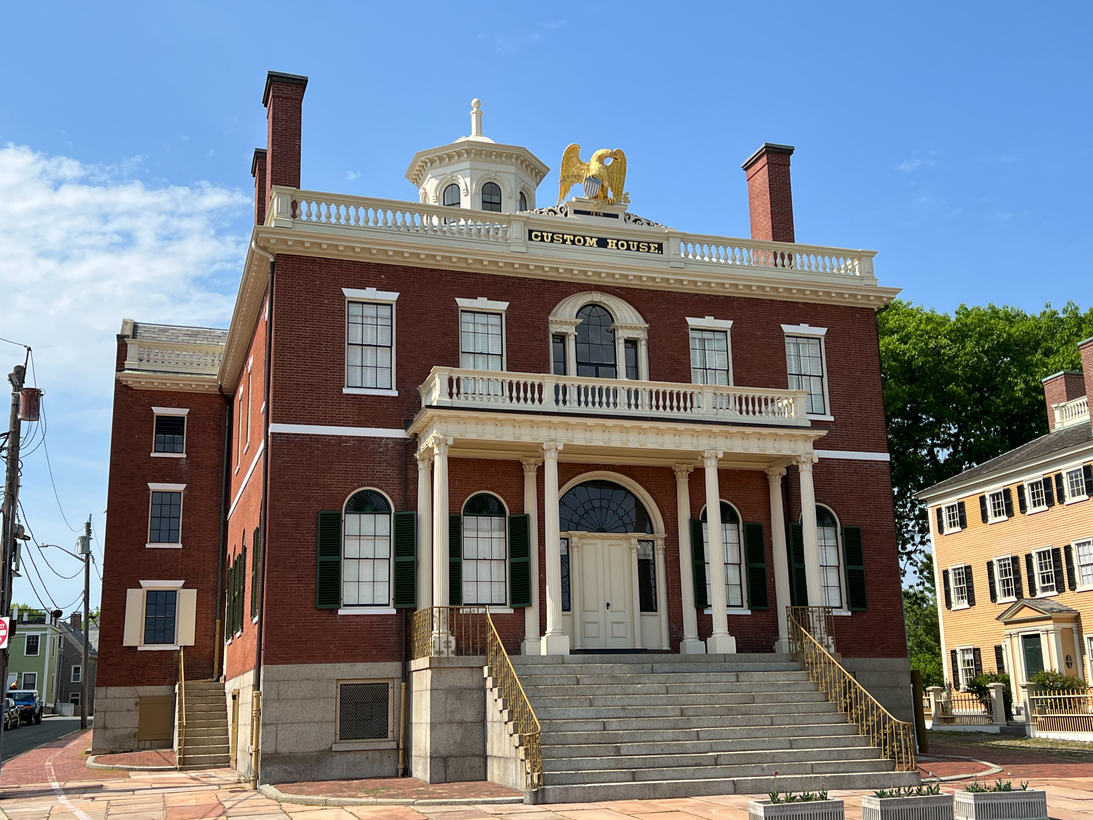
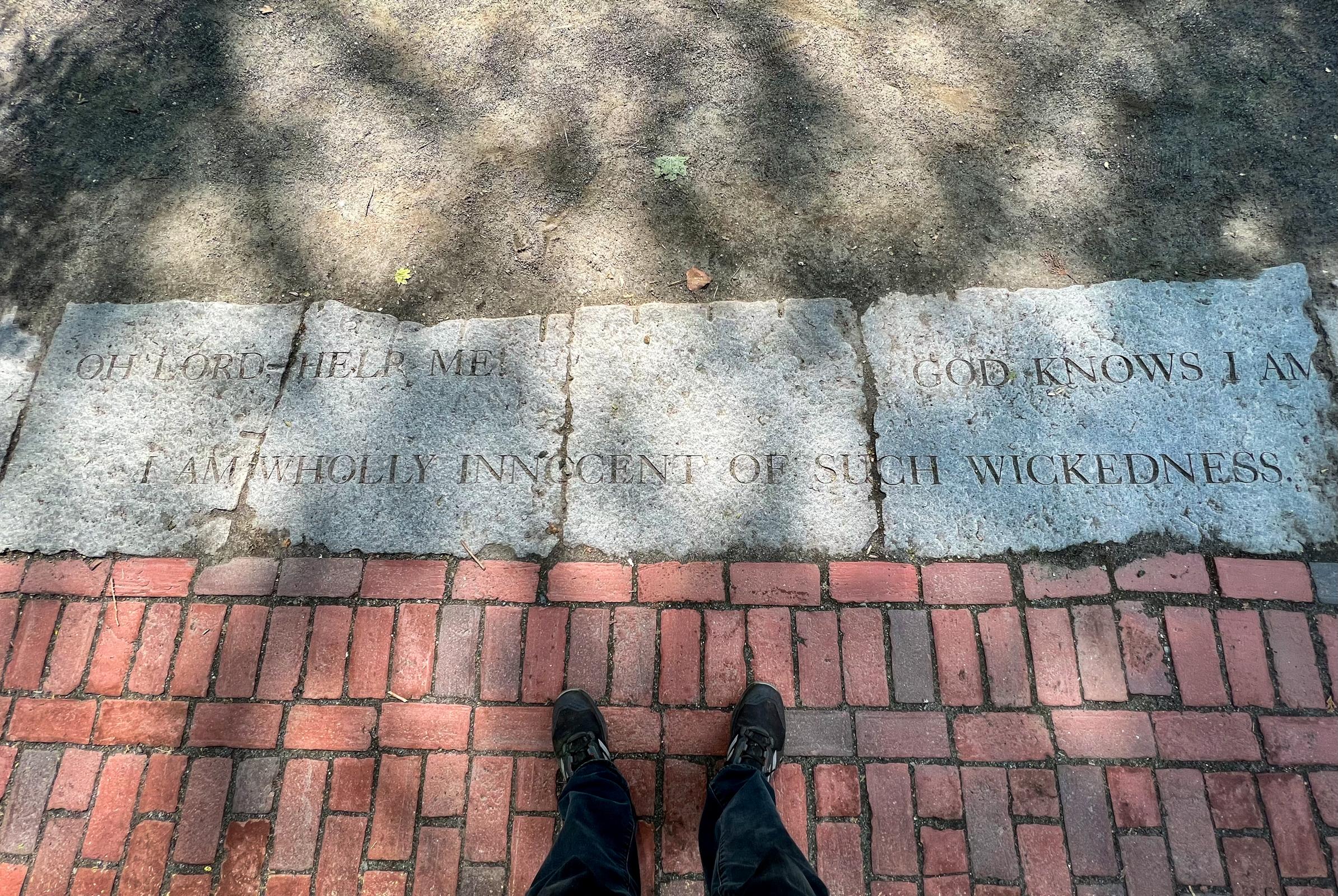
The Minute Man National Historic Park in Concord, MA is where the American Revolution began. The Saugus Iron Works National Historic Site, founded in 1641, was the first successful iron works in the New World. The Salem Maritime National Historic Site in Salem, MA was important in the building of New England’s maritime industry. We often think of Salem as the home of the famous Witch Trials, and we did pay homage to some of the murdered Pilgrim pioneers who died in that outbreak of 17th Century hysteria.
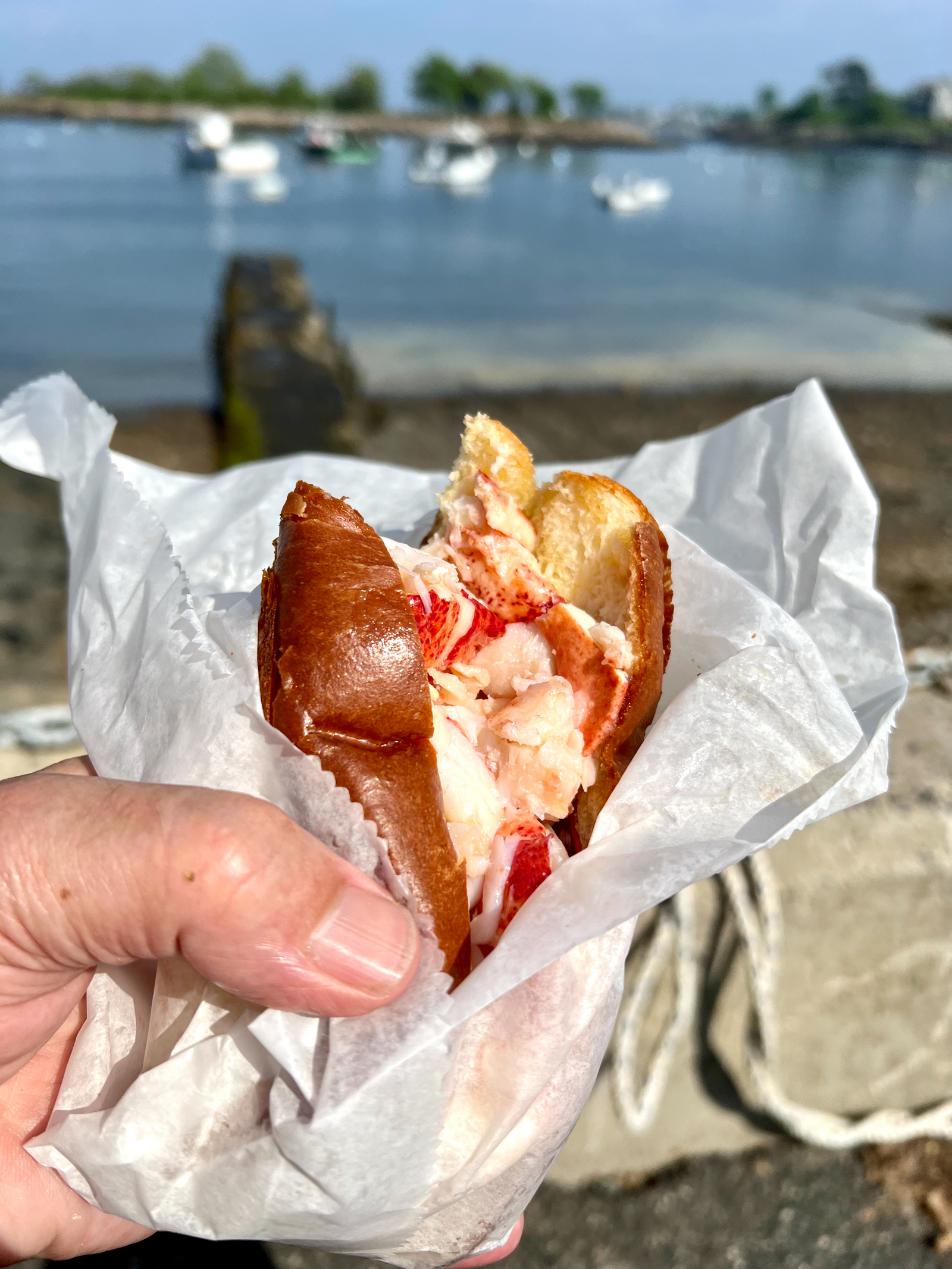
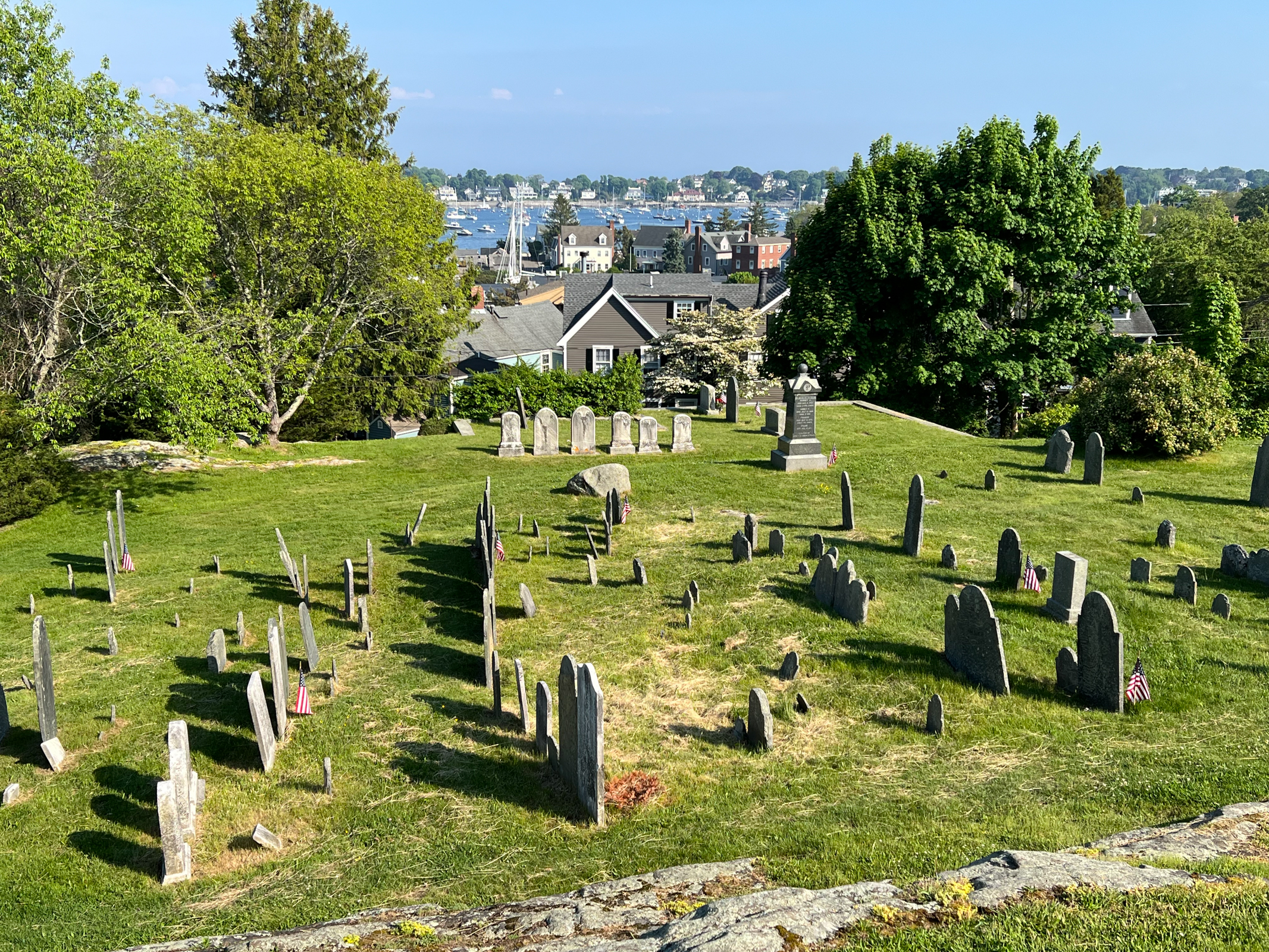
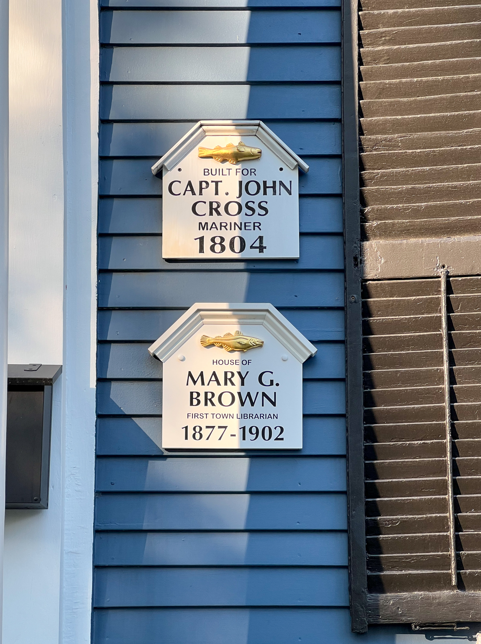
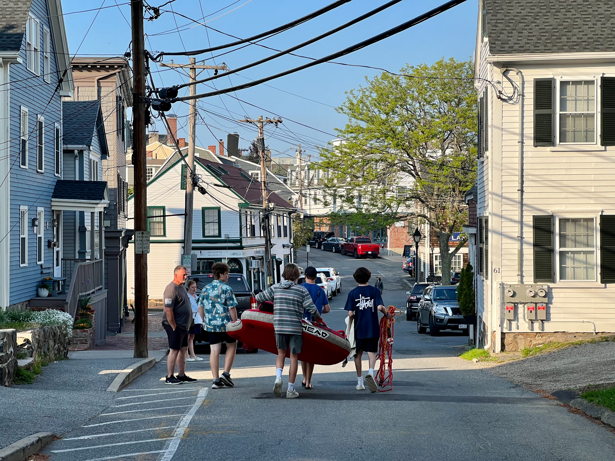
After a long day of deep social and historical enlightenment, we decided to cool off in the little coastal town of Marblehead. For many generations, this was a small Massachusetts fishing village. It still has parts of that history but is now a very wealthy small town situated beautifully on a crazy, rocky part of the coast. After a classic lobster dinner in a diner, we wandered this fascinating area for many hours amazed by what we saw in this unique place.
We ended our day in the old part of the North End of Boston. The Old North Church and the Paul Revere statue helped link much of the history that we had seen today. We also walked eight miles today in the unseasonable heat and humidity to see it all. We collapsed in our motel near the airport before flying back to San Francisco early the next morning. It was a short but great trip.
As we were leaving our hotel in Saskatoon, the waitress told us to be careful of the coming Alberta Clipper. I had no idea what it was, but it sounded scary. When I looked it up it was defined as a major weather event that is also sometimes called the Saskatchewan Screamer, the Manitoba Mauler or even the Ontario Scario-o. The storms sweep in at high speed with biting winds, usually bringing with them sharp cold fronts and drastically lower temperatures. It is common for an Albert Clipper to cause temperature to drop by 30 degrees F in as little as 8 hours. With wind chill, it can get down to -20 to -50 degrees F.
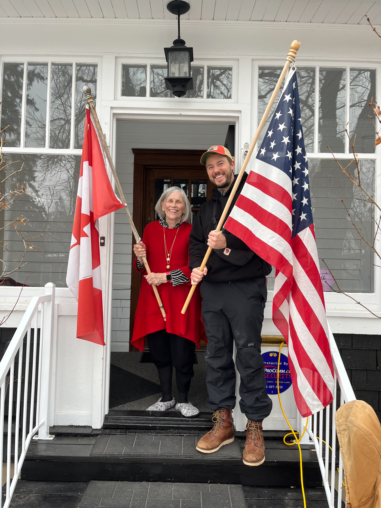
With that as our motivation, we didn’t stop much as we drove southwest from Saskatchewan to Alberta. One of the few places that we did stop was Medicine Hat, AB. One of Walker’s bosses who works in New York City grew up here, where his mom still lives. With the Alberta Clipper barreling down on us, we vowed we would spend only a few minutes visiting her. But she turned out to be one of the most engaging people I have ever met. Despite her age, she was very young at heart. Walker and I spent far more time than we planned visiting this delightful woman of Medicine Hat.
Because of the Clipper, we sadly drove by several libraries in Alberta that I had hoped to photograph. Racing south we crossed the border at the beautifully named town of Sweet Grass, MT. From here Interstate 15 extends all the way south to Mexico.
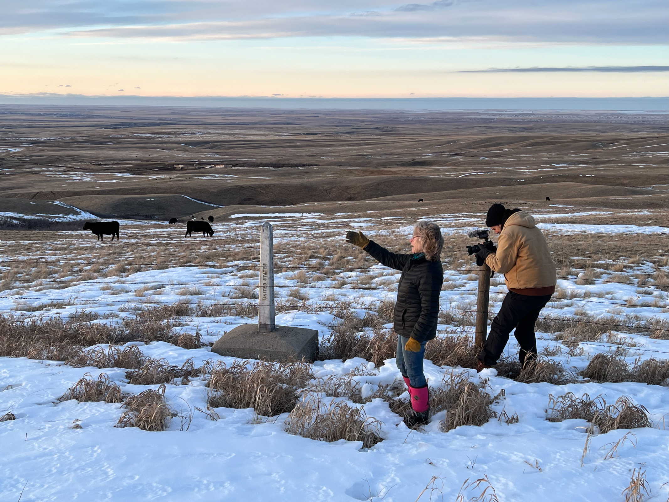
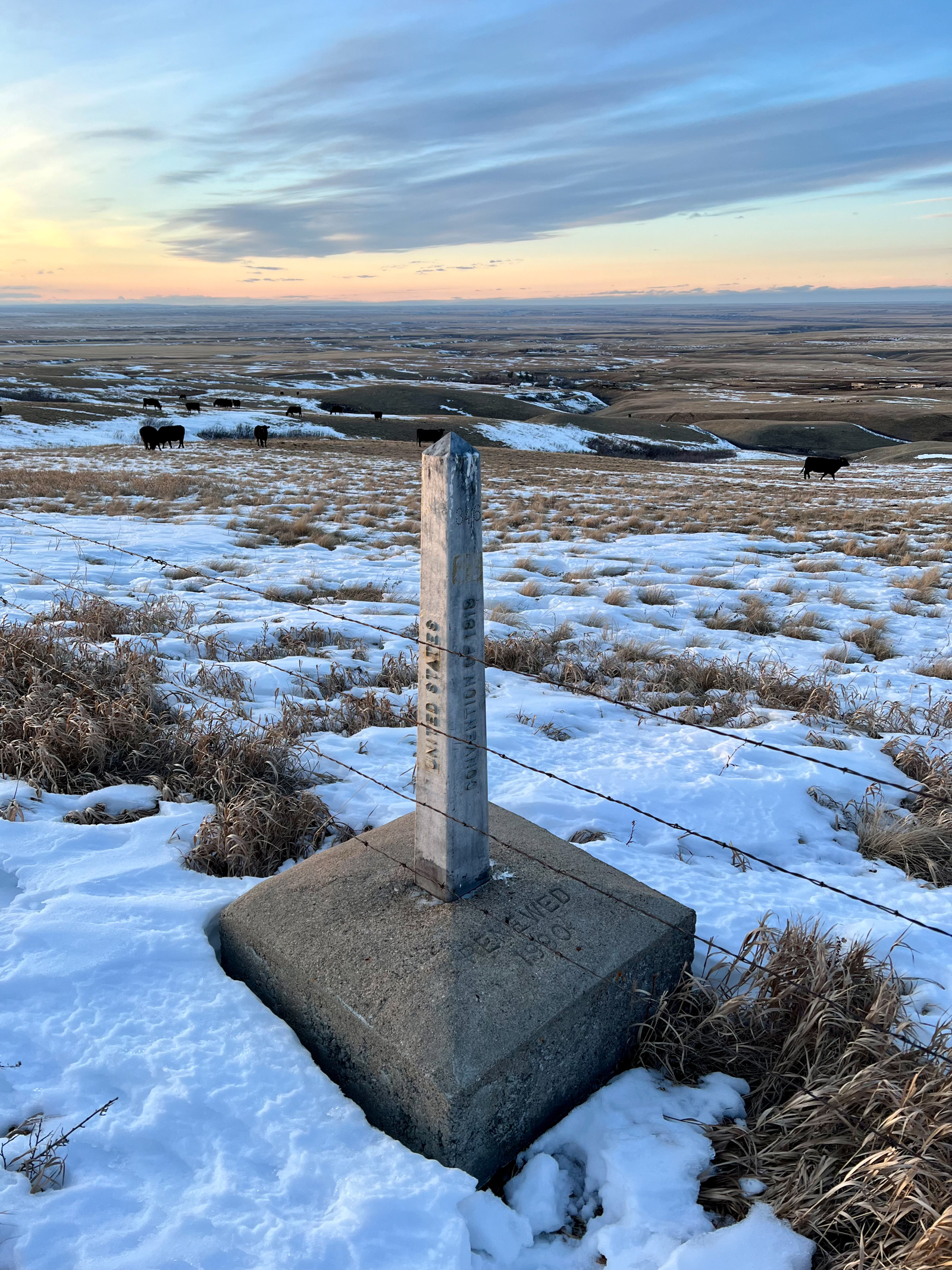
Walker was still working on the feral pig story, and we stopped to interview a rancher who was dealing with them on the American side of the border. As we drove with her at sunset, our SUV bounced over snowy open fields and windswept hills to the border fence itself. Here I was astonished to see how the border was simply a stand of barbed wire and a stone obelisk marker. I thought how militarized the border had become with Mexico and felt that we were standing in a world apart in Sweet Grass, MT. The rancher had to maintain her fence with Canada, and she was jokingly proud of defending America against the invasion of feral pigs.
In the short time we spent with her, I couldn’t form more than surface impressions of her life on a ranch at the edge of the country in northern Montana. What I did see was that the ranch was beautiful, the Big Sky was awesome, and her life seemed admirable. My mother’s family were pioneering ranching people in the Deer Lodge Valley of Montana, and I have always held a fascination and respect for this part of the world and this difficult but often satisfying rural way of life. Many of my photo projects have explored rural issues and people, especially in the American West. I worry when I read stories on some country people who seem susceptible to conspiracy thinking and MAGA madness. I think it is important for us in our liberal urban bubbles to find ways meet, talk with, and understand this important part of American life. It is one reason why I am here. A recent NY Times article on the importance of keeping connected to rural America stated, “Rural people working together to save their hospitals, build a nursing home or establish a mobile food pantry are the antidote to the violent polarization that everyone is worried about.” Spending time on this trip mostly in rural parts of Canada and the US was like breath of very cold fresh air. Sharp, sometimes painful, but ultimately exhilarating.
Another takeaway from this trip was gaining a new appreciation for journalism. I was able to watch our son Walker filming in all kinds of situations and interviewing all kinds of people. The stories that we read and see on the news don’t just happen, but often involve an enormous amount of hard work and insight by people like Walker. Journalism right now is going through many problems, but it is also essential to our democracy and our country. It was reassuring for me to see how a story is developed over time into an idea that, perhaps, can make a positive difference in the world.
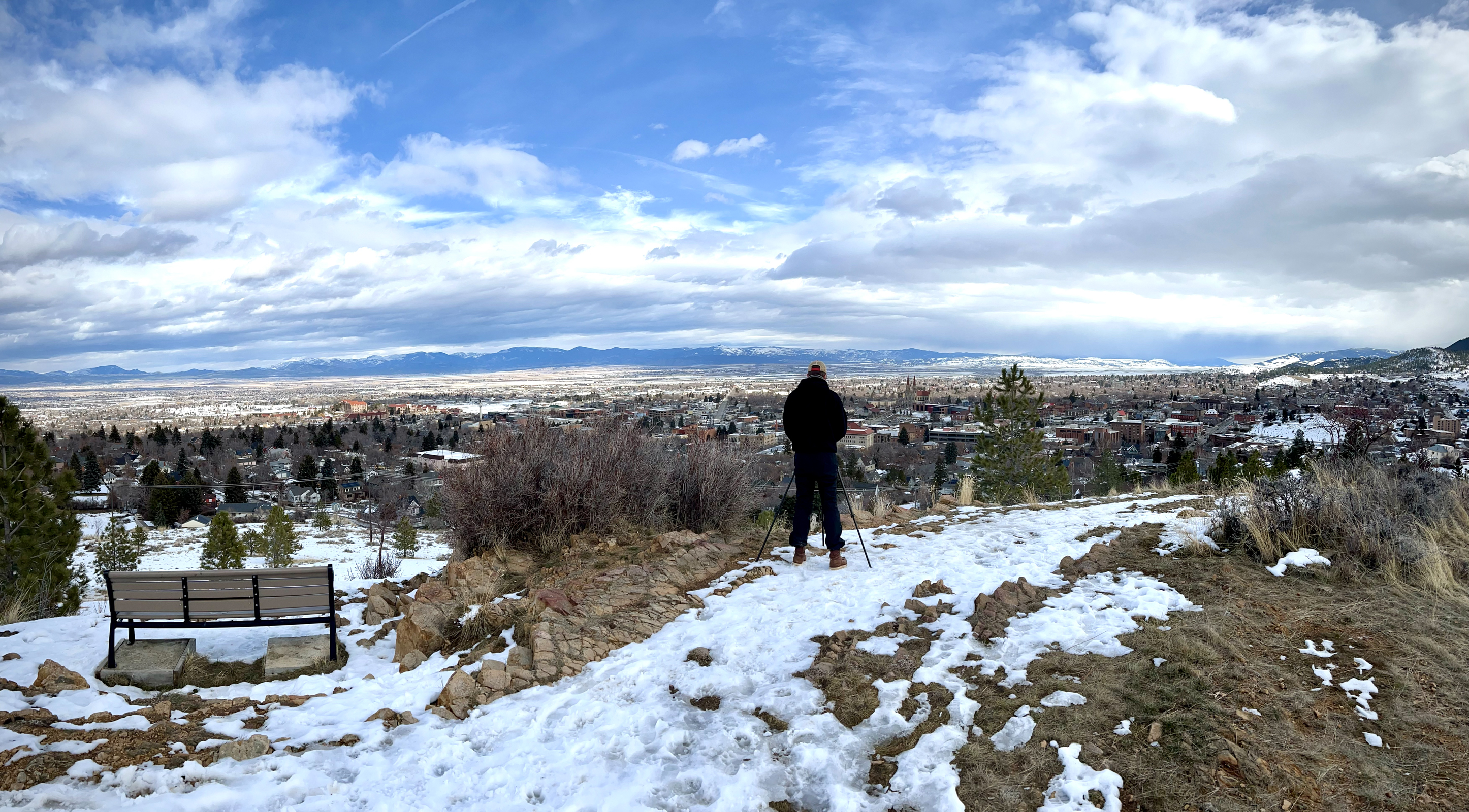
Walker ended his work by filming in Helena, Montana’s state capitol. He finished by interviewing the State Veterinarian about feral pigs. She thought that this breed could be a problem in the US, and they should stay in Canada.
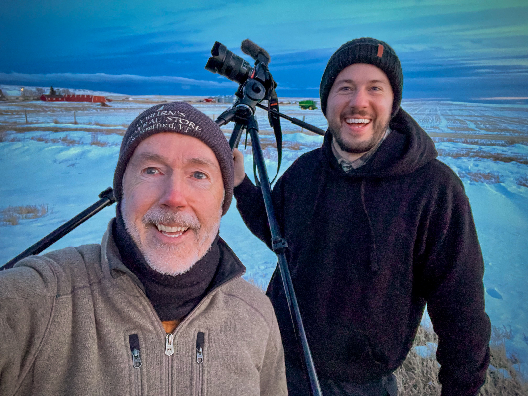
After a drive south to Bozeman for food and a very short night of sleep, I checked my phone for the weather and discovered that where we had been in Canada was getting slammed by the Alberta Clipper. We made it out in the nick of time.
ScreenshotScreenshot
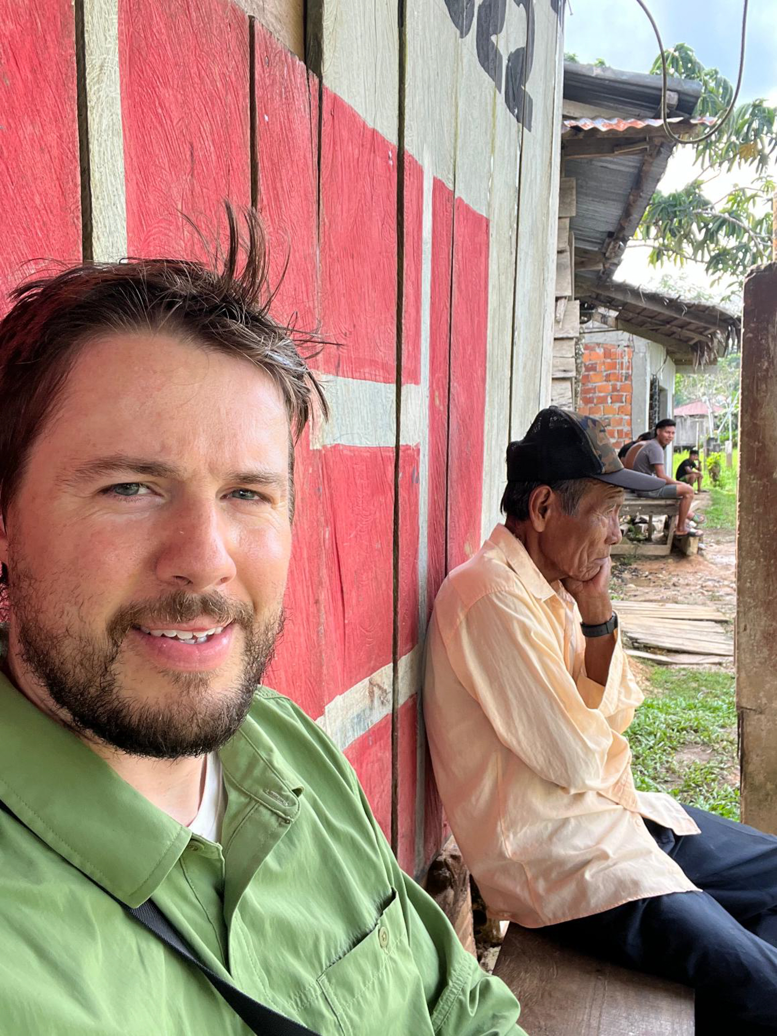
As I flew west to the beautiful weather of San Francisco, Walker continued south for his next four assignments in the hot and humid Amazonian jungle of Peru. We will miss him until her gets back. I sure hope he can take a long rest soon!
Thanks for coming along on the road trip. I will let you know about the next one!
I'm photographer Robert Dawson. Join me and my son, Walker, as we drive across the country this summer photographing public libraries for my next book, due out in 2013. Our trip will complete 17 years of field work documenting this precious American resource.
For more on my work and my upcoming American Public Library photography book, please visit robertdawson.com.